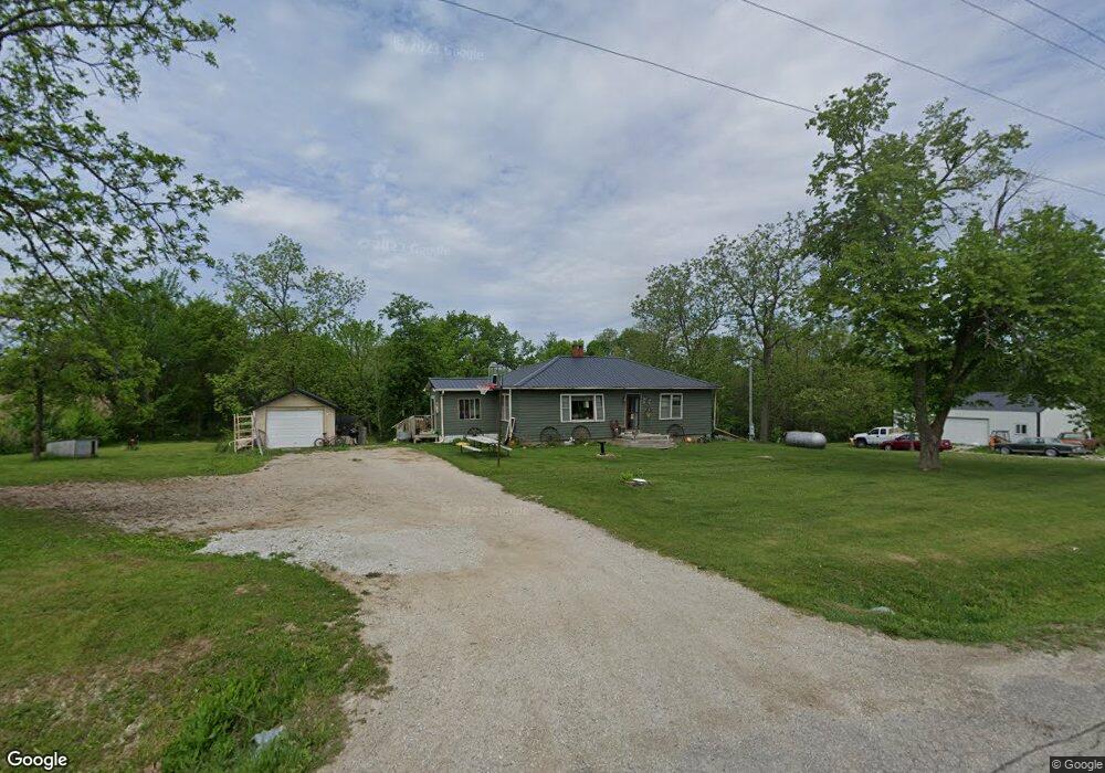
1055 Highway 5 Bussey, IA 50044
Estimated Value: $155,000 - $211,565
3
Beds
2
Baths
1,040
Sq Ft
$166/Sq Ft
Est. Value
About This Home
This home is located at 1055 Highway 5, Bussey, IA 50044 and is currently estimated at $172,641, approximately $166 per square foot. 1055 Highway 5 is a home located in Monroe County with nearby schools including Kendall Elementary School, Lincoln Center, and Grant Center.
Ownership History
Date
Name
Owned For
Owner Type
Purchase Details
Closed on
Oct 14, 2009
Sold by
Montgomery Debra and Montgomery Debra Mae
Bought by
Rankin Steven B
Current Estimated Value
Home Financials for this Owner
Home Financials are based on the most recent Mortgage that was taken out on this home.
Original Mortgage
$83,460
Outstanding Balance
$54,470
Interest Rate
5.07%
Mortgage Type
FHA
Estimated Equity
$118,171
Create a Home Valuation Report for This Property
The Home Valuation Report is an in-depth analysis detailing your home's value as well as a comparison with similar homes in the area
Home Values in the Area
Average Home Value in this Area
Purchase History
| Date | Buyer | Sale Price | Title Company |
|---|---|---|---|
| Rankin Steven B | $85,000 | None Available |
Source: Public Records
Mortgage History
| Date | Status | Borrower | Loan Amount |
|---|---|---|---|
| Open | Rankin Steven B | $83,460 |
Source: Public Records
Tax History Compared to Growth
Tax History
| Year | Tax Paid | Tax Assessment Tax Assessment Total Assessment is a certain percentage of the fair market value that is determined by local assessors to be the total taxable value of land and additions on the property. | Land | Improvement |
|---|---|---|---|---|
| 2024 | $1,796 | $141,480 | $46,830 | $94,650 |
| 2023 | $1,682 | $141,480 | $46,830 | $94,650 |
| 2022 | $1,608 | $110,900 | $33,840 | $77,060 |
| 2021 | $1,448 | $110,900 | $33,840 | $77,060 |
| 2020 | $1,460 | $96,590 | $32,180 | $64,410 |
| 2019 | $1,494 | $96,590 | $32,180 | $64,410 |
| 2018 | $1,494 | $91,180 | $29,120 | $62,060 |
| 2017 | $1,468 | $91,180 | $29,120 | $62,060 |
| 2016 | $1,468 | $88,050 | $0 | $0 |
| 2015 | $1,402 | $83,930 | $0 | $0 |
| 2014 | $1,402 | $83,930 | $0 | $0 |
Source: Public Records
Map
Nearby Homes
- 1805 S D Ave
- 610 S G Ave
- 604 W 6th St
- 304 W Weston Dr
- 2331 Victory Ln
- Tbd Barrows Ave
- Tbd 325th St
- 2255 238th Place
- 708 Edwards St
- Tbd 315th St
- 1186 310th St
- 0000 218th Place
- 1279 565th Trail
- 1279 565 Trail
- 002 218th Place
- 000 285th St
- 0 Millstream Ct Unit 24336276
- 000 147th St
- 189th Street
- 725 N E St