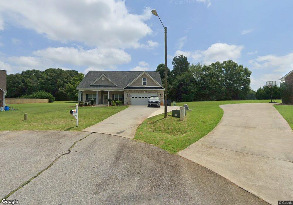
1055 Saxton Cir Salisbury, NC 28147
Estimated Value: $385,000 - $408,000
About This Home
This home is located at 1055 Saxton Cir, Salisbury, NC 28147 and is currently estimated at $398,091, approximately $200 per square foot. 1055 Saxton Cir is a home located in Rowan County with nearby schools including Knollwood Elementary School, Southeast Middle School, and Jesse C Carson High School.
Ownership History
We collect this data history from publicly available records. To have your information removed, we recommend requesting removal directly through your county’s website.
Purchase Details
Purchase Details
Home Financials for this Owner
Home Financials are based on the most recent Mortgage that was taken out on this home.Purchase History
We collect this data history from publicly available records. To have your information removed, we recommend requesting removal directly through your county’s website.
| Date | Buyer | Sale Price | Title Company |
|---|---|---|---|
| -- | None Available | ||
| $198,000 | None Available |
Mortgage History
We collect this data history from publicly available records. To have your information removed, we recommend requesting removal directly through your county’s website.
| Date | Status | Borrower | Loan Amount |
|---|---|---|---|
| Open | $193,971 |
Tax History
We collect this data history from publicly available records. To have your information removed, we recommend requesting removal directly through your county’s website.
| Year | Tax Paid | Tax Assessment Tax Assessment Total Assessment is a certain percentage of the fair market value that is determined by local assessors to be the total taxable value of land and additions on the property. | Land | Improvement |
|---|---|---|---|---|
| 2025 | $2,338 | $345,160 | $37,500 | $307,660 |
| 2024 | $2,338 | $345,160 | $37,500 | $307,660 |
| 2023 | $2,338 | $345,160 | $37,500 | $307,660 |
| 2022 | $1,689 | $223,753 | $32,000 | $191,753 |
| 2021 | $1,673 | $223,753 | $32,000 | $191,753 |
| 2020 | $1,673 | $223,753 | $32,000 | $191,753 |
| 2019 | $1,673 | $223,753 | $32,000 | $191,753 |
| 2018 | $1,429 | $192,822 | $32,000 | $160,822 |
| 2017 | $1,429 | $192,822 | $32,000 | $160,822 |
| 2016 | $1,429 | $192,822 | $32,000 | $160,822 |
| 2015 | $1,446 | $192,822 | $32,000 | $160,822 |
| 2014 | $1,367 | $191,150 | $28,500 | $162,650 |
Map
- 1045 Saxton Cir
- 202 Bramblewood Dr
- 1131 Greenheather Dr
- 4115 Miller Rd
- 130 Lois Ln
- 246 Maple Ridge Cir
- 2940 Shue Rd
- 206 Cedar Dr
- 1630 Grace Church Rd
- 265 Alan Cir
- 596 Maple Ridge Cir
- 2100 Airport Rd
- 101 E Chamblee Dr
- 1115 Joy St
- 2885 Wright Ave
- 311 Random Dr
- 1009 Cedar Village Trail
- 124 Village Creek Way
- 119 Progress Place
- 140 Overbrook Rd
- 1046 Saxton Cir
- 1030 Saxton Cir
- 215 Bramblewood Dr
- 111 Bramblewood Dr
- 143 Bramblewood Dr
- 397 Bramblewood Dr
- 183 Bramblewood Dr Unit 58
- 183 Bramblewood Dr
- 381 Bramblewood Dr
- 1010 Saxton Cir
- 4025 Shue Rd
- 110 Bramblewood Dr
- 132 Bramblewood Dr
- 366 Bramblewood Dr
- 346 Bramblewood Dr
- 384 Bramblewood Dr
- 152 Bramblewood Dr
- 420 Bramblewood Dr
- 402 Bramblewood Dr
- 111 Bayhill Rd
Ask me questions while you tour the home.