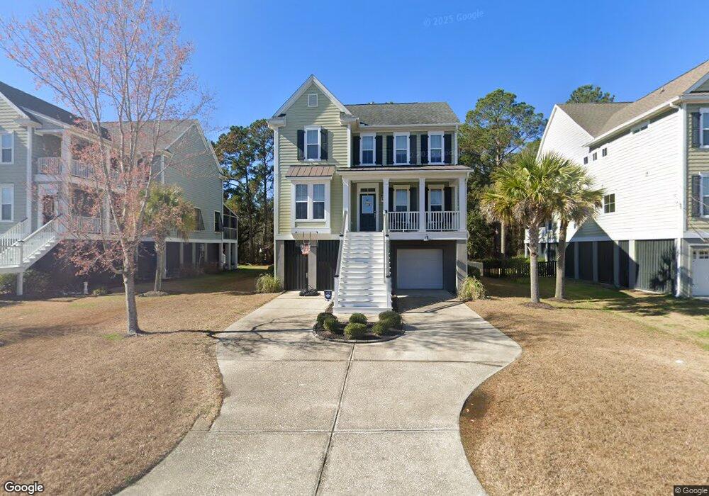
1055 Victoria Rd Charleston, SC 29492
Wando NeighborhoodEstimated Value: $763,276 - $944,000
3
Beds
3
Baths
1,537
Sq Ft
$558/Sq Ft
Est. Value
About This Home
This home is located at 1055 Victoria Rd, Charleston, SC 29492 and is currently estimated at $857,319, approximately $557 per square foot. 1055 Victoria Rd is a home located in Berkeley County with nearby schools including Daniel Island School and Bishop England High School.
Ownership History
Date
Name
Owned For
Owner Type
Purchase Details
Closed on
Aug 26, 2010
Sold by
Centex Homes
Bought by
Voges Christopher John and Voges Kelly Marie
Current Estimated Value
Home Financials for this Owner
Home Financials are based on the most recent Mortgage that was taken out on this home.
Original Mortgage
$309,459
Outstanding Balance
$205,999
Interest Rate
4.6%
Mortgage Type
New Conventional
Estimated Equity
$651,320
Create a Home Valuation Report for This Property
The Home Valuation Report is an in-depth analysis detailing your home's value as well as a comparison with similar homes in the area
Home Values in the Area
Average Home Value in this Area
Purchase History
| Date | Buyer | Sale Price | Title Company |
|---|---|---|---|
| Voges Christopher John | $309,459 | -- |
Source: Public Records
Mortgage History
| Date | Status | Borrower | Loan Amount |
|---|---|---|---|
| Open | Voges Christopher John | $309,459 |
Source: Public Records
Tax History Compared to Growth
Tax History
| Year | Tax Paid | Tax Assessment Tax Assessment Total Assessment is a certain percentage of the fair market value that is determined by local assessors to be the total taxable value of land and additions on the property. | Land | Improvement |
|---|---|---|---|---|
| 2025 | $1,630 | $388,286 | $100,203 | $288,083 |
| 2024 | $1,568 | $15,531 | $4,008 | $11,523 |
| 2023 | $1,568 | $15,531 | $4,008 | $11,523 |
| 2022 | $1,576 | $13,505 | $3,513 | $9,992 |
| 2021 | $1,618 | $13,500 | $3,513 | $9,992 |
| 2020 | $1,640 | $13,505 | $3,513 | $9,992 |
| 2019 | $1,628 | $13,505 | $3,513 | $9,992 |
| 2018 | $1,496 | $11,744 | $3,000 | $8,744 |
| 2017 | $1,417 | $11,744 | $3,000 | $8,744 |
| 2016 | $1,453 | $11,740 | $3,000 | $8,740 |
| 2015 | $1,322 | $11,740 | $3,000 | $8,740 |
| 2014 | $1,303 | $11,630 | $3,000 | $8,630 |
| 2013 | -- | $11,630 | $3,000 | $8,630 |
Source: Public Records
Map
Nearby Homes
- 303 Megans Bay Ln
- 312 Megans Bay Ln
- 324 Megans Bay Ln
- 1036 Victoria Rd
- 327 Megans Bay Ln
- 311 Coki Amalie Ct
- 104 Antilles Cir
- 100 Antilles Cir
- 524 Amalie Farms Dr
- 414 Amalie Farms Dr
- 0 Saint Thomas Island Dr
- 542 Amalie Farms Dr
- 156 Sandshell Dr
- 1054 Saint Thomas Island Dr
- 00 Clements Ferry Rd
- 0 Harvest Time Place
- 0 Sportsman Island Dr Unit 25025614
- 1088 Saint Thomas Island Dr
- 861 Dunham St
- 840 Forrest Dr
- 1055 Victoria Rd Unit LT 102
- 1057 Victoria Rd
- 1053 Victoria Rd
- 1051 Victoria Rd
- 1059 Victoria Rd
- 1059 Victoria Rd Unit 104
- 1049 Victoria Rd
- 309 Megans Bay Ln Unit LT 86
- 309 Megans Bay Ln
- 308 Coki Amalie Ct
- 311 Megans Bay Ln
- 311 Megans Bay Ln Unit LOT 85
- 307 Megans Bay Ln
- 305 Megans Bay Ln
- 305 Megans Bay Ln Unit LT 88
- 313 Megans Bay Ln
- 310 Coki Amalie Ct
- 301 Megans Bay Ln Unit LOT 90
- 301 Megans Bay Ln
- 1067 Victoria Rd