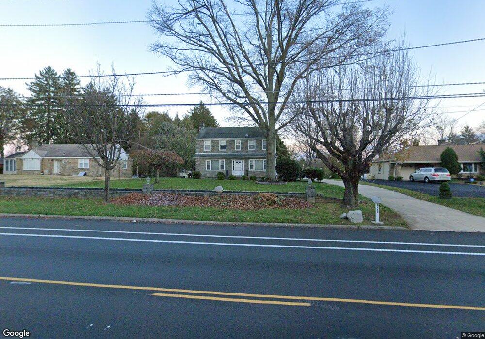
1055 Welsh Rd Philadelphia, PA 19115
Bustleton NeighborhoodEstimated Value: $649,407 - $690,000
--
Bed
1
Bath
2,576
Sq Ft
$260/Sq Ft
Est. Value
About This Home
This home is located at 1055 Welsh Rd, Philadelphia, PA 19115 and is currently estimated at $670,852, approximately $260 per square foot. 1055 Welsh Rd is a home located in Philadelphia County with nearby schools including Frank Anne School, CCA Baldi Middle School, and George Washington High School.
Ownership History
Date
Name
Owned For
Owner Type
Purchase Details
Closed on
Jun 8, 2000
Sold by
Pisauro Eric D and Pisauro Patricia C
Bought by
Florio Antonio and Florio Giovanna
Current Estimated Value
Home Financials for this Owner
Home Financials are based on the most recent Mortgage that was taken out on this home.
Original Mortgage
$100,000
Outstanding Balance
$31,856
Interest Rate
6.87%
Estimated Equity
$638,996
Create a Home Valuation Report for This Property
The Home Valuation Report is an in-depth analysis detailing your home's value as well as a comparison with similar homes in the area
Home Values in the Area
Average Home Value in this Area
Purchase History
| Date | Buyer | Sale Price | Title Company |
|---|---|---|---|
| Florio Antonio | $216,000 | -- |
Source: Public Records
Mortgage History
| Date | Status | Borrower | Loan Amount |
|---|---|---|---|
| Open | Florio Antonio | $100,000 |
Source: Public Records
Tax History Compared to Growth
Tax History
| Year | Tax Paid | Tax Assessment Tax Assessment Total Assessment is a certain percentage of the fair market value that is determined by local assessors to be the total taxable value of land and additions on the property. | Land | Improvement |
|---|---|---|---|---|
| 2025 | $7,139 | $576,600 | $115,320 | $461,280 |
| 2024 | $7,139 | $576,600 | $115,320 | $461,280 |
| 2023 | $7,139 | $510,000 | $102,000 | $408,000 |
| 2022 | $4,121 | $465,000 | $102,000 | $363,000 |
| 2021 | $4,751 | $0 | $0 | $0 |
| 2020 | $4,751 | $0 | $0 | $0 |
| 2019 | $4,549 | $0 | $0 | $0 |
| 2018 | $4,363 | $0 | $0 | $0 |
| 2017 | $4,363 | $0 | $0 | $0 |
| 2016 | $4,363 | $0 | $0 | $0 |
| 2015 | $4,177 | $0 | $0 | $0 |
| 2014 | -- | $311,700 | $158,227 | $153,473 |
| 2012 | -- | $49,728 | $13,026 | $36,702 |
Source: Public Records
Map
Nearby Homes
- 1060 Welsh Rd
- 1012 Twist Rd
- 1009 Twist Rd
- 9762 Redd Rambler Terrace
- 9346 Rising Sun Ave
- 727 Sherrie Rd
- 9314 Trout Rd
- 9703 Northeast Ave
- 8905 Springview Rd
- 1123 Grant Ave
- 9825 Verree Rd
- 9739 Krewstown Rd
- 9812 Ferndale St
- 8912 Springview Rd
- 1020 Grant Ave
- 1132 Bingham St
- 9810 Bridle Rd
- 9376 Neil Rd Unit A
- 637 Charette Rd
- 9336 Neil Rd Unit B
- 1051 Welsh Rd
- 1059 Welsh Rd
- 1047 Welsh Rd
- 1063 Welsh Rd
- 1008 Creswood Rd
- 1010 Creswood Rd
- 1006 Creswood Rd
- 1012 Creswood Rd
- 1004 Creswood Rd
- 1067 Welsh Rd
- 1014 Creswood Rd
- 1066 Welsh Rd
- 1043 Welsh Rd
- 1078 Welsh Rd
- 1016 Creswood Rd
- 1062 Welsh Rd
- 1002 Creswood Rd
- 1071 Welsh Rd
- 1039 Welsh Rd
- 1084 Welsh Rd