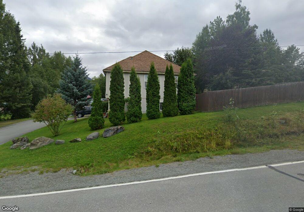
10555 Chain of Rock St Eagle River, AK 99577
Eagle River NeighborhoodEstimated Value: $534,977 - $603,000
3
Beds
2
Baths
2,439
Sq Ft
$234/Sq Ft
Est. Value
About This Home
This home is located at 10555 Chain of Rock St, Eagle River, AK 99577 and is currently estimated at $569,992, approximately $233 per square foot. 10555 Chain of Rock St is a home located in Anchorage Municipality with nearby schools including Homestead Elementary School, Gruening Middle School, and Chugiak High School.
Ownership History
Date
Name
Owned For
Owner Type
Purchase Details
Closed on
Apr 14, 2009
Sold by
Bobby Cindra D and Bobby Paul S
Bought by
Leavelle Allen O and Leavelle Sherrie L
Current Estimated Value
Home Financials for this Owner
Home Financials are based on the most recent Mortgage that was taken out on this home.
Original Mortgage
$370,000
Outstanding Balance
$235,768
Interest Rate
5.17%
Mortgage Type
VA
Estimated Equity
$334,224
Purchase Details
Closed on
May 17, 2002
Sold by
Frank Linda and Parker Michael
Bought by
Bobby Cindra D and Bobby Paul S
Home Financials for this Owner
Home Financials are based on the most recent Mortgage that was taken out on this home.
Original Mortgage
$244,800
Interest Rate
7.13%
Mortgage Type
VA
Create a Home Valuation Report for This Property
The Home Valuation Report is an in-depth analysis detailing your home's value as well as a comparison with similar homes in the area
Home Values in the Area
Average Home Value in this Area
Purchase History
| Date | Buyer | Sale Price | Title Company |
|---|---|---|---|
| Leavelle Allen O | -- | First American Title Ins Co | |
| Bobby Cindra D | -- | First American Title |
Source: Public Records
Mortgage History
| Date | Status | Borrower | Loan Amount |
|---|---|---|---|
| Open | Leavelle Allen O | $370,000 | |
| Previous Owner | Bobby Cindra D | $244,800 |
Source: Public Records
Tax History Compared to Growth
Tax History
| Year | Tax Paid | Tax Assessment Tax Assessment Total Assessment is a certain percentage of the fair market value that is determined by local assessors to be the total taxable value of land and additions on the property. | Land | Improvement |
|---|---|---|---|---|
| 2025 | $4,086 | $516,200 | $124,600 | $391,600 |
| 2024 | $4,086 | $477,700 | $110,100 | $367,600 |
| 2023 | $7,168 | $430,500 | $105,900 | $324,600 |
| 2022 | $3,759 | $425,200 | $101,100 | $324,100 |
| 2021 | $7,027 | $395,000 | $101,100 | $293,900 |
| 2020 | $2,729 | $382,300 | $101,100 | $281,200 |
| 2019 | $3,032 | $385,800 | $101,100 | $284,700 |
| 2018 | $5,383 | $382,900 | $101,100 | $281,800 |
| 2017 | $5,586 | $368,700 | $95,100 | $273,600 |
| 2016 | $5,420 | $379,100 | $92,000 | $287,100 |
| 2015 | $5,420 | $358,800 | $92,000 | $266,800 |
| 2014 | $5,420 | $368,000 | $83,800 | $284,200 |
Source: Public Records
Map
Nearby Homes
- 17415 Palos Verdes Dr
- 17705 Teklanika Dr
- 11041 Katlian Dr
- 10141 Colville St
- 11240 Echo St
- 10845 Anvik Cir
- 17106 Laoana Dr
- 11313 Upper Sunny Cir
- 18709 Whirlaway Rd
- 17031 Coronado Rd
- 16840 Park Place St
- 11288 Wood River Way Unit 6
- 10204 Eagle View Dr
- 18720 N Lowrie Loop
- 10172 Eagle View Dr
- 10921 Adanak Cir
- 11114 Kaskanak Dr
- L2 B1 Eklutna Highland Estates
- 12121 Horseshoe Dr
- 8887 Sasquatch Cir
- 10567 Chain of Rock St
- 10509 Chain of Rock St
- 10516 Chain of Rock St
- 10607 Chain of Rock St
- 10579 Chain of Rock St
- 17627 Chilkat Ct
- 17620 Meadow Creek Dr
- 10610 Chain of Rock St
- 10466 Chain of Rock St
- 17554 Meadow Creek Dr
- 17634 Meadow Creek Dr
- 17548 Palos Verdes Dr
- 17707 Chilkat Ct
- 17541 Palos Verdes Dr
- 17546 Meadow Creek Dr
- 10452 Chain of Rock St
- 17608 Chilkat Ct
- 17540 Palos Verdes Dr
- 17535 Palos Verdes Dr
- 10614 Tokositna Cir