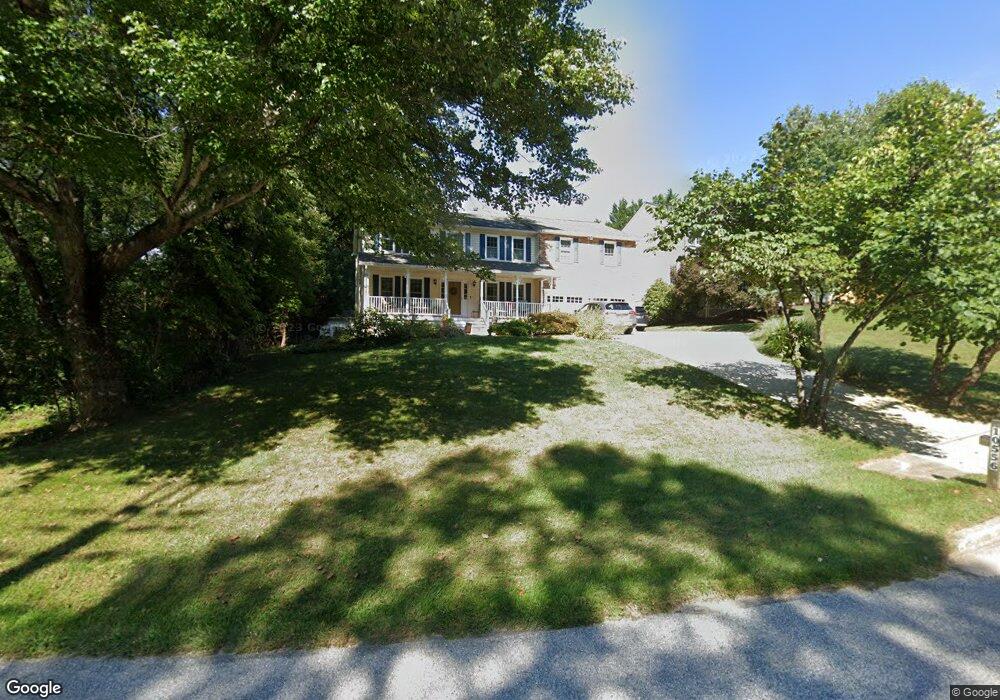
10556 Stansfield Rd Laurel, MD 20723
Estimated Value: $762,000 - $961,000
Studio
3
Baths
3,262
Sq Ft
$256/Sq Ft
Est. Value
About This Home
This home is located at 10556 Stansfield Rd, Laurel, MD 20723 and is currently estimated at $834,919, approximately $255 per square foot. 10556 Stansfield Rd is a home located in Howard County with nearby schools including Hammond Elementary School, Hammond Middle School, and Reservoir High School.
Ownership History
Date
Name
Owned For
Owner Type
Purchase Details
Closed on
Apr 7, 2022
Sold by
Emery Michael C
Bought by
Emery Living Trust
Current Estimated Value
Purchase Details
Closed on
Apr 23, 1992
Sold by
Lilly Floyd E
Bought by
Emery Michael C and Emery Pamela P T
Home Financials for this Owner
Home Financials are based on the most recent Mortgage that was taken out on this home.
Original Mortgage
$179,000
Interest Rate
8.76%
Create a Home Valuation Report for This Property
The Home Valuation Report is an in-depth analysis detailing your home's value as well as a comparison with similar homes in the area
Home Values in the Area
Average Home Value in this Area
Purchase History
| Date | Buyer | Sale Price | Title Company |
|---|---|---|---|
| Emery Living Trust | -- | None Listed On Document | |
| Emery Michael C | $269,000 | -- |
Source: Public Records
Mortgage History
| Date | Status | Borrower | Loan Amount |
|---|---|---|---|
| Previous Owner | Emery Michael C | $179,000 |
Source: Public Records
Tax History
| Year | Tax Paid | Tax Assessment Tax Assessment Total Assessment is a certain percentage of the fair market value that is determined by local assessors to be the total taxable value of land and additions on the property. | Land | Improvement |
|---|---|---|---|---|
| 2025 | $7,395 | $683,600 | $246,600 | $437,000 |
| 2024 | $7,395 | $619,500 | $0 | $0 |
| 2023 | $7,927 | $555,400 | $0 | $0 |
| 2022 | $7,475 | $491,300 | $176,600 | $314,700 |
| 2021 | $7,535 | $491,300 | $176,600 | $314,700 |
| 2020 | $7,535 | $491,300 | $176,600 | $314,700 |
| 2019 | $7,592 | $526,500 | $229,500 | $297,000 |
| 2018 | $7,625 | $526,500 | $229,500 | $297,000 |
| 2017 | $7,699 | $526,500 | $0 | $0 |
| 2016 | -- | $531,900 | $0 | $0 |
| 2015 | -- | $521,333 | $0 | $0 |
| 2014 | -- | $510,767 | $0 | $0 |
Source: Public Records
Map
Nearby Homes
- 10571 Scaggsville Rd
- 8616 Doves Fly Way
- 10747 Glen Hannah Dr
- 7209 Brooklyn Bridge Rd
- 8251 Mary Lee Ln
- 7106 Donston Dr
- 10213 Deep Skies Dr
- 8302 Spring Blossom Ct
- 16140 Kenny Rd
- 9843 Snow Bird Ln
- 8380 Ice Crystal Dr
- 7926 Helmart Dr
- 7920 Helmart Dr
- 11375 Harding Rd
- 9437 Fairview Ave
- 9429 Fairview Ave
- 7019 Fitzpatrick Dr
- 9425 Fairview Ave
- 9756 Knowledge Dr
- 15708 Dorset Rd Unit 202
- 10546 Stansfield Rd
- 10509 Bill Lilly Ct
- 10501 Bill Lilly Ct
- 10505 Bill Lilly Ct
- 10513 Bill Lilly Ct
- 10500 Bill Lilly Ct
- 10517 Bill Lilly Ct
- 10504 Bill Lilly Ct
- 8681 Tower Dr
- 8686 Tower Dr
- 10508 Bill Lilly Ct
- 10521 Bill Lilly Ct
- 10512 Bill Lilly Ct
- 8677 Tower Dr
- 8682 Tower Dr
- 10502 Stansfield Rd
- 10525 Bill Lilly Ct
- 10506 Stansfield Rd
- 8673 Tower Dr
- 10526 Stansfield Rd
Your Personal Tour Guide
Ask me questions while you tour the home.