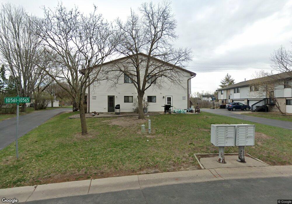
10557 Grouse Cir NW Coon Rapids, MN 55433
Estimated Value: $224,000 - $236,000
2
Beds
2
Baths
1,397
Sq Ft
$164/Sq Ft
Est. Value
About This Home
This home is located at 10557 Grouse Cir NW, Coon Rapids, MN 55433 and is currently estimated at $229,382, approximately $164 per square foot. 10557 Grouse Cir NW is a home located in Anoka County with nearby schools including Lucile Bruner Elementary School, Hamilton Elementary School, and Laughlin Junior/Senior High School.
Ownership History
Date
Name
Owned For
Owner Type
Purchase Details
Closed on
Apr 27, 2007
Sold by
Flagg Ronald J and Flagg Jessica M
Bought by
Lundquist Sandra L
Current Estimated Value
Home Financials for this Owner
Home Financials are based on the most recent Mortgage that was taken out on this home.
Original Mortgage
$137,900
Outstanding Balance
$84,018
Interest Rate
6.2%
Mortgage Type
New Conventional
Estimated Equity
$145,364
Purchase Details
Closed on
Nov 30, 2001
Sold by
Ziener Ronald and Ziener Chad
Bought by
Flagg Ronald and Vanno Jessica
Purchase Details
Closed on
Jul 26, 1999
Sold by
Rusten Traci L
Bought by
Ziemer Chad R and Ziemer Ronald
Purchase Details
Closed on
Jul 31, 1997
Sold by
Sylvester Timothy J and Sylvester Carla M
Bought by
Rusten Traci L
Create a Home Valuation Report for This Property
The Home Valuation Report is an in-depth analysis detailing your home's value as well as a comparison with similar homes in the area
Home Values in the Area
Average Home Value in this Area
Purchase History
| Date | Buyer | Sale Price | Title Company |
|---|---|---|---|
| Lundquist Sandra L | $137,900 | -- | |
| Flagg Ronald | $129,900 | -- | |
| Ziemer Chad R | $91,750 | -- | |
| Rusten Traci L | $73,000 | -- |
Source: Public Records
Mortgage History
| Date | Status | Borrower | Loan Amount |
|---|---|---|---|
| Open | Lundquist Sandra L | $137,900 |
Source: Public Records
Tax History Compared to Growth
Tax History
| Year | Tax Paid | Tax Assessment Tax Assessment Total Assessment is a certain percentage of the fair market value that is determined by local assessors to be the total taxable value of land and additions on the property. | Land | Improvement |
|---|---|---|---|---|
| 2025 | $2,038 | $217,000 | $60,500 | $156,500 |
| 2024 | $2,038 | $209,300 | $47,300 | $162,000 |
| 2023 | $1,938 | $191,800 | $50,100 | $141,700 |
| 2022 | $1,820 | $208,600 | $55,600 | $153,000 |
| 2021 | $1,645 | $177,400 | $36,300 | $141,100 |
| 2020 | $1,688 | $159,300 | $22,000 | $137,300 |
| 2019 | $1,459 | $157,000 | $29,700 | $127,300 |
| 2018 | $1,509 | $135,500 | $0 | $0 |
| 2017 | $1,239 | $126,800 | $0 | $0 |
| 2016 | $1,259 | $105,900 | $0 | $0 |
| 2015 | $1,159 | $105,900 | $16,100 | $89,800 |
| 2014 | -- | $77,000 | $5,200 | $71,800 |
Source: Public Records
Map
Nearby Homes
- 10634 Hummingbird St NW
- 10658 Hummingbird St NW
- 1900 Coon Rapids Blvd NW Unit 1
- 1285 105th Ave NW
- 1285 103rd Ln NW
- 2001 103rd Ln NW
- 9967 Egret Blvd NW
- 1025 105th Ave NW
- 2201 108th Ave NW
- 10705 Unity St NW Unit 6
- 10708 Tamarack St NW Unit 10
- 11036 Hanson Blvd NW Unit 20
- 990 106th Ln NW Unit 29
- 995 106th Ln NW Unit 52
- 1054 109th Ln NW
- 10170 Tamarack St NW
- 10783 Tamarack Cir NW
- 10239 Raven St NW
- 10511 Redwood St NW
- 10478 Quince St NW
- 10549 Grouse Cir NW
- 10553 Grouse Cir NW
- 10561 Grouse Cir NW
- 10545 Grouse Cir NW
- 10541 Grouse Cir NW
- 1620 106th Ave NW
- 10537 Grouse Cir NW
- 1604 106th Ave NW
- 10569 Grouse Cir NW
- 1612 106th Ave NW
- 10529 Grouse Cir NW
- 10533 Grouse Cir NW
- 1616 106th Ave NW
- 10577 Grouse Cir NW
- 1608 106th Ave NW
- 10525 Grouse Cir NW
- 10521 Grouse Cir NW
- 1600 106th Ave NW
- 10560 Grouse Cir NW
- 10512 Grouse Cir NW