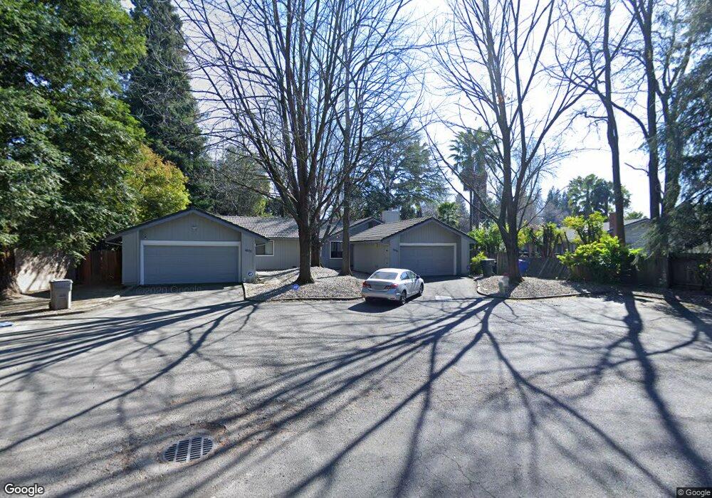
1056 Johnfer Way Sacramento, CA 95831
Pocket-Greenhaven NeighborhoodEstimated Value: $366,000 - $485,000
3
Beds
2
Baths
1,168
Sq Ft
$351/Sq Ft
Est. Value
About This Home
This home is located at 1056 Johnfer Way, Sacramento, CA 95831 and is currently estimated at $410,454, approximately $351 per square foot. 1056 Johnfer Way is a home located in Sacramento County with nearby schools including Caroline Wenzel Elementary School, Sam Brannan Middle School, and John F. Kennedy High School.
Ownership History
Date
Name
Owned For
Owner Type
Purchase Details
Closed on
Jan 24, 2000
Sold by
Kunisaki Rodney L
Bought by
Kunisaki Rodney L and Kunisaki Julie K
Current Estimated Value
Purchase Details
Closed on
May 29, 1996
Sold by
Staley Anne and Kienzle Helen B
Bought by
Kunisaki Rodney L
Home Financials for this Owner
Home Financials are based on the most recent Mortgage that was taken out on this home.
Original Mortgage
$61,600
Interest Rate
7.97%
Create a Home Valuation Report for This Property
The Home Valuation Report is an in-depth analysis detailing your home's value as well as a comparison with similar homes in the area
Home Values in the Area
Average Home Value in this Area
Purchase History
| Date | Buyer | Sale Price | Title Company |
|---|---|---|---|
| Kunisaki Rodney L | -- | -- | |
| Kunisaki Rodney L | -- | -- | |
| Kunisaki Rodney L | $77,000 | North American Title Co |
Source: Public Records
Mortgage History
| Date | Status | Borrower | Loan Amount |
|---|---|---|---|
| Closed | Kunisaki Rodney L | $61,600 |
Source: Public Records
Tax History Compared to Growth
Tax History
| Year | Tax Paid | Tax Assessment Tax Assessment Total Assessment is a certain percentage of the fair market value that is determined by local assessors to be the total taxable value of land and additions on the property. | Land | Improvement |
|---|---|---|---|---|
| 2025 | $1,777 | $127,886 | $58,128 | $69,758 |
| 2024 | $1,777 | $125,380 | $56,989 | $68,391 |
| 2023 | $1,728 | $122,922 | $55,872 | $67,050 |
| 2022 | $1,713 | $120,513 | $54,777 | $65,736 |
| 2021 | $1,631 | $118,151 | $53,703 | $64,448 |
| 2020 | $1,635 | $116,941 | $53,153 | $63,788 |
| 2019 | $1,602 | $114,649 | $52,111 | $62,538 |
| 2018 | $1,561 | $112,402 | $51,090 | $61,312 |
| 2017 | $1,536 | $110,199 | $50,089 | $60,110 |
| 2016 | $1,491 | $108,039 | $49,107 | $58,932 |
| 2015 | $1,464 | $106,417 | $48,370 | $58,047 |
| 2014 | $1,436 | $104,333 | $47,423 | $56,910 |
Source: Public Records
Map
Nearby Homes
- 1052 Johnfer Way
- 989 Johnfer Way
- 966 Briarcrest Way
- 37 Starlit Cir
- 959 Johnfer Way
- 792 Parklin Ave
- 6874 Westmoreland Way
- 6010 Machado Way
- 6235 Allenport Way
- 6625 Fordham Way
- 6415 Chetwood Way
- 6661 S Land Park Dr
- 1261 42nd Ave
- 14 Westlite Ct
- 7110 Westmoreland Way
- 5880 Gloria Dr
- 6058 13th St
- 14 Miranda Ct
- 7170 Westmoreland Way
- 657 Brickyard Dr
- 1055 Johnfer Way
- 6485 Greenhaven Dr
- 6489 Greenhaven Dr
- 6481 Greenhaven Dr
- 1054 Johnfer Way
- 6475 Greenhaven Dr
- 6465 Greenhaven Dr
- 6493 Greenhaven Dr
- 1050 Johnfer Way
- 6499 Greenhaven Dr
- 6461 Greenhaven Dr
- 1048 Johnfer Way
- 1043 Johnfer Way
- 6501 Greenhaven Dr
- 1046 Johnfer Way
- 6451 Greenhaven Dr
- 6505 Greenhaven Dr
- 994 Astro Ct
- 990 Astro Ct
- 1041 Johnfer Way