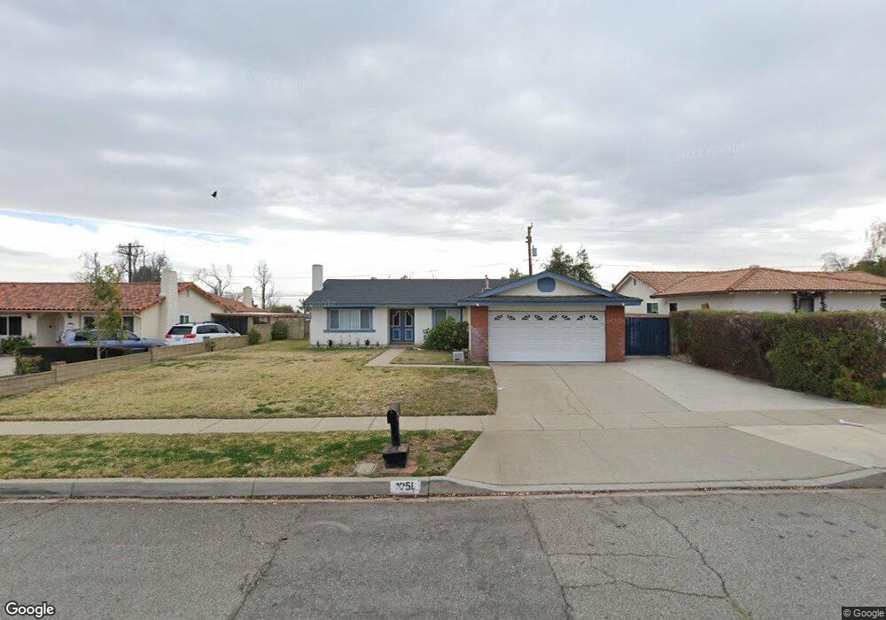
1056 Patrick St Upland, CA 91784
Upland AreaEstimated Value: $846,148 - $935,000
About This Home
This home is located at 1056 Patrick St, Upland, CA 91784 and is currently estimated at $901,037, approximately $466 per square foot. 1056 Patrick St is a home located in San Bernardino County with nearby schools including Pepper Tree Elementary, Pioneer Junior High School, and Upland High School.
Ownership History
We collect this data history from publicly available records. To have your information removed, we recommend requesting removal directly through your county’s website.
Purchase Details
Purchase Details
Home Values in the Area
Average Home Value in this Area
Purchase History
We collect this data history from publicly available records. To have your information removed, we recommend requesting removal directly through your county’s website.
| Date | Buyer | Sale Price | Title Company |
|---|---|---|---|
| -- | None Listed On Document | ||
| -- | North American Title Co |
Mortgage History
We collect this data history from publicly available records. To have your information removed, we recommend requesting removal directly through your county’s website.
| Date | Status | Borrower | Loan Amount |
|---|---|---|---|
| Previous Owner | $350,000 | ||
| Previous Owner | $63,000 | ||
| Previous Owner | $162,000 |
Tax History
We collect this data history from publicly available records. To have your information removed, we recommend requesting removal directly through your county’s website.
| Year | Tax Paid | Tax Assessment Tax Assessment Total Assessment is a certain percentage of the fair market value that is determined by local assessors to be the total taxable value of land and additions on the property. | Land | Improvement |
|---|---|---|---|---|
| 2026 | $4,692 | $433,491 | $75,064 | $358,427 |
| 2025 | $4,692 | $424,991 | $73,592 | $351,399 |
| 2024 | $4,542 | $416,658 | $72,149 | $344,509 |
| 2023 | $4,472 | $408,488 | $70,734 | $337,754 |
| 2022 | $4,374 | $400,478 | $69,347 | $331,131 |
| 2021 | $4,366 | $392,625 | $67,987 | $324,638 |
| 2020 | $4,247 | $388,599 | $67,290 | $321,309 |
| 2019 | $4,232 | $380,980 | $65,971 | $315,009 |
| 2018 | $4,128 | $373,509 | $64,677 | $308,832 |
| 2017 | $4,008 | $366,185 | $63,409 | $302,776 |
| 2016 | $3,800 | $359,005 | $62,166 | $296,839 |
| 2015 | $3,713 | $353,612 | $61,232 | $292,380 |
| 2014 | $3,616 | $346,686 | $60,033 | $286,653 |
Map
- 1031 W Patrick St
- 1055 W Aster St
- 1693 N Mountain Ave Unit D
- 1669 N San Antonio Ave
- 1630 Carmel Cir E
- 946 Coronado St
- 1273 N North Hills Dr
- 1686 Carmel Cir E
- 1623 N Vallejo Way
- 1635 Carmel Cir W
- 1649 Carmel Cir W
- 1672 Carmel Cir W
- 1644 Carmel Cir W
- 1579 Wedgewood Way
- 1763 N Vallejo Way
- 1668 Lakewood Ave
- 1432 N Erin Ave
- 943 W 14th St
- 874 W 19th St
- 1695 N Palm Ave
- 1046 Patrick St
- 1034 Patrick St
- 1045 Sullivan St
- 1068 Patrick St
- 1055 Sullivan St
- 1033 Sullivan St
- 1047 Patrick St
- 1067 Sullivan St
- 1031 Patrick St
- 1057 Patrick St
- 1078 Patrick St
- 1069 Patrick St
- 1642 Shamrock Ave
- 1648 Shamrock Ave
- 1077 Sullivan St
- 1654 Shamrock Ave
- 1634 Shamrock Ave
- 1090 Patrick St
- 1079 Patrick St
- 1660 Shamrock Ave
Ask me questions while you tour the home.