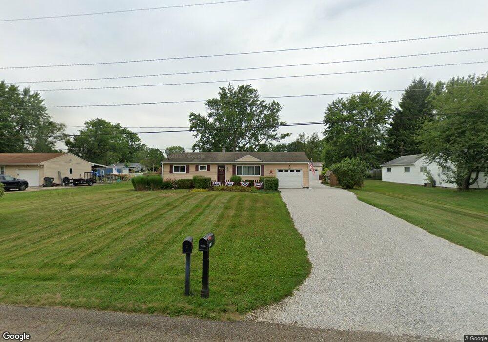
10567 Barcus Ave NE Alliance, OH 44601
Estimated Value: $161,000 - $190,345
2
Beds
1
Bath
960
Sq Ft
$187/Sq Ft
Est. Value
About This Home
This home is located at 10567 Barcus Ave NE, Alliance, OH 44601 and is currently estimated at $179,086, approximately $186 per square foot. 10567 Barcus Ave NE is a home located in Stark County with nearby schools including Marlington High School and Regina Coeli/St Joseph School.
Ownership History
Date
Name
Owned For
Owner Type
Purchase Details
Closed on
Nov 18, 2004
Sold by
Sanor Jasen J and Sanor Karen S
Bought by
Fish Chad F and Fish Elisha M
Current Estimated Value
Home Financials for this Owner
Home Financials are based on the most recent Mortgage that was taken out on this home.
Original Mortgage
$88,940
Outstanding Balance
$44,768
Interest Rate
5.91%
Mortgage Type
Purchase Money Mortgage
Estimated Equity
$134,318
Purchase Details
Closed on
May 28, 1999
Sold by
Moles Karen S
Bought by
Sanor Jasen J and Sanor Karen S
Home Financials for this Owner
Home Financials are based on the most recent Mortgage that was taken out on this home.
Original Mortgage
$59,867
Interest Rate
6.92%
Mortgage Type
FHA
Purchase Details
Closed on
Sep 26, 1989
Create a Home Valuation Report for This Property
The Home Valuation Report is an in-depth analysis detailing your home's value as well as a comparison with similar homes in the area
Purchase History
| Date | Buyer | Sale Price | Title Company |
|---|---|---|---|
| Fish Chad F | $92,000 | Quest Title Agency Inc | |
| Sanor Jasen J | $59,900 | -- | |
| -- | $37,500 | -- |
Source: Public Records
Mortgage History
| Date | Status | Borrower | Loan Amount |
|---|---|---|---|
| Open | Fish Chad F | $88,940 | |
| Closed | Sanor Jasen J | $59,867 |
Source: Public Records
Tax History
| Year | Tax Paid | Tax Assessment Tax Assessment Total Assessment is a certain percentage of the fair market value that is determined by local assessors to be the total taxable value of land and additions on the property. | Land | Improvement |
|---|---|---|---|---|
| 2025 | -- | $55,200 | $21,880 | $33,320 |
| 2024 | -- | $55,200 | $21,880 | $33,320 |
| 2023 | $1,502 | $42,560 | $11,620 | $30,940 |
| 2022 | $1,507 | $42,560 | $11,620 | $30,940 |
| 2021 | $1,512 | $42,560 | $11,620 | $30,940 |
| 2020 | $1,413 | $35,460 | $10,010 | $25,450 |
| 2019 | $1,292 | $32,690 | $10,010 | $22,680 |
Source: Public Records
Map
Nearby Homes
- 10645 Wilma Ave NE
- 10684 Dot Ave NE
- 10666 Wilma Ave NE
- 0 Meadow St NE
- 10580 Heltman Ave NE
- 0 W Main St Unit 5090123
- 13004 Edison St NE
- 0 Westwood St
- 13109 Edison St NE
- 1235 Spring Ridge Cir Unit 17A
- 1601 Raywood Rd
- 347 Buckeye Ave
- 550 Johnson Ave
- 432 Johnson Ave
- 1114 Briarcliff Ave
- 1310 Overlook Dr
- 664 Fairview Place
- 160 Bonnieview Ave
- 8539 Schubert Ave NE
- 1156 Parkside Dr
- 10545 Barcus Ave NE
- 10585 Barcus Ave NE
- 10570 Dot Ave NE
- 10533 Barcus Ave NE
- 10605 Barcus Ave NE
- 10544 Dot Ave NE
- 10588 Dot Ave NE
- 10570 Barcus Ave NE
- 10588 Barcus Ave NE
- 10530 Barcus Ave NE
- 10530 Dot Ave NE
- 10606 Dot Ave NE
- 10625 Barcus Ave NE
- 10606 Barcus Ave NE
- 10626 Dot Ave NE
- 12534 Agnes St NE
- 10626 Barcus Ave NE
- 10645 Barcus Ave NE
- 12488 Beeson St NE
- 10567 Dot Ave NE
Your Personal Tour Guide
Ask me questions while you tour the home.