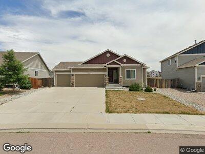
10568 Abrams Dr Colorado Springs, CO 80925
Lorson Ranch NeighborhoodEstimated Value: $506,810 - $546,000
5
Beds
3
Baths
1,604
Sq Ft
$324/Sq Ft
Est. Value
About This Home
This home is located at 10568 Abrams Dr, Colorado Springs, CO 80925 and is currently estimated at $519,703, approximately $324 per square foot. 10568 Abrams Dr is a home with nearby schools including Grand Mountain School, Mesa Ridge High School, and Valley Christian Academy.
Ownership History
Date
Name
Owned For
Owner Type
Purchase Details
Closed on
Oct 15, 2020
Sold by
Hanson James A and Hanson Christine P
Bought by
Bonney Sean K and Bonney Paula G
Current Estimated Value
Home Financials for this Owner
Home Financials are based on the most recent Mortgage that was taken out on this home.
Original Mortgage
$312,000
Outstanding Balance
$280,625
Interest Rate
2.9%
Mortgage Type
VA
Estimated Equity
$237,675
Purchase Details
Closed on
Jan 9, 2020
Sold by
Armstrong Dea and Armstrong Michael
Bought by
Hanson James A and Hanson Christine P
Home Financials for this Owner
Home Financials are based on the most recent Mortgage that was taken out on this home.
Original Mortgage
$165,000
Interest Rate
3.6%
Mortgage Type
New Conventional
Purchase Details
Closed on
Aug 11, 2015
Sold by
Saint Aubyn Homes Llc
Bought by
Armstrong Michael G and Armstrong Dea
Home Financials for this Owner
Home Financials are based on the most recent Mortgage that was taken out on this home.
Original Mortgage
$306,398
Interest Rate
4.13%
Mortgage Type
VA
Create a Home Valuation Report for This Property
The Home Valuation Report is an in-depth analysis detailing your home's value as well as a comparison with similar homes in the area
Home Values in the Area
Average Home Value in this Area
Purchase History
| Date | Buyer | Sale Price | Title Company |
|---|---|---|---|
| Bonney Sean K | $416,000 | Legacy Title Group Llc | |
| Hanson James A | $365,000 | North American Title | |
| Armstrong Michael G | $306,400 | Heritage Title |
Source: Public Records
Mortgage History
| Date | Status | Borrower | Loan Amount |
|---|---|---|---|
| Open | Bonney Sean K | $312,000 | |
| Previous Owner | Hanson James A | $165,000 | |
| Previous Owner | Armstrong Michael G | $319,362 | |
| Previous Owner | Armstrong Michael G | $306,398 |
Source: Public Records
Tax History Compared to Growth
Tax History
| Year | Tax Paid | Tax Assessment Tax Assessment Total Assessment is a certain percentage of the fair market value that is determined by local assessors to be the total taxable value of land and additions on the property. | Land | Improvement |
|---|---|---|---|---|
| 2024 | $4,762 | $35,600 | $6,040 | $29,560 |
| 2022 | $3,547 | $25,620 | $4,810 | $20,810 |
| 2021 | $3,693 | $26,360 | $4,950 | $21,410 |
| 2020 | $2,581 | $25,380 | $4,330 | $21,050 |
| 2019 | $2,573 | $25,380 | $4,330 | $21,050 |
| 2018 | $1,995 | $21,120 | $4,360 | $16,760 |
| 2017 | $2,037 | $21,120 | $4,360 | $16,760 |
| 2016 | $3,059 | $23,640 | $4,380 | $19,260 |
| 2015 | $1,196 | $8,770 | $8,770 | $0 |
| 2014 | $1,474 | $10,860 | $10,860 | $0 |
Source: Public Records
Map
Nearby Homes
- 10585 Abrams Dr
- 10622 Abrams Dr
- 10394 Abrams Dr
- 6677 Lamine Dr
- 10384 Declaration Dr
- 10670 Abrams Dr
- 10636 Deer Meadow Cir
- 6687 Stingray Ln
- 10340 Abrams Dr
- 10898 Aliso Dr
- 10781 Yuba Dr
- 10905 Pigeon Dr
- 10671 Cattle Baron Way
- 10924 Pigeon Dr
- 6878 Alliance Loop
- 6186 Popper Dr
- 6685 Alliance Loop
- 10734 Witcher Dr
- 6253 Saddlebred Way
- 10856 Saco Dr
- 10568 Abrams Dr
- 10574 Abrams Dr
- 10562 Abrams Dr
- 10580 Abrams Dr
- 10556 Abrams Dr
- 10573 Abrams Dr
- 10579 Abrams Dr
- 10561 Abrams Dr
- 10550 Abrams Dr
- 10586 Abrams Dr
- 10592 Abrams Dr
- 10591 Abrams Dr
- 6447 Stingray Ln
- 6459 Stingray Ln
- 10538 Abrams Dr
- 10532 Abrams Dr
- 10526 Abrams Dr
- 10598 Abrams Dr
- 6423 Stingray Ln
- 6435 Stingray Ln