Estimated Value: $254,000 - $287,000
3
Beds
2
Baths
1,861
Sq Ft
$144/Sq Ft
Est. Value
About This Home
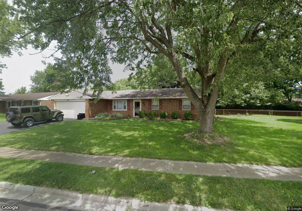
This home is located at 1057 Colorado Dr, Xenia, OH 45385 and is currently estimated at $267,789, approximately $143 per square foot. 1057 Colorado Dr is a home located in Greene County with nearby schools including Xenia High School, Summit Academy Community School for Alternative Learners - Xenia, and Legacy Christian Academy.
Ownership History
Date
Name
Owned For
Owner Type
Purchase Details
Closed on
Aug 20, 2013
Sold by
Woodhouse Gay N
Bought by
Downing Christopher L and Downing Tonya M
Current Estimated Value
Home Financials for this Owner
Home Financials are based on the most recent Mortgage that was taken out on this home.
Original Mortgage
$128,250
Outstanding Balance
$95,146
Interest Rate
4.33%
Mortgage Type
New Conventional
Estimated Equity
$172,643
Purchase Details
Closed on
Jul 27, 2007
Sold by
Caudill Benjamin F and Caudill Neva L
Bought by
Woodhouse Gay N
Home Financials for this Owner
Home Financials are based on the most recent Mortgage that was taken out on this home.
Original Mortgage
$129,980
Interest Rate
6.71%
Mortgage Type
Unknown
Purchase Details
Closed on
Apr 9, 1996
Sold by
Zoerb Terry L
Bought by
Caudill Benjamin F and Caudill L
Create a Home Valuation Report for This Property
The Home Valuation Report is an in-depth analysis detailing your home's value as well as a comparison with similar homes in the area
Home Values in the Area
Average Home Value in this Area
Purchase History
| Date | Buyer | Sale Price | Title Company |
|---|---|---|---|
| Downing Christopher L | $135,000 | None Available | |
| Woodhouse Gay N | $135,000 | Midwest Title Company | |
| Caudill Benjamin F | $98,500 | -- |
Source: Public Records
Mortgage History
| Date | Status | Borrower | Loan Amount |
|---|---|---|---|
| Open | Downing Christopher L | $128,250 | |
| Closed | Woodhouse Gay N | $129,980 |
Source: Public Records
Tax History Compared to Growth
Tax History
| Year | Tax Paid | Tax Assessment Tax Assessment Total Assessment is a certain percentage of the fair market value that is determined by local assessors to be the total taxable value of land and additions on the property. | Land | Improvement |
|---|---|---|---|---|
| 2024 | $2,992 | $69,930 | $16,760 | $53,170 |
| 2023 | $2,992 | $69,930 | $16,760 | $53,170 |
| 2022 | $2,482 | $49,480 | $9,860 | $39,620 |
| 2021 | $2,516 | $49,480 | $9,860 | $39,620 |
| 2020 | $2,410 | $49,480 | $9,860 | $39,620 |
| 2019 | $2,199 | $42,500 | $9,810 | $32,690 |
| 2018 | $2,208 | $42,500 | $9,810 | $32,690 |
| 2017 | $2,022 | $42,500 | $9,810 | $32,690 |
| 2016 | $2,023 | $38,210 | $9,810 | $28,400 |
| 2015 | $2,028 | $38,210 | $9,810 | $28,400 |
| 2014 | $1,942 | $38,210 | $9,810 | $28,400 |
Source: Public Records
Map
Nearby Homes
- 1107 Arkansas Dr
- 1255 Colorado Dr
- 1908 Whitt St
- 2499 Jenny Marie Dr
- 2345 Tennessee Dr
- 1829 Gayhart Dr
- 1866 Roxbury Dr
- 2421 Louisiana Dr
- 2540 Jenny Marie Dr
- 1769 Gayhart Dr
- 2257 Maryland Dr
- 1403 Texas Dr
- 2540 Cornwall Dr
- 0 Berkshire Dr Unit 942854
- 2142 Michigan Dr
- 1778 Arapaho Dr
- 2545 Harmony Dr
- 2692 Kingman Dr
- 1653 Seneca Dr
- 2705 Tennessee Dr
- 1043 Colorado Dr
- 1167 Colorado Dr
- 1029 Colorado Dr
- 1080 Colorado Dr
- 2026 Gayhart Dr
- 1171 Colorado Dr
- 1096 Colorado Dr
- 2038 Gayhart Dr
- 2076 Tennessee Dr
- 2012 Gayhart Dr
- 1110 Colorado Dr
- 1170 Colorado Dr
- 1193 Colorado Dr
- 1063 Arkansas Dr
- 2050 Gayhart Dr
- 2092 Tennessee Dr
- 1998 Gayhart Dr
- 1079 Arkansas Dr
- 2075 Mississippi Dr
- 1001 Colorado Dr