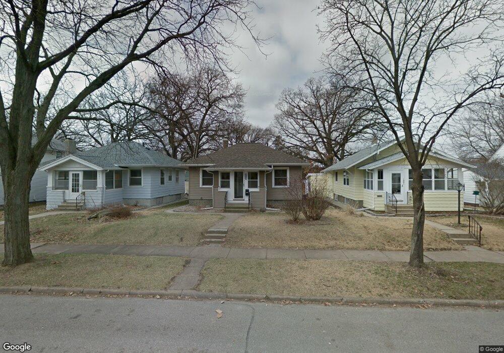
1057 Daniels St NE Cedar Rapids, IA 52402
Mound View NeighborhoodEstimated Value: $139,000 - $152,159
2
Beds
1
Bath
783
Sq Ft
$184/Sq Ft
Est. Value
About This Home
This home is located at 1057 Daniels St NE, Cedar Rapids, IA 52402 and is currently estimated at $144,040, approximately $183 per square foot. 1057 Daniels St NE is a home located in Linn County with nearby schools including Franklin Middle School, George Washington High School, and Isaac Newton Christian Academy.
Ownership History
Date
Name
Owned For
Owner Type
Purchase Details
Closed on
Jun 22, 2022
Sold by
Crumes Dustin L and Crumes Sue Michele
Bought by
Crumes Taylor
Current Estimated Value
Home Financials for this Owner
Home Financials are based on the most recent Mortgage that was taken out on this home.
Original Mortgage
$15,000
Outstanding Balance
$14,318
Interest Rate
5.81%
Estimated Equity
$129,722
Purchase Details
Closed on
Oct 31, 2011
Sold by
Crumes Dustin L
Bought by
Novak Austin A
Home Financials for this Owner
Home Financials are based on the most recent Mortgage that was taken out on this home.
Original Mortgage
$92,536
Interest Rate
4.09%
Mortgage Type
Seller Take Back
Create a Home Valuation Report for This Property
The Home Valuation Report is an in-depth analysis detailing your home's value as well as a comparison with similar homes in the area
Home Values in the Area
Average Home Value in this Area
Purchase History
| Date | Buyer | Sale Price | Title Company |
|---|---|---|---|
| Crumes Taylor | $150,000 | None Listed On Document | |
| Novak Austin A | $94,536 | None Available |
Source: Public Records
Mortgage History
| Date | Status | Borrower | Loan Amount |
|---|---|---|---|
| Open | Crumes Taylor | $15,000 | |
| Open | Crumes Taylor | $135,000 | |
| Closed | Crumes Taylor | $15,000 | |
| Previous Owner | Novak Austin A | $92,536 |
Source: Public Records
Tax History Compared to Growth
Tax History
| Year | Tax Paid | Tax Assessment Tax Assessment Total Assessment is a certain percentage of the fair market value that is determined by local assessors to be the total taxable value of land and additions on the property. | Land | Improvement |
|---|---|---|---|---|
| 2025 | $2,028 | $121,400 | $20,200 | $101,200 |
| 2024 | $1,966 | $114,600 | $18,200 | $96,400 |
| 2023 | $1,966 | $114,600 | $18,200 | $96,400 |
| 2022 | $1,806 | $93,200 | $18,200 | $75,000 |
| 2021 | $1,862 | $87,200 | $18,200 | $69,000 |
| 2020 | $1,862 | $84,400 | $16,200 | $68,200 |
| 2019 | $1,772 | $82,200 | $16,200 | $66,000 |
| 2018 | $1,722 | $82,200 | $16,200 | $66,000 |
| 2017 | $1,604 | $73,700 | $16,200 | $57,500 |
| 2016 | $1,628 | $76,600 | $16,200 | $60,400 |
| 2015 | $1,716 | $80,681 | $18,180 | $62,501 |
| 2014 | $1,716 | $90,985 | $18,540 | $72,445 |
| 2013 | $1,894 | $90,985 | $18,540 | $72,445 |
Source: Public Records
Map
Nearby Homes
- 1046 12th St NE
- 909 Daniels St NE
- 1522 J Ave NE
- 910 Maplewood Dr NE
- 2000 Sierra Cir NE
- 2011 Sierra Cir NE
- 2006 Sierra Cir NE
- 2015 Sierra Cir NE
- 832 Daniels St NE
- 2019 Sierra Cir NE
- 2012 Sierra Cir NE
- 2018 Sierra Cir NE
- 826 Daniels St NE
- 2023 Sierra Cir NE
- 2103 Sierra Cir NE
- 2102 Sierra Cir NE
- 2109 Sierra Cir NE
- 2110 Sierra Cir NE
- 2115 Sierra Cir NE
- 2116 Sierra Cir NE
- 1061 Daniels St NE
- 1051 Daniels St NE
- 1047 Daniels St NE
- 1067 Daniels St NE
- 1043 Daniels St NE
- 1041 Daniels St NE
- 1052 Center Point Rd NE
- 1060 Center Point Rd NE
- 1044 Center Point Rd NE
- 1058 Daniels St NE
- 1035 Daniels St NE
- 1062 Daniels St NE
- 1038 Center Point Rd NE
- 1066 Daniels St NE
- 1052 Daniels St NE
- 1326 J Ave NE
- 1036 Center Point Rd NE
- 1027 Daniels St NE
- 1044 Daniels St NE
- 1032 Center Point Rd NE