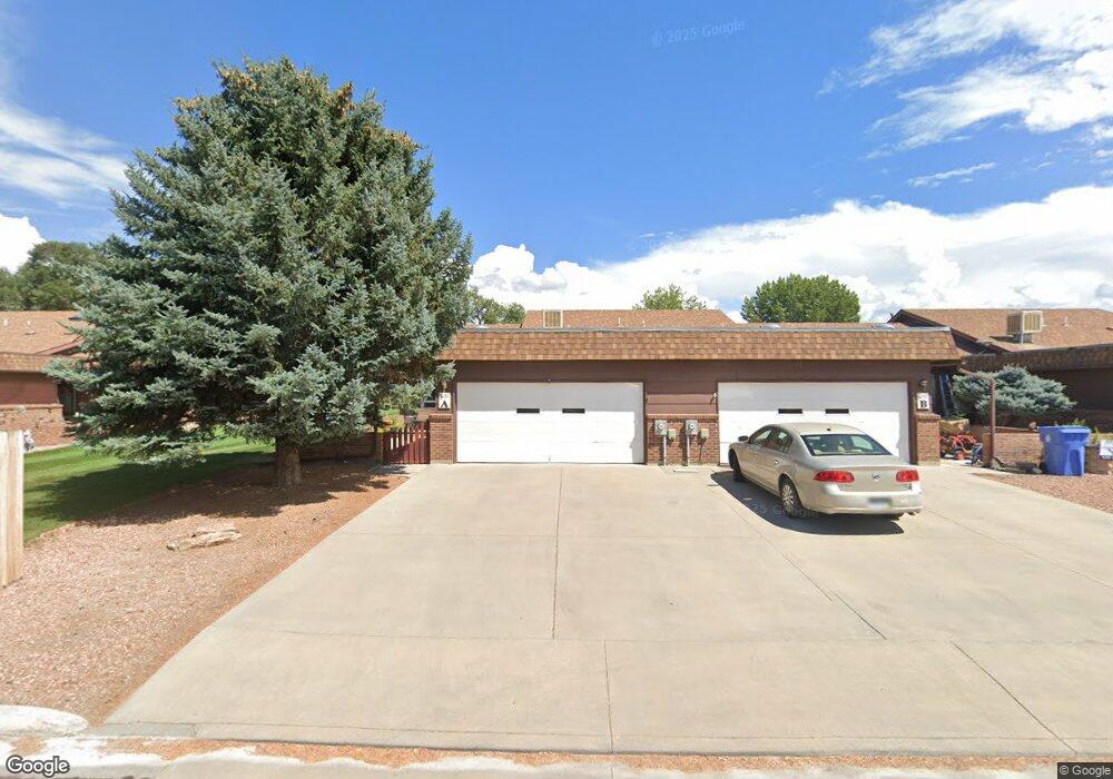
1057 Margo Ct Unit A Montrose, CO 81401
Estimated Value: $395,000 - $410,000
2
Beds
2
Baths
1,766
Sq Ft
$228/Sq Ft
Est. Value
About This Home
This home is located at 1057 Margo Ct Unit A, Montrose, CO 81401 and is currently estimated at $402,644, approximately $227 per square foot. 1057 Margo Ct Unit A is a home located in Montrose County with nearby schools including Johnson Elementary School, Centennial Middle School, and Montrose High School.
Ownership History
Date
Name
Owned For
Owner Type
Purchase Details
Closed on
Apr 27, 2018
Sold by
Hirst Elisabeth M
Bought by
Brown Michael J and Brown Vicki L
Current Estimated Value
Home Financials for this Owner
Home Financials are based on the most recent Mortgage that was taken out on this home.
Original Mortgage
$125,000
Outstanding Balance
$107,728
Interest Rate
4.44%
Mortgage Type
New Conventional
Estimated Equity
$294,916
Purchase Details
Closed on
Feb 4, 1992
Sold by
H & P Construction Co Inc
Bought by
Hirst H Charles H and Hirst Elisabeth M
Create a Home Valuation Report for This Property
The Home Valuation Report is an in-depth analysis detailing your home's value as well as a comparison with similar homes in the area
Home Values in the Area
Average Home Value in this Area
Purchase History
| Date | Buyer | Sale Price | Title Company |
|---|---|---|---|
| Brown Michael J | $220,000 | Fidelity National Title | |
| Hirst H Charles H | $89,000 | -- |
Source: Public Records
Mortgage History
| Date | Status | Borrower | Loan Amount |
|---|---|---|---|
| Open | Brown Michael J | $125,000 |
Source: Public Records
Tax History Compared to Growth
Tax History
| Year | Tax Paid | Tax Assessment Tax Assessment Total Assessment is a certain percentage of the fair market value that is determined by local assessors to be the total taxable value of land and additions on the property. | Land | Improvement |
|---|---|---|---|---|
| 2024 | $1,526 | $21,170 | $2,850 | $18,320 |
| 2023 | $1,526 | $25,790 | $3,480 | $22,310 |
| 2022 | $1,304 | $18,680 | $2,430 | $16,250 |
| 2021 | $1,343 | $19,220 | $2,500 | $16,720 |
| 2020 | $1,037 | $15,260 | $2,070 | $13,190 |
| 2019 | $1,044 | $15,260 | $2,070 | $13,190 |
| 2018 | $450 | $12,810 | $1,670 | $11,140 |
| 2017 | $446 | $12,810 | $1,670 | $11,140 |
| 2016 | $463 | $13,500 | $1,610 | $11,890 |
| 2015 | $909 | $13,500 | $1,610 | $11,890 |
| 2014 | $753 | $11,960 | $1,160 | $10,800 |
Source: Public Records
Map
Nearby Homes
- 1119 Phillips Ct
- 1119 Phillips Ct Unit G
- 1119 Phillips Ct Unit A
- 1239 Leeds Ave
- 2555 Iris Ct
- 1219 Peppertree Dr
- 2250 Phillips Cir
- 1323 Manchester Dr
- 2345 Phillips Cir Unit D
- 2210 Devon St
- 2130 Devon St
- 2409 Pecan St
- 1510 Kent Ave Unit A
- 1510 Kent Ave
- 2136 Stratford Dr Unit A
- 2125 Hartford Way Unit A
- 2135 Winston Way Unit B
- 1131 S 12th St
- 1205 Dover Rd
- 2799 Stoney Creek Ln
- 1057 Margo Ct
- 1057 Margo Ct Unit F
- 1057 Margo Ct Unit E
- 1057 Margo Ct Unit D
- 1057 Margo Ct Unit C
- 1057 Margo Ct Unit B
- 0 Sunnyside Ave Unit 635277
- 0 Sunnyside Ave Unit 2505 Sunnysdie "Road
- 0 Sunnyside Ave Unit 2505 Sunnyside Road
- 0 Sunnyside Ave Unit 638915
- 0 Sunnyside Ave Unit 651117
- 0 Sunnyside Ave Unit 661975
- 0 Sunnyside Ave Unit 663388
- 0 Sunnyside Ave Unit 2505 Sunnyside Rd
- 0 Sunnyside Ave Unit 2505 Sunnyside
- 0 Sunnyside Ave
- 1043 Margo Ct #D
- 2333 Oldham Way
- 2327 Oldham Way
- 2339 Oldham Way