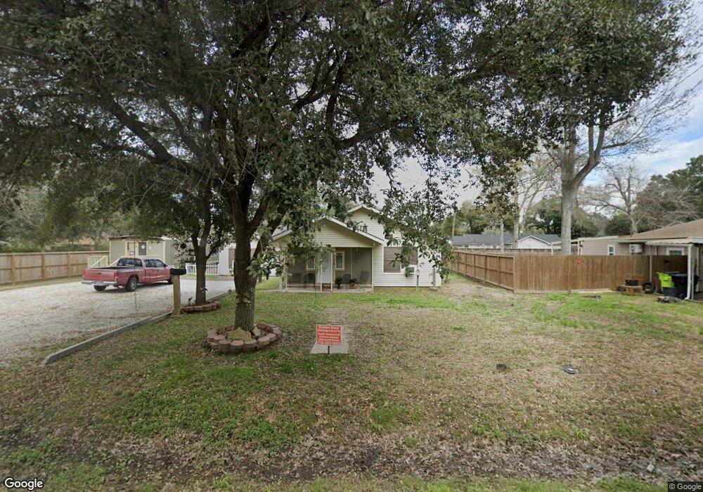
1057 Sally Anne Dr Rosenberg, TX 77471
Estimated Value: $232,039 - $268,000
4
Beds
2
Baths
2,037
Sq Ft
$126/Sq Ft
Est. Value
About This Home
This home is located at 1057 Sally Anne Dr, Rosenberg, TX 77471 and is currently estimated at $255,760, approximately $125 per square foot. 1057 Sally Anne Dr is a home located in Fort Bend County with nearby schools including Smith Elementary School, J J Wessendorff Middle School, and Lamar Junior High School.
Ownership History
Date
Name
Owned For
Owner Type
Purchase Details
Closed on
Dec 9, 2006
Sold by
Garcia Helene M and Garcia Charles A
Bought by
Lerma Lupe G
Current Estimated Value
Home Financials for this Owner
Home Financials are based on the most recent Mortgage that was taken out on this home.
Original Mortgage
$55,000
Outstanding Balance
$37,328
Interest Rate
8.9%
Mortgage Type
Purchase Money Mortgage
Estimated Equity
$218,432
Purchase Details
Closed on
Dec 22, 1987
Sold by
Zwahr George Eta
Bought by
Lerma Lupe G
Create a Home Valuation Report for This Property
The Home Valuation Report is an in-depth analysis detailing your home's value as well as a comparison with similar homes in the area
Home Values in the Area
Average Home Value in this Area
Purchase History
| Date | Buyer | Sale Price | Title Company |
|---|---|---|---|
| Lerma Lupe G | -- | Fidelity National Title | |
| Lerma Lupe G | -- | -- |
Source: Public Records
Mortgage History
| Date | Status | Borrower | Loan Amount |
|---|---|---|---|
| Open | Lerma Lupe G | $55,000 |
Source: Public Records
Tax History Compared to Growth
Tax History
| Year | Tax Paid | Tax Assessment Tax Assessment Total Assessment is a certain percentage of the fair market value that is determined by local assessors to be the total taxable value of land and additions on the property. | Land | Improvement |
|---|---|---|---|---|
| 2025 | $178 | $116,984 | $16,393 | $100,591 |
| 2024 | $178 | $146,858 | -- | $157,411 |
| 2023 | $139 | $133,507 | $0 | $158,546 |
| 2022 | $674 | $121,370 | $0 | $144,730 |
| 2021 | $2,289 | $110,340 | $15,910 | $94,430 |
| 2020 | $2,199 | $103,600 | $15,910 | $87,690 |
| 2019 | $2,151 | $94,180 | $15,910 | $78,270 |
| 2018 | $1,987 | $85,620 | $15,910 | $69,710 |
| 2017 | $1,817 | $77,840 | $15,910 | $61,930 |
| 2016 | $1,652 | $70,760 | $15,910 | $54,850 |
| 2015 | $1,076 | $64,330 | $15,910 | $48,420 |
| 2014 | $1,235 | $64,490 | $15,910 | $48,580 |
Source: Public Records
Map
Nearby Homes
- 1109 Frances Dr
- 4602 Avenue H
- 1806 Cedar Dr
- 1809 Hawthorn Dr
- 1805 Hawthorn Dr
- 5002 Quebec Blvd
- 4502 River Rd
- 5027 Quebec Blvd
- 1922 Teakwood St
- 5121 Alderney Ct
- 4707 E Parma Dr
- 5303 Rivers Edge Dr
- 1504 Radio Ln
- 5106 Alderney Ct
- 5319 Rivers Edge Dr
- 1004 Country Club Dr
- 1230 Law Ct
- 512 and 514 Travis St
- 000 Fm 2218 Rd
- 1403 Divin Dr
- 1053 Sally Anne Dr
- 1059 Sally Anne Dr
- 1034 Lindsey Dr
- 1038 Lindsey Dr
- 1028 Lindsey Dr
- 1063 Sally Anne Dr
- 1058 Sally Anne Dr
- 1054 Sally Anne Dr
- 1051 Sally Anne Dr
- 1052 Sally Anne Dr
- 1062 Sally Anne Dr
- 1026 Lindsey Dr
- 1042 Lindsey Dr
- 1067 Sally Anne Dr
- 1066 Sally Anne Dr
- 1033 Lindsey Dr
- 1050 Sally Anne Dr
- 1037 Lindsey Dr
- 1047 Sally Anne Dr
- 1024 Lindsey Dr