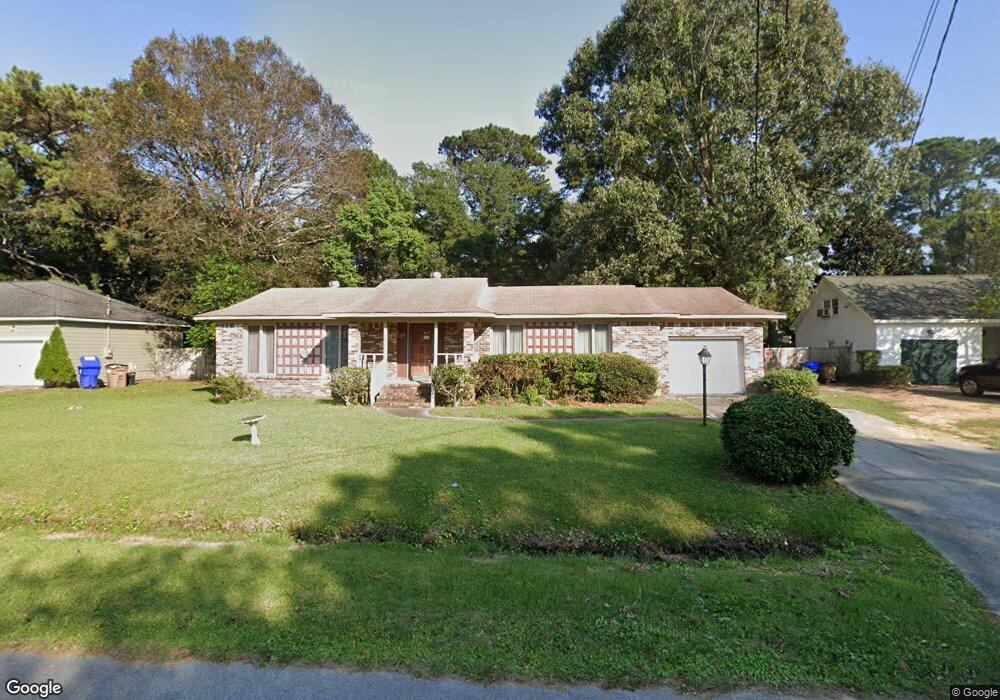
1058 Renwood Dr Charleston, SC 29412
James Island NeighborhoodEstimated Value: $504,201 - $582,000
3
Beds
2
Baths
1,475
Sq Ft
$365/Sq Ft
Est. Value
About This Home
This home is located at 1058 Renwood Dr, Charleston, SC 29412 and is currently estimated at $538,550, approximately $365 per square foot. 1058 Renwood Dr is a home located in Charleston County with nearby schools including James Island Elementary School, Camp Road Middle, and James Island Charter High School.
Ownership History
Date
Name
Owned For
Owner Type
Purchase Details
Closed on
Apr 19, 2022
Sold by
Donna Ferrell
Bought by
Dfrf Renwood Llc
Current Estimated Value
Purchase Details
Closed on
Jul 19, 2021
Sold by
Donna Ferrell
Bought by
Dfrf Renwood Llc
Purchase Details
Closed on
Apr 28, 2017
Sold by
Williams Curtis T
Bought by
Ferrell Donna and Ferrell Roslyn
Purchase Details
Closed on
Oct 16, 2015
Sold by
Estate Of Reuben L Ferrell and Ferrell Roslyn
Bought by
Ferrell Roslyn and Ferrell Donna
Purchase Details
Closed on
Oct 29, 2008
Sold by
Estate Of Martha P Ferrell and Ferrell Roslyn
Bought by
Ferrell Roslyn and Ferrell Donna
Create a Home Valuation Report for This Property
The Home Valuation Report is an in-depth analysis detailing your home's value as well as a comparison with similar homes in the area
Home Values in the Area
Average Home Value in this Area
Purchase History
| Date | Buyer | Sale Price | Title Company |
|---|---|---|---|
| Dfrf Renwood Llc | -- | Carver-Young Sally A | |
| Dfrf Renwood Llc | -- | Carver-Young Sally A | |
| Dfrf Renwood Llc | $4,054 | Carver-Young Sally A | |
| Ferrell Donna | $13,760 | None Available | |
| Ferrell Roslyn | -- | -- | |
| Ferrell Reuben L | -- | -- | |
| Ferrell Roslyn | -- | -- |
Source: Public Records
Tax History Compared to Growth
Tax History
| Year | Tax Paid | Tax Assessment Tax Assessment Total Assessment is a certain percentage of the fair market value that is determined by local assessors to be the total taxable value of land and additions on the property. | Land | Improvement |
|---|---|---|---|---|
| 2024 | $4,094 | $14,730 | $0 | $0 |
| 2023 | $4,094 | $14,730 | $0 | $0 |
| 2022 | $3,738 | $14,730 | $0 | $0 |
| 2021 | $3,721 | $14,730 | $0 | $0 |
| 2020 | $3,643 | $14,730 | $0 | $0 |
| 2019 | $3,375 | $12,800 | $0 | $0 |
| 2017 | $3,305 | $12,800 | $0 | $0 |
| 2016 | $3,195 | $12,800 | $0 | $0 |
| 2015 | $3,058 | $12,800 | $0 | $0 |
| 2014 | $2,751 | $0 | $0 | $0 |
| 2011 | -- | $0 | $0 | $0 |
Source: Public Records
Map
Nearby Homes
- 1418 Kentwood Cir
- 1014 Arborwood Dr
- 1107 Secessionville Rd
- 1416 Camp Rd
- 1453 Camp Rd
- 1402 Camp Rd Unit 1H
- 1402 Camp Rd Unit 12F
- 1402 Camp Rd Unit 8B
- 1402 Camp Rd Unit 9C
- 1402 Camp Rd Unit 5E
- 1402 Camp Rd Unit 6E
- 1402 Camp Rd Unit 9G
- 1030 Pauline Ave
- 1 S Anderson Ave
- 1335 Camp Rd
- 1359 White House Blvd
- 1135 Bellwood Rd
- 1336 Briarfield Ave
- 1137 Rivercrest Dr
- 17 S Anderson Ave Unit A,B,C, D
- 1062 Renwood Dr
- 1054 Renwood Dr
- 1057 Woodside Dr
- 1053 Woodside Dr
- 1063 Woodside Dr
- 1066 Renwood Dr
- 1050 Renwood Dr
- 1059 Renwood Dr
- 1055 Renwood Dr
- 1047 Woodside Dr
- 1063 Renwood Dr
- 1051 Renwood Dr
- 1069 Woodside Dr
- 1046 Renwood Dr
- 1070 Renwood Dr
- 1045 Woodside Dr
- 1056 Kingswood Dr
- 1067 Renwood Dr
- 1062 Kingswood Dr
- 1060 Woodside Dr