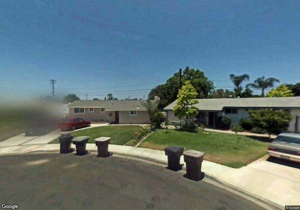
10581 Patricia Dr Anaheim, CA 92804
West Anaheim NeighborhoodEstimated Value: $817,000 - $908,178
3
Beds
2
Baths
1,269
Sq Ft
$696/Sq Ft
Est. Value
About This Home
This home is located at 10581 Patricia Dr, Anaheim, CA 92804 and is currently estimated at $883,295, approximately $696 per square foot. 10581 Patricia Dr is a home located in Orange County with nearby schools including Jonas E. Salk Elementary School, Dale Jr High School, and Magnolia High.
Ownership History
Date
Name
Owned For
Owner Type
Purchase Details
Closed on
Jul 16, 2020
Sold by
Sanchez Tony and Sanchez Patricia M
Bought by
Sanchez Tony and Sanchez Patricia M
Current Estimated Value
Purchase Details
Closed on
Nov 9, 2004
Sold by
Sanchez Patricia M and Sanchez Tony
Bought by
Sanchez Tony and Sanchez Patricia M
Home Financials for this Owner
Home Financials are based on the most recent Mortgage that was taken out on this home.
Original Mortgage
$315,000
Outstanding Balance
$157,300
Interest Rate
5.79%
Mortgage Type
New Conventional
Estimated Equity
$725,995
Purchase Details
Closed on
Aug 22, 2003
Sold by
Perez Patricia
Bought by
Perez Patricia and Sanchez Tony
Home Financials for this Owner
Home Financials are based on the most recent Mortgage that was taken out on this home.
Original Mortgage
$80,000
Interest Rate
5.6%
Mortgage Type
Stand Alone Second
Purchase Details
Closed on
Oct 4, 2002
Sold by
Perez Patricia
Bought by
Perez Patricia
Home Financials for this Owner
Home Financials are based on the most recent Mortgage that was taken out on this home.
Original Mortgage
$200,000
Interest Rate
6.17%
Purchase Details
Closed on
Oct 27, 2000
Sold by
Perez Rudolph Richison
Bought by
Perez Patricia
Home Financials for this Owner
Home Financials are based on the most recent Mortgage that was taken out on this home.
Original Mortgage
$167,900
Interest Rate
7.82%
Purchase Details
Closed on
Oct 19, 2000
Sold by
Kuhn Matthew B and Kuhn Michelle L
Bought by
Perez Patricia
Home Financials for this Owner
Home Financials are based on the most recent Mortgage that was taken out on this home.
Original Mortgage
$167,900
Interest Rate
7.82%
Purchase Details
Closed on
Mar 30, 2000
Sold by
Doherty William J
Bought by
Kuhn Matthew B and Kuhn Michelle L
Purchase Details
Closed on
Nov 10, 1993
Sold by
Doherty William J
Bought by
Doherty William J
Home Financials for this Owner
Home Financials are based on the most recent Mortgage that was taken out on this home.
Original Mortgage
$120,000
Interest Rate
6.54%
Create a Home Valuation Report for This Property
The Home Valuation Report is an in-depth analysis detailing your home's value as well as a comparison with similar homes in the area
Home Values in the Area
Average Home Value in this Area
Purchase History
| Date | Buyer | Sale Price | Title Company |
|---|---|---|---|
| Sanchez Tony | -- | None Available | |
| Sanchez Tony | -- | North American Title Co | |
| Perez Patricia | -- | Fidelity National Title | |
| Perez Patricia | -- | Fidelity National Title | |
| Perez Patricia | -- | Fidelity National Title Ins | |
| Perez Patricia | $210,000 | Fidelity National Title Ins | |
| Kuhn Matthew B | $120,000 | -- | |
| Doherty William J | -- | Chicago Title Company |
Source: Public Records
Mortgage History
| Date | Status | Borrower | Loan Amount |
|---|---|---|---|
| Open | Sanchez Tony | $315,000 | |
| Closed | Perez Patricia | $80,000 | |
| Closed | Perez Patricia | $200,000 | |
| Closed | Perez Patricia | $167,900 | |
| Previous Owner | Doherty William J | $120,000 |
Source: Public Records
Tax History Compared to Growth
Tax History
| Year | Tax Paid | Tax Assessment Tax Assessment Total Assessment is a certain percentage of the fair market value that is determined by local assessors to be the total taxable value of land and additions on the property. | Land | Improvement |
|---|---|---|---|---|
| 2025 | $3,867 | $316,276 | $251,946 | $64,330 |
| 2024 | $3,867 | $310,075 | $247,006 | $63,069 |
| 2023 | $3,779 | $303,996 | $242,163 | $61,833 |
| 2022 | $3,739 | $298,036 | $237,415 | $60,621 |
| 2021 | $3,629 | $292,193 | $232,760 | $59,433 |
| 2020 | $3,688 | $289,197 | $230,373 | $58,824 |
| 2019 | $3,618 | $283,527 | $225,856 | $57,671 |
| 2018 | $3,576 | $277,968 | $221,427 | $56,541 |
| 2017 | $3,422 | $272,518 | $217,085 | $55,433 |
| 2016 | $3,441 | $267,175 | $212,828 | $54,347 |
| 2015 | $3,413 | $263,162 | $209,631 | $53,531 |
| 2014 | $3,244 | $258,008 | $205,525 | $52,483 |
Source: Public Records
Map
Nearby Homes
- 9272 Cerritos Ave
- 10301 Rhiems Rd
- 10301 Antigua St
- 9155 Pacific Ave Unit 265
- 90093 Stacie Ln
- 9592 Katella Ave
- 2533 W Chanticleer Rd
- 1765 S Biscayne Ct
- 9041 Stacie Ln Unit 12
- 2631 W Cerritos Ave
- 1737 S Garden Dr
- 9762 Gamble Ave
- 9881 Aldgate Ave
- 9552 Dewey Dr
- 927 S Webster Ave
- 8921 Kennelly Ln
- 998 S Crossbow Ln Unit 12D
- 1250 S Brookhurst St Unit 1059
- 1250 S Brookhurst St Unit 2028
- 1250 S Brookhurst St
- 10591 Patricia Dr
- 10582 Patricia Dr
- 9542 Harle Ave
- 9552 Harle Ave
- 10601 Patricia Dr
- 9522 Harle Ave
- 10592 Patricia Dr
- 9562 Harle Ave
- 9512 Harle Ave
- 10582 Gilbert St
- 10602 Patricia Dr
- 10592 Gilbert St
- 10611 Patricia Dr
- 10602 Gilbert St
- 9572 Harle Ave
- 10612 Patricia Dr
- 10562 Gilbert St
- 10621 Patricia Dr
- 10591 Larry Dr
- 10612 Gilbert St