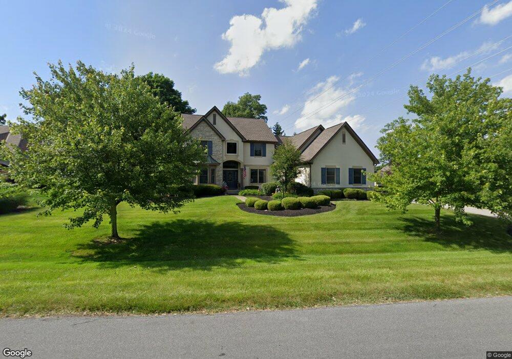
10589 Wellington Blvd Powell, OH 43065
Liberty Township NeighborhoodEstimated Value: $784,000 - $1,005,000
4
Beds
4
Baths
3,000
Sq Ft
$295/Sq Ft
Est. Value
About This Home
This home is located at 10589 Wellington Blvd, Powell, OH 43065 and is currently estimated at $883,813, approximately $294 per square foot. 10589 Wellington Blvd is a home located in Delaware County with nearby schools including Scioto Ridge Elementary School, Olentangy Liberty Middle School, and Olentangy Liberty High School.
Ownership History
Date
Name
Owned For
Owner Type
Purchase Details
Closed on
Nov 9, 1998
Sold by
Davidson Phillips Inc
Bought by
Topper Investment Group Ltd
Current Estimated Value
Home Financials for this Owner
Home Financials are based on the most recent Mortgage that was taken out on this home.
Original Mortgage
$300,000
Interest Rate
6.72%
Mortgage Type
New Conventional
Create a Home Valuation Report for This Property
The Home Valuation Report is an in-depth analysis detailing your home's value as well as a comparison with similar homes in the area
Home Values in the Area
Average Home Value in this Area
Purchase History
| Date | Buyer | Sale Price | Title Company |
|---|---|---|---|
| Topper Investment Group Ltd | $371,000 | -- |
Source: Public Records
Mortgage History
| Date | Status | Borrower | Loan Amount |
|---|---|---|---|
| Previous Owner | Topper Investment Group Ltd | $300,000 |
Source: Public Records
Tax History Compared to Growth
Tax History
| Year | Tax Paid | Tax Assessment Tax Assessment Total Assessment is a certain percentage of the fair market value that is determined by local assessors to be the total taxable value of land and additions on the property. | Land | Improvement |
|---|---|---|---|---|
| 2024 | $15,393 | $284,730 | $53,410 | $231,320 |
| 2023 | $15,453 | $284,730 | $53,410 | $231,320 |
| 2022 | $13,803 | $201,500 | $50,890 | $150,610 |
| 2021 | $13,890 | $201,500 | $50,890 | $150,610 |
| 2020 | $13,958 | $201,500 | $50,890 | $150,610 |
| 2019 | $12,821 | $194,320 | $50,890 | $143,430 |
| 2018 | $13,015 | $194,320 | $50,890 | $143,430 |
| 2017 | $12,748 | $180,260 | $60,940 | $119,320 |
| 2016 | $12,720 | $180,260 | $60,940 | $119,320 |
| 2015 | $11,536 | $180,260 | $60,940 | $119,320 |
| 2014 | $11,695 | $180,260 | $60,940 | $119,320 |
| 2013 | $11,736 | $176,790 | $60,940 | $115,850 |
Source: Public Records
Map
Nearby Homes
- 4840 Paddington Way
- 4933 Emerald Lakes Blvd Unit 4903
- 10053 Juliana Cir Unit 10053
- 524 Commons Dr Unit 524
- 10010 Beckford Ct
- 5175 Woodbridge Ave
- 3910 Summit View Rd
- 8151 Winchcombe Dr
- 2672 Sawmill Reserve Dr Unit 2672
- 261 Andover Dr
- 255 Winter Hill Place
- 274 Stamford Dr
- 5444 Stratford Ave
- 91 Tiller Dr
- 0 Arrowhead Rd
- 7909 Melrue Ct
- 8632 Copperview Dr
- 9529 Wayne Brown Dr
- 7889 Avaleen Cir S Unit 16
- 87 Murphys Oval Unit N87
- 10583 Wellington Blvd
- 10496 Buxton Place
- 10596 Wellington Blvd
- 10488 Buxton Place
- 10590 Wellington Blvd
- 10577 Wellington Blvd
- 10478 Buxton Place
- 10584 Wellington Blvd
- 10491 Cambridge Place
- 10491 Cambridge Place Unit L63
- 10466 Buxton Place
- 10487 Cambridge Place
- 10578 Wellington Blvd
- 10460 Buxton Place
- 10490 Cambridge Place
- 10571 Wellington Blvd
- 4444 N Hampton Dr
- 10483 Cambridge Place
- 10476 Cambridge Place
- 10448 Buxton Place