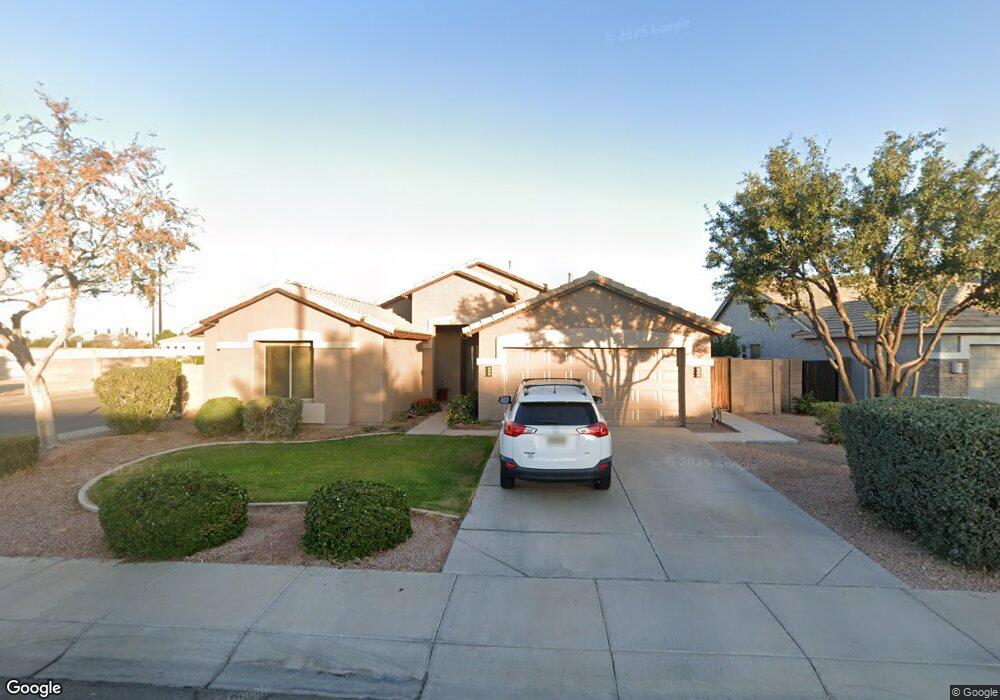
1059 S Amber St Chandler, AZ 85286
East Chandler NeighborhoodEstimated Value: $540,893 - $633,000
--
Bed
3
Baths
2,049
Sq Ft
$293/Sq Ft
Est. Value
About This Home
This home is located at 1059 S Amber St, Chandler, AZ 85286 and is currently estimated at $600,473, approximately $293 per square foot. 1059 S Amber St is a home located in Maricopa County with nearby schools including Chandler Traditional Academy-Humphrey, Santan Junior High School, and BASIS Chandler Primary North Campus.
Ownership History
Date
Name
Owned For
Owner Type
Purchase Details
Closed on
Feb 2, 2024
Sold by
Fantus Matthew A and Fantus Natalie C
Bought by
Fantus Family Trust and Fantus
Current Estimated Value
Purchase Details
Closed on
Sep 6, 2005
Sold by
Villa Robert K and Villa Jamie L
Bought by
Fantus Matthew A and Fantus Natalie C
Home Financials for this Owner
Home Financials are based on the most recent Mortgage that was taken out on this home.
Original Mortgage
$295,900
Interest Rate
5.7%
Mortgage Type
New Conventional
Purchase Details
Closed on
Oct 18, 2001
Sold by
First American Title Insurance Company
Bought by
Villa Robert K and Damron Jamie L
Home Financials for this Owner
Home Financials are based on the most recent Mortgage that was taken out on this home.
Original Mortgage
$163,750
Interest Rate
6.62%
Mortgage Type
New Conventional
Create a Home Valuation Report for This Property
The Home Valuation Report is an in-depth analysis detailing your home's value as well as a comparison with similar homes in the area
Home Values in the Area
Average Home Value in this Area
Purchase History
| Date | Buyer | Sale Price | Title Company |
|---|---|---|---|
| Fantus Family Trust | -- | None Listed On Document | |
| Fantus Matthew A | $369,900 | -- | |
| Villa Robert K | $170,410 | First American Title |
Source: Public Records
Mortgage History
| Date | Status | Borrower | Loan Amount |
|---|---|---|---|
| Previous Owner | Fantus Matthew A | $295,900 | |
| Previous Owner | Villa Robert K | $163,750 |
Source: Public Records
Tax History Compared to Growth
Tax History
| Year | Tax Paid | Tax Assessment Tax Assessment Total Assessment is a certain percentage of the fair market value that is determined by local assessors to be the total taxable value of land and additions on the property. | Land | Improvement |
|---|---|---|---|---|
| 2025 | $2,128 | $27,318 | -- | -- |
| 2024 | $2,055 | $26,017 | -- | -- |
| 2023 | $2,055 | $41,880 | $8,370 | $33,510 |
| 2022 | $1,983 | $30,520 | $6,100 | $24,420 |
| 2021 | $2,079 | $29,170 | $5,830 | $23,340 |
| 2020 | $2,069 | $27,070 | $5,410 | $21,660 |
| 2019 | $1,990 | $25,280 | $5,050 | $20,230 |
| 2018 | $1,927 | $24,060 | $4,810 | $19,250 |
| 2017 | $1,796 | $22,980 | $4,590 | $18,390 |
| 2016 | $1,730 | $23,030 | $4,600 | $18,430 |
| 2015 | $1,677 | $22,260 | $4,450 | $17,810 |
Source: Public Records
Map
Nearby Homes
- 1946 E Browning Place
- 1925 E Geronimo St
- 927 S Soho Ln
- 1954 E Geronimo St
- 950 S Edith Dr
- 1991 E Browning Place
- 476 S Soho Ln Unit 2
- 629 S Danyell Dr
- 2133 E Kesler Ln
- 900 S Canal Dr Unit 238
- 2145 E Longhorn Place
- 1750 E Camino Ct
- 505 S Soho Ln Unit 30
- 1670 E Whitten St
- 2230 E Whitten St
- 2253 E Kempton Rd
- 600 S Velero St
- 1731 E Folley Ct
- 333 S Cooper Rd
- 2477 E Flintlock Place Unit II
- 1069 S Amber St
- 1951 E Derringer Way
- 1079 S Amber St
- 1961 E Derringer Way
- 1060 S Amber St
- 1922 E Derringer Way
- 1089 S Amber St
- 1080 S Amber St
- 1950 E Springfield Place
- 1971 E Derringer Way
- 1912 E Derringer Way
- 1962 E Derringer Way Unit 1
- 1962 E Derringer Way
- 1099 S Amber St
- 1960 E Springfield Place
- 1090 S Amber St
- 1972 E Derringer Way Unit 2
- 1972 E Derringer Way
- 1981 E Derringer Way
- 1100 S Amber St