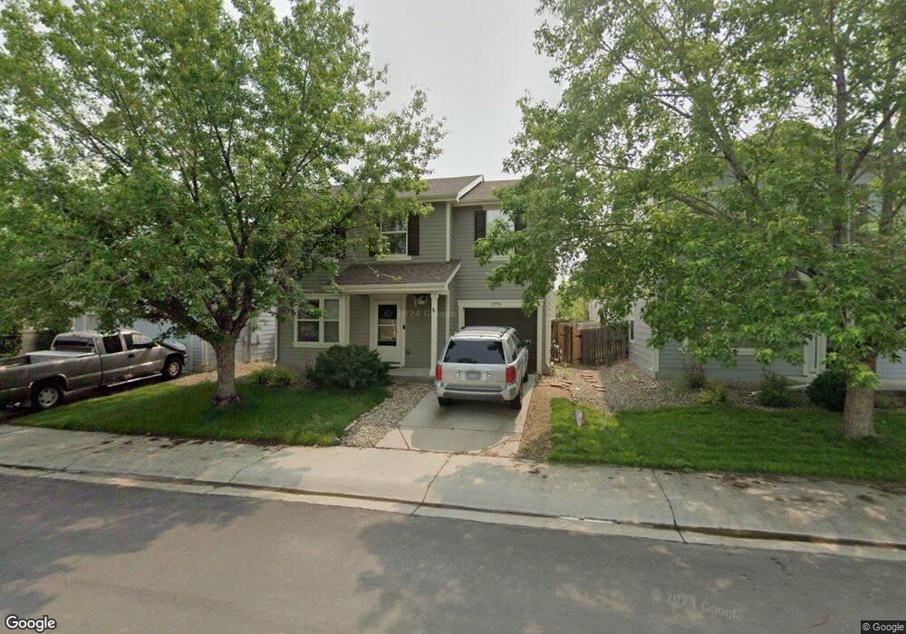
10596 Butte Dr Longmont, CO 80504
Estimated Value: $416,000 - $444,000
3
Beds
2
Baths
1,500
Sq Ft
$285/Sq Ft
Est. Value
About This Home
This home is located at 10596 Butte Dr, Longmont, CO 80504 and is currently estimated at $426,860, approximately $284 per square foot. 10596 Butte Dr is a home located in Weld County with nearby schools including Centennial Elementary School, Coal Ridge Middle School, and Mead High School.
Ownership History
Date
Name
Owned For
Owner Type
Purchase Details
Closed on
Nov 4, 2019
Sold by
Dixon Thomas W and Dixon Sharon A
Bought by
10596 Butte Drive Llc
Current Estimated Value
Purchase Details
Closed on
Mar 7, 2014
Sold by
Switzer Amber
Bought by
Dixon Thomas W and Dixon Sharon A
Purchase Details
Closed on
Dec 18, 2009
Sold by
Aue Christine M
Bought by
Switzer Amber
Home Financials for this Owner
Home Financials are based on the most recent Mortgage that was taken out on this home.
Original Mortgage
$152,192
Interest Rate
5.01%
Mortgage Type
FHA
Purchase Details
Closed on
May 28, 2004
Sold by
Kb Home Colorado Inc
Bought by
Aue Christine M
Home Financials for this Owner
Home Financials are based on the most recent Mortgage that was taken out on this home.
Original Mortgage
$88,000
Interest Rate
6.02%
Mortgage Type
Unknown
Create a Home Valuation Report for This Property
The Home Valuation Report is an in-depth analysis detailing your home's value as well as a comparison with similar homes in the area
Home Values in the Area
Average Home Value in this Area
Purchase History
| Date | Buyer | Sale Price | Title Company |
|---|---|---|---|
| 10596 Butte Drive Llc | -- | None Available | |
| Dixon Thomas W | $167,750 | Fidelity National Title Ins | |
| Switzer Amber | $155,000 | Land Title Guarantee Company | |
| Aue Christine M | $166,162 | -- |
Source: Public Records
Mortgage History
| Date | Status | Borrower | Loan Amount |
|---|---|---|---|
| Previous Owner | Switzer Amber | $152,192 | |
| Previous Owner | Aue Christine M | $88,000 |
Source: Public Records
Tax History Compared to Growth
Tax History
| Year | Tax Paid | Tax Assessment Tax Assessment Total Assessment is a certain percentage of the fair market value that is determined by local assessors to be the total taxable value of land and additions on the property. | Land | Improvement |
|---|---|---|---|---|
| 2025 | $2,362 | $26,380 | $5,380 | $21,000 |
| 2024 | $2,362 | $26,380 | $5,380 | $21,000 |
| 2023 | $2,265 | $29,120 | $5,820 | $23,300 |
| 2022 | $1,981 | $21,020 | $4,450 | $16,570 |
| 2021 | $2,018 | $21,630 | $4,580 | $17,050 |
| 2020 | $1,921 | $20,770 | $3,040 | $17,730 |
| 2019 | $1,943 | $20,770 | $3,040 | $17,730 |
| 2018 | $1,563 | $16,910 | $3,020 | $13,890 |
| 2017 | $1,500 | $16,910 | $3,020 | $13,890 |
| 2016 | $1,187 | $13,290 | $2,150 | $11,140 |
| 2015 | $1,147 | $13,290 | $2,150 | $11,140 |
| 2014 | $913 | $10,590 | $1,990 | $8,600 |
Source: Public Records
Map
Nearby Homes
- 10592 Butte Dr
- 10688 Durango Place
- 10691 Durango Place
- 10910 Turner Blvd Unit 203
- 10910 Turner Blvd Unit 127
- 10752 County Road 7
- 0 Del Camino Business Park Lot 1 Unit 986024
- 9746 County Road 7
- 4616 Tilbury Ct
- 10555 Aspen St Unit 198
- 10684 Aspen St
- 10684 Aspen St Unit 72
- 10529 Bald Eagle Cir Unit 394
- 10529 Bald Eagle Cir
- 4795 Audrey St Unit 260
- 10597 Bald Eagle Cir Unit 244
- 10611 Barron Cir Unit 426
- 4768 Silverleaf Ave
- 10574 Bald Eagle Cir
- 3545 Cottonwood Cir
- 10594 Butte Dr
- 10598 Butte Dr
- 10597 Durango Place
- 10595 Durango Place
- 10599 Durango Place
- 10593 Durango Place
- 10590 Butte Dr
- 10597 Butte Dr
- 10595 Butte Dr
- 10599 Butte Dr
- 10591 Durango Place
- 10593 Butte Dr
- 10588 Butte Dr
- 10650 Butte Dr
- 10591 Butte Dr
- 10651 Durango Place
- 10596 Durango Place
- 10594 Durango Place
- 10598 Durango Place
- 10589 Butte Dr