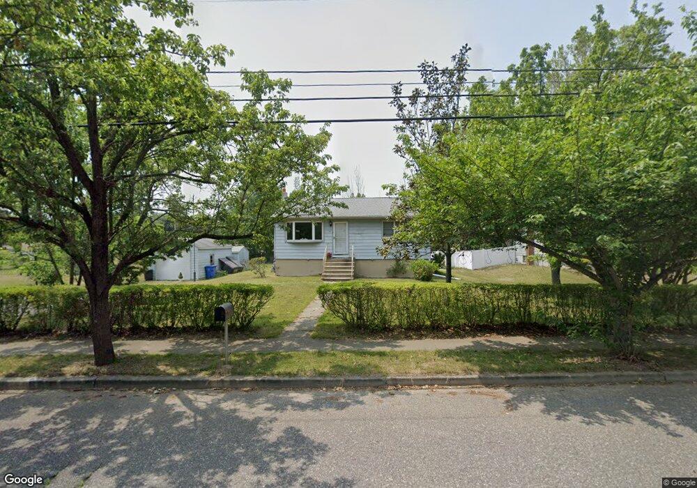
106 Barker Ave Bridgeport, NJ 08014
Logan Township NeighborhoodEstimated Value: $221,000 - $247,989
--
Bed
--
Bath
1,152
Sq Ft
$200/Sq Ft
Est. Value
About This Home
This home is located at 106 Barker Ave, Bridgeport, NJ 08014 and is currently estimated at $229,997, approximately $199 per square foot. 106 Barker Ave is a home located in Gloucester County with nearby schools including Logan Township Elementary School, Frederick Douglass Christian School, and Faith Temple Christian School.
Ownership History
Date
Name
Owned For
Owner Type
Purchase Details
Closed on
Jul 16, 2008
Sold by
Sinclair Michele R and Mclaughlin Stephen J
Bought by
Mclaughlin Stephen J and Mclaughlin Michele
Current Estimated Value
Home Financials for this Owner
Home Financials are based on the most recent Mortgage that was taken out on this home.
Original Mortgage
$173,057
Outstanding Balance
$113,218
Interest Rate
6.35%
Mortgage Type
New Conventional
Estimated Equity
$116,779
Purchase Details
Closed on
Aug 27, 2004
Sold by
Quattrochi Roberta J
Bought by
Sinclair Michele R and Mclaughlin Stephen J
Home Financials for this Owner
Home Financials are based on the most recent Mortgage that was taken out on this home.
Original Mortgage
$111,900
Interest Rate
7.37%
Mortgage Type
Purchase Money Mortgage
Create a Home Valuation Report for This Property
The Home Valuation Report is an in-depth analysis detailing your home's value as well as a comparison with similar homes in the area
Home Values in the Area
Average Home Value in this Area
Purchase History
| Date | Buyer | Sale Price | Title Company |
|---|---|---|---|
| Mclaughlin Stephen J | -- | Summit Ridge Title Agency | |
| Sinclair Michele R | $139,900 | Group 21 Title Agency |
Source: Public Records
Mortgage History
| Date | Status | Borrower | Loan Amount |
|---|---|---|---|
| Open | Mclaughlin Stephen J | $173,057 | |
| Closed | Sinclair Michele R | $111,900 |
Source: Public Records
Tax History Compared to Growth
Tax History
| Year | Tax Paid | Tax Assessment Tax Assessment Total Assessment is a certain percentage of the fair market value that is determined by local assessors to be the total taxable value of land and additions on the property. | Land | Improvement |
|---|---|---|---|---|
| 2025 | $2,642 | $203,200 | $56,300 | $146,900 |
| 2024 | $2,525 | $203,200 | $56,300 | $146,900 |
| 2023 | $2,525 | $125,600 | $33,800 | $91,800 |
| 2022 | $2,624 | $125,600 | $33,800 | $91,800 |
| 2021 | $1,855 | $125,600 | $33,800 | $91,800 |
| 2020 | $2,732 | $125,600 | $33,800 | $91,800 |
| 2019 | $2,728 | $125,600 | $33,800 | $91,800 |
| 2018 | $2,653 | $125,600 | $33,800 | $91,800 |
| 2017 | $2,986 | $119,100 | $31,500 | $87,600 |
| 2016 | $2,687 | $119,100 | $31,500 | $87,600 |
| 2015 | $2,346 | $119,100 | $31,500 | $87,600 |
| 2014 | $2,268 | $119,100 | $31,500 | $87,600 |
Source: Public Records
Map
Nearby Homes
- 89 Main St
- 33 Mechanic St
- 3 S Bridgeport Rd
- 126 Repaupo Station Rd
- 43 45 Repaupo Station Rd
- 788 Paulsboro Rd
- 792 Paulsboro Rd
- 415 Paulsboro Rd
- 13 Sweet Bay Ln
- 746 Allen Ave
- 159 Mill Rd
- 751 Duncan Ave
- 347 Paulsboro Rd
- 2153 Route 322
- 132 Tomlin Station Rd
- 127 Center St
- 42 Jackson St
- 242 S Poplar St
- 157 S Poplar St
- 342 Democrat Rd