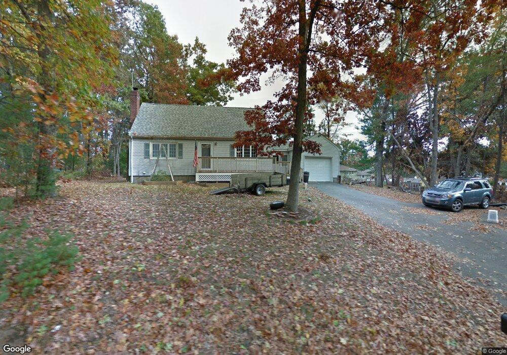
106 Forrest St Plaistow, NH 03865
Estimated Value: $478,000 - $533,000
3
Beds
2
Baths
1,555
Sq Ft
$328/Sq Ft
Est. Value
About This Home
This home is located at 106 Forrest St, Plaistow, NH 03865 and is currently estimated at $509,539, approximately $327 per square foot. 106 Forrest St is a home with nearby schools including Pollard Elementary School, Timberlane Regional Middle School, and Timberlane Regional High School.
Ownership History
Date
Name
Owned For
Owner Type
Purchase Details
Closed on
Oct 12, 2012
Sold by
Gallagher David A and Gallagher Joy L
Bought by
Gallagher Ft and Gallagher David A
Current Estimated Value
Purchase Details
Closed on
May 19, 2003
Sold by
Rees William R and Rees Margaret A
Bought by
Gallagher David A and Gallagher Joy L
Home Financials for this Owner
Home Financials are based on the most recent Mortgage that was taken out on this home.
Original Mortgage
$187,250
Interest Rate
5.84%
Create a Home Valuation Report for This Property
The Home Valuation Report is an in-depth analysis detailing your home's value as well as a comparison with similar homes in the area
Home Values in the Area
Average Home Value in this Area
Purchase History
| Date | Buyer | Sale Price | Title Company |
|---|---|---|---|
| Gallagher Ft | -- | -- | |
| Gallagher David A | $252,000 | -- |
Source: Public Records
Mortgage History
| Date | Status | Borrower | Loan Amount |
|---|---|---|---|
| Previous Owner | Gallagher David A | $157,500 | |
| Previous Owner | Gallagher David A | $187,250 |
Source: Public Records
Tax History Compared to Growth
Tax History
| Year | Tax Paid | Tax Assessment Tax Assessment Total Assessment is a certain percentage of the fair market value that is determined by local assessors to be the total taxable value of land and additions on the property. | Land | Improvement |
|---|---|---|---|---|
| 2024 | $6,255 | $301,900 | $128,500 | $173,400 |
| 2023 | $6,744 | $301,900 | $128,500 | $173,400 |
| 2022 | $5,739 | $301,900 | $128,500 | $173,400 |
| 2021 | $5,724 | $301,900 | $128,500 | $173,400 |
| 2020 | $6,240 | $288,240 | $111,740 | $176,500 |
| 2019 | $6,142 | $288,240 | $111,740 | $176,500 |
| 2018 | $6,123 | $249,010 | $113,010 | $136,000 |
| 2017 | $5,966 | $249,010 | $113,010 | $136,000 |
| 2016 | $5,603 | $249,010 | $113,010 | $136,000 |
| 2015 | $5,501 | $227,670 | $108,670 | $119,000 |
| 2014 | $5,199 | $206,890 | $104,490 | $102,400 |
| 2011 | $5,112 | $206,890 | $104,490 | $102,400 |
Source: Public Records
Map
Nearby Homes
- 135 Forrest St Unit 10
- 135 Forrest St Unit 4
- 98 Sweet Hill Rd
- 15 Autumn Cir Unit A
- 120 Newton Rd Unit 2D
- 55 Sweet Hill Rd
- 7 Squaw Creek Dr
- 28 Forrest St
- 15 Canterbury Forest Unit B
- 18 Horizon Way
- 17 Horizon Way
- 80 Margerie St
- 440 North Ave Unit 60
- 440 North Ave Unit 201
- 440 North Ave Unit 145
- 440 North Ave Unit 110
- 14 Corliss Hill Rd
- 3 W Pine St Unit 4
- 38 Brickett Hill Cir Unit 38
- 116 Crosby St