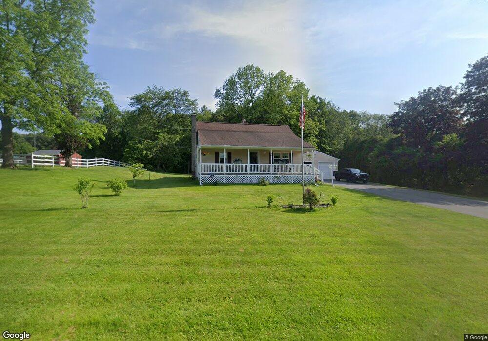
106 Gilbert Rd Southampton, MA 01073
Estimated Value: $390,000 - $515,000
4
Beds
2
Baths
1,469
Sq Ft
$308/Sq Ft
Est. Value
About This Home
This home is located at 106 Gilbert Rd, Southampton, MA 01073 and is currently estimated at $452,820, approximately $308 per square foot. 106 Gilbert Rd is a home located in Hampshire County with nearby schools including William E Norris School, White Oak School, and Westfield Christian Academy.
Ownership History
Date
Name
Owned For
Owner Type
Purchase Details
Closed on
Jan 12, 2018
Sold by
Kaleta William B and Kaleta Janet E
Bought by
Kaleta Tammy L
Current Estimated Value
Purchase Details
Closed on
Sep 29, 1978
Bought by
Kaleta William B and Kaleta Janet E
Create a Home Valuation Report for This Property
The Home Valuation Report is an in-depth analysis detailing your home's value as well as a comparison with similar homes in the area
Home Values in the Area
Average Home Value in this Area
Purchase History
| Date | Buyer | Sale Price | Title Company |
|---|---|---|---|
| Kaleta Tammy L | -- | -- | |
| Kaleta William B | -- | -- |
Source: Public Records
Mortgage History
| Date | Status | Borrower | Loan Amount |
|---|---|---|---|
| Previous Owner | Kaleta William B | $54,000 | |
| Previous Owner | Kaleta William B | $58,000 | |
| Previous Owner | Kaleta William B | $25,000 |
Source: Public Records
Tax History Compared to Growth
Tax History
| Year | Tax Paid | Tax Assessment Tax Assessment Total Assessment is a certain percentage of the fair market value that is determined by local assessors to be the total taxable value of land and additions on the property. | Land | Improvement |
|---|---|---|---|---|
| 2025 | $4,112 | $290,200 | $114,000 | $176,200 |
| 2024 | $4,135 | $290,200 | $114,000 | $176,200 |
| 2023 | $3,944 | $275,200 | $114,000 | $161,200 |
| 2022 | $3,888 | $258,000 | $113,700 | $144,300 |
| 2021 | $3,793 | $237,500 | $104,500 | $133,000 |
| 2020 | $3,737 | $236,200 | $104,500 | $131,700 |
| 2019 | $3,665 | $226,600 | $104,500 | $122,100 |
| 2018 | $3,481 | $208,200 | $94,200 | $114,000 |
| 2017 | $3,177 | $208,200 | $94,200 | $114,000 |
| 2015 | $3,167 | $201,600 | $85,600 | $116,000 |
Source: Public Records
Map
Nearby Homes
- Lot 5 Brickyard Rd
- 119 Brickyard Rd
- 117 Russellville Rd
- 369 College Hwy
- Lot 5 Gil Farm Rd
- Lot 6 Gil Farm Rd
- 132 North Rd
- 336 Russellville Rd
- 100 Fomer Rd
- 216 College Hwy
- 45 Jaeger Dr
- 47 Jaeger Dr
- 232 Russellville Rd
- Lot 57 White Loaf Rd
- 17 Maple St
- 150 Middle Rd
- 64 Old Stage Rd
- 94 Pequot Rd (Rear)
- 868 Southampton Rd Unit 18
- 19 3rd Ave
- 108 Gilbert Rd
- 104 Gilbert Rd
- 105 Gilbert Rd
- 187 Brickyard Rd
- 191 Brickyard Rd
- 99 Gilbert Rd
- 192 Brickyard Rd
- 182 Brickyard Rd
- 97 Gilbert Rd
- 194 Brickyard Rd
- 96 Gilbert Rd
- 195 Brickyard Rd
- 94 Gilbert Rd
- 178 Brickyard Rd
- 199 Brickyard Rd
- 9 Buchanan Cir
- 8 Buchanan Cir
- 6 Buchanan Cir
- 7 Buchanan Cir
- 206 Brickyard Rd