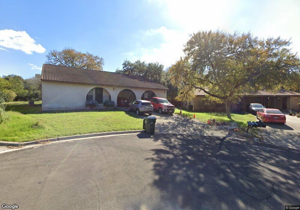
106 L B J Cove Unit 108 San Marcos, TX 78666
Hughson Heights NeighborhoodEstimated Value: $376,562 - $408,000
--
Bed
--
Bath
2,128
Sq Ft
$184/Sq Ft
Est. Value
About This Home
This home is located at 106 L B J Cove Unit 108, San Marcos, TX 78666 and is currently estimated at $392,141, approximately $184 per square foot. 106 L B J Cove Unit 108 is a home located in Hays County with nearby schools including Crockett Elementary School, Dorris Miller Middle School, and San Marcos High School.
Ownership History
Date
Name
Owned For
Owner Type
Purchase Details
Closed on
Dec 1, 2023
Sold by
Razar Investments Ltd
Bought by
Terrill Morgan E and Simien Leslie
Current Estimated Value
Home Financials for this Owner
Home Financials are based on the most recent Mortgage that was taken out on this home.
Original Mortgage
$300,000
Outstanding Balance
$295,143
Interest Rate
7.63%
Mortgage Type
New Conventional
Estimated Equity
$96,998
Purchase Details
Closed on
Oct 17, 2023
Sold by
Razlan Llc
Bought by
Azar Robert E
Home Financials for this Owner
Home Financials are based on the most recent Mortgage that was taken out on this home.
Original Mortgage
$300,000
Outstanding Balance
$295,143
Interest Rate
7.63%
Mortgage Type
New Conventional
Estimated Equity
$96,998
Purchase Details
Closed on
Dec 20, 2017
Sold by
Azar Robert E
Bought by
Razian Llc
Home Financials for this Owner
Home Financials are based on the most recent Mortgage that was taken out on this home.
Original Mortgage
$209,925
Interest Rate
3.83%
Mortgage Type
New Conventional
Purchase Details
Closed on
Oct 31, 2017
Sold by
Miller Clinton W and Miller Teresa K
Bought by
Azar Robert
Home Financials for this Owner
Home Financials are based on the most recent Mortgage that was taken out on this home.
Original Mortgage
$209,925
Interest Rate
3.83%
Mortgage Type
New Conventional
Purchase Details
Closed on
Jun 7, 2007
Sold by
Holman Eddie and Holman Mary
Bought by
Miller Clinton W and Miller Teresa K
Home Financials for this Owner
Home Financials are based on the most recent Mortgage that was taken out on this home.
Original Mortgage
$164,000
Interest Rate
6.16%
Mortgage Type
Purchase Money Mortgage
Purchase Details
Closed on
Jun 7, 2005
Sold by
Davis Natalie Ann and Davis Michael Warner
Bought by
Holman Eddie and Holman Mary
Home Financials for this Owner
Home Financials are based on the most recent Mortgage that was taken out on this home.
Original Mortgage
$126,000
Interest Rate
5.87%
Mortgage Type
Fannie Mae Freddie Mac
Purchase Details
Closed on
May 14, 2004
Sold by
Kennedy Sonya Davis and Davis Sonya
Bought by
Davis Natalie Ann and Davis Michael Warner
Purchase Details
Closed on
Jul 14, 1999
Sold by
Clark Janet A
Bought by
Miller Clinton W and Miller Teresa K
Create a Home Valuation Report for This Property
The Home Valuation Report is an in-depth analysis detailing your home's value as well as a comparison with similar homes in the area
Home Values in the Area
Average Home Value in this Area
Purchase History
| Date | Buyer | Sale Price | Title Company |
|---|---|---|---|
| Terrill Morgan E | -- | Corridor Title | |
| Razar Investments Ltd | -- | Corridor Title | |
| Azar Robert E | -- | None Listed On Document | |
| Razian Llc | -- | None Available | |
| Azar Robert | -- | None Available | |
| Miller Clinton W | -- | Gracy Title Company | |
| Holman Eddie | -- | New Braunfels Title Co | |
| Davis Natalie Ann | -- | -- | |
| Miller Clinton W | -- | -- |
Source: Public Records
Mortgage History
| Date | Status | Borrower | Loan Amount |
|---|---|---|---|
| Open | Terrill Morgan E | $300,000 | |
| Previous Owner | Azar Robert | $209,925 | |
| Previous Owner | Miller Clinton W | $164,000 | |
| Previous Owner | Holman Eddie | $126,000 |
Source: Public Records
Tax History Compared to Growth
Tax History
| Year | Tax Paid | Tax Assessment Tax Assessment Total Assessment is a certain percentage of the fair market value that is determined by local assessors to be the total taxable value of land and additions on the property. | Land | Improvement |
|---|---|---|---|---|
| 2025 | $7,873 | $302,072 | $212,650 | $89,422 |
| 2024 | $7,873 | $400,000 | $212,650 | $187,350 |
| 2023 | $5,708 | $300,090 | $212,650 | $87,440 |
| 2022 | $5,490 | $267,920 | $180,210 | $87,710 |
| 2021 | $5,487 | $248,960 | $135,160 | $113,800 |
| 2020 | $5,166 | $234,362 | $135,160 | $99,202 |
| 2019 | $6,228 | $253,000 | $81,090 | $171,910 |
| 2018 | $6,172 | $249,560 | $81,090 | $168,470 |
| 2017 | $5,332 | $221,770 | $22,500 | $199,270 |
| 2016 | $4,936 | $205,310 | $22,500 | $182,810 |
| 2015 | $4,855 | $205,310 | $22,500 | $182,810 |
Source: Public Records
Map
Nearby Homes
- 114 Algarita St
- 205 Hughson Dr
- 412 Craddock Ave
- 0 Old Ranch Road 12
- 135 Eastwood Ln
- 105 Yaupon Ct
- 118 Yaupon Ct
- 903 Sagewood Trail Unit 905
- 1610 Ramona Cir
- 103 Sierra Ridge Dr
- TBD LOT 2 Old Ranch Road 12
- TBD LOT 1 Old Ranch Road 12
- 211 Ridgewood Dr
- 609 Chicago St
- 140 Coers Dr
- 108 Dolly St
- 806 Sagewood Trail Unit 808
- 1805 Ramona Cir
- 2 Tanglewood Trail
- 1837 Pearce Ct
- 108 L B J Cove Unit 108
- 105 L B J Cove Unit 107
- 102 L B J Cove
- 110 Algarita St
- 401 Hughson Dr
- 101 L B J Cove Unit 103
- 405 Hughson Dr
- 118 Algarita St
- 314-316 Craddock Ave
- 314 Craddock Ave Unit 316
- 106 Algarita St
- 409 Hughson Dr
- 122 Algarita St
- 100 Algarita St
- 126 Algarita St
- 304 Craddock Ave Unit 306
- 311 Craddock Ave Unit 103
- 311 Craddock Ave Unit 201
- 311 Craddock Ave Unit 102
- 311 Craddock Ave Unit 101