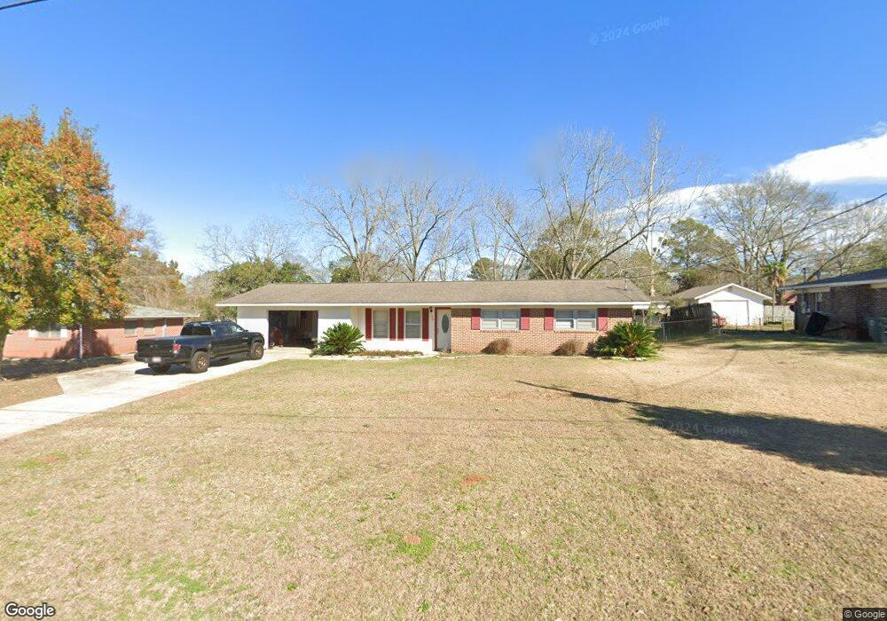
106 Mockingbird Ln Enterprise, AL 36330
Estimated Value: $170,000 - $188,000
3
Beds
2
Baths
1,555
Sq Ft
$113/Sq Ft
Est. Value
About This Home
This home is located at 106 Mockingbird Ln, Enterprise, AL 36330 and is currently estimated at $175,778, approximately $113 per square foot. 106 Mockingbird Ln is a home located in Coffee County with nearby schools including Harrand Creek Elementary School, Dauphin Junior High School, and Enterprise High School.
Ownership History
Date
Name
Owned For
Owner Type
Purchase Details
Closed on
Aug 18, 2021
Sold by
Cassibo Marisha and Nieuwenhuis Daniel
Bought by
Cassibo Marisa and Cassibo Joshua
Current Estimated Value
Purchase Details
Closed on
Apr 7, 2010
Sold by
Mendoza Timothy and Mendoza Rhonda
Bought by
Nieuwenhuis Marisa E and Nieuwenhuis Daniel P
Purchase Details
Closed on
Nov 26, 2008
Sold by
Boggs Michael A and Boggs Cynthia A
Bought by
Mendoza Timothy Jacob and Mendoza Rhonda
Home Financials for this Owner
Home Financials are based on the most recent Mortgage that was taken out on this home.
Original Mortgage
$88,870
Interest Rate
6.38%
Create a Home Valuation Report for This Property
The Home Valuation Report is an in-depth analysis detailing your home's value as well as a comparison with similar homes in the area
Purchase History
| Date | Buyer | Sale Price | Title Company |
|---|---|---|---|
| Cassibo Marisa | $137,500 | None Available | |
| Nieuwenhuis Marisa E | -- | -- | |
| Mendoza Timothy Jacob | -- | -- |
Source: Public Records
Mortgage History
| Date | Status | Borrower | Loan Amount |
|---|---|---|---|
| Previous Owner | Mendoza Timothy Jacob | $88,870 |
Source: Public Records
Tax History
| Year | Tax Paid | Tax Assessment Tax Assessment Total Assessment is a certain percentage of the fair market value that is determined by local assessors to be the total taxable value of land and additions on the property. | Land | Improvement |
|---|---|---|---|---|
| 2024 | $1,562 | $32,180 | $3,060 | $29,120 |
| 2023 | $1,446 | $26,672 | $3,000 | $23,672 |
| 2022 | $1,299 | $26,680 | $0 | $0 |
| 2021 | $1,061 | $23,700 | $0 | $0 |
| 2020 | $1,026 | $22,900 | $0 | $0 |
| 2019 | $482 | $11,460 | $0 | $0 |
| 2018 | $508 | $12,080 | $0 | $0 |
| 2017 | $473 | $11,260 | $0 | $0 |
| 2016 | $482 | $11,460 | $0 | $0 |
| 2015 | $482 | $11,460 | $0 | $0 |
| 2014 | $48 | $11,400 | $0 | $0 |
| 2013 | $508 | $0 | $0 | $0 |
Source: Public Records
Map
Nearby Homes
- 302 Robin Ln
- 216 Morgan Ln
- 287 County Road 755
- 208 Deerfield Dr
- 202 Deerfield Dr
- 117 Deerfield Dr
- 311 Antler Dr
- 203 W Emerald Dr
- 105 Deerfield Dr
- 121 Lightfoot Dr
- 170 Commons Dr
- 114 Iroquois Rd
- 115 Woodrun Dr
- 608 Wildwood Dr
- 117 Foxhill Dr
- 40 Woodfield Place
- 48 Woodfield Place
- 209 Wildwood Dr
- 105 Comanche St
- 78 Woodfield Place
- 108 Mockingbird Ln
- 104 Mockingbird Ln
- 207 Cardinal Ln
- 205 Cardinal Ln
- 110 Mockingbird Ln
- 109 Mockingbird Ln
- 102 Mockingbird Ln
- 107 Mockingbird Ln
- 209 Cardinal Ln
- 111 Mockingbird Ln
- 203 Cardinal Ln
- 211 Cardinal Ln
- 105 Mockingbird Ln
- 113 Mockingbird Ln
- 112 Mockingbird Ln
- 100 Mockingbird Ln
- 201 Cardinal Ln
- 213 Cardinal Ln
- 204 Meadowlark Ln
- 204 Cardinal Ln
Your Personal Tour Guide
Ask me questions while you tour the home.