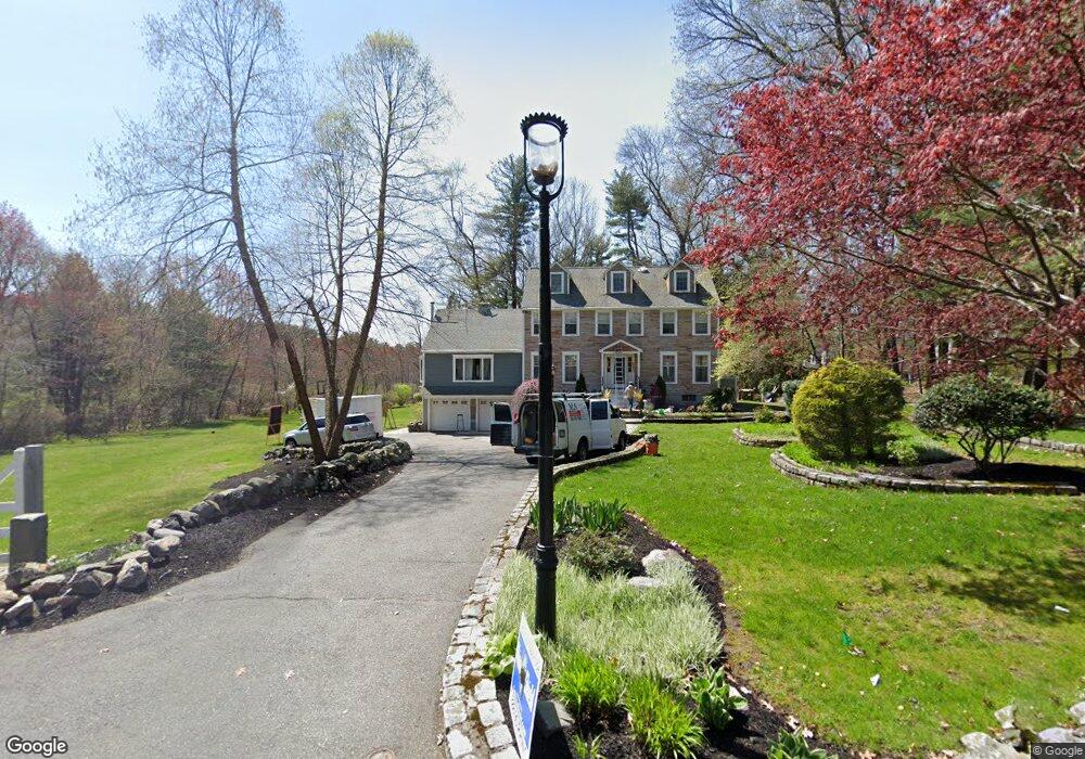
106 Powers Rd Sudbury, MA 01776
Estimated Value: $1,299,023 - $1,539,000
4
Beds
4
Baths
3,524
Sq Ft
$401/Sq Ft
Est. Value
About This Home
This home is located at 106 Powers Rd, Sudbury, MA 01776 and is currently estimated at $1,413,756, approximately $401 per square foot. 106 Powers Rd is a home located in Middlesex County with nearby schools including Josiah Haynes Elementary School, Ephraim Curtis Middle School, and Lincoln-Sudbury Regional High School.
Ownership History
Date
Name
Owned For
Owner Type
Purchase Details
Closed on
May 30, 2013
Sold by
Frissora Sudbury Ft and Frissora
Bought by
Frissora John T and Frissora Valerie D
Current Estimated Value
Home Financials for this Owner
Home Financials are based on the most recent Mortgage that was taken out on this home.
Original Mortgage
$417,000
Outstanding Balance
$291,023
Interest Rate
3.45%
Mortgage Type
New Conventional
Estimated Equity
$1,122,733
Purchase Details
Closed on
Sep 5, 2012
Sold by
Frissora Charles H and Frissora Catherine J
Bought by
Frissora Ft and Frissora
Purchase Details
Closed on
May 23, 2012
Sold by
Frissora Ft and Frissora
Bought by
Frissora Charles H and Frissora Catherine J
Create a Home Valuation Report for This Property
The Home Valuation Report is an in-depth analysis detailing your home's value as well as a comparison with similar homes in the area
Home Values in the Area
Average Home Value in this Area
Purchase History
| Date | Buyer | Sale Price | Title Company |
|---|---|---|---|
| Frissora John T | $750,000 | -- | |
| Frissora John T | $750,000 | -- | |
| Frissora Ft | -- | -- | |
| Frissora Ft | -- | -- | |
| Frissora Charles H | -- | -- | |
| Frissora Charles H | -- | -- |
Source: Public Records
Mortgage History
| Date | Status | Borrower | Loan Amount |
|---|---|---|---|
| Open | Frissora John T | $417,000 | |
| Closed | Frissora Charles H | $417,000 | |
| Previous Owner | Frissora Charles H | $80,000 |
Source: Public Records
Tax History
| Year | Tax Paid | Tax Assessment Tax Assessment Total Assessment is a certain percentage of the fair market value that is determined by local assessors to be the total taxable value of land and additions on the property. | Land | Improvement |
|---|---|---|---|---|
| 2025 | $17,701 | $1,209,100 | $439,400 | $769,700 |
| 2024 | $17,056 | $1,167,400 | $426,600 | $740,800 |
| 2023 | $16,024 | $1,016,100 | $395,000 | $621,100 |
| 2022 | $15,707 | $870,200 | $362,600 | $507,600 |
| 2021 | $4,542 | $789,400 | $362,600 | $426,800 |
| 2020 | $14,564 | $789,400 | $362,600 | $426,800 |
| 2019 | $14,138 | $789,400 | $362,600 | $426,800 |
| 2018 | $13,926 | $776,700 | $386,600 | $390,100 |
| 2017 | $3,579 | $754,200 | $367,800 | $386,400 |
| 2016 | $12,980 | $729,200 | $353,800 | $375,400 |
| 2015 | $12,227 | $694,700 | $326,600 | $368,100 |
| 2014 | $11,929 | $661,600 | $317,000 | $344,600 |
Source: Public Records
Map
Nearby Homes
- 20 Cobblestone Place
- 8 Snowberry Ln
- 2 Skyview Ln
- 42 Dakin Rd
- 19 Skyview Ln
- 68 Longfellow Rd
- 377 Willis Rd
- 41 Old Coach Rd
- 48 Chanticleer Rd
- 96 Mossman Rd
- 96 Forest Ridge Rd Unit 96
- 23 Deer Path Unit 5
- 62 Waltham St
- 56 Seymour St
- 31-33 Roosevelt St
- 367 Powder Mill Rd
- 5 Hayes St Unit 5
- 40 Rookery Ln Unit 5
- 72 Rookery Ln Unit 3
- 22 Douglas Ave Unit 2
- 98 Powers Rd
- 112 Powers Rd
- 105 Powers Rd
- 93 Powers Rd
- 115 Powers Rd
- 120 Powers Rd
- 0 Lot 0 Powers Rd Unit 50498207
- 0 Powers Rd
- 70 Powers Rd
- 87 Powers Rd
- 82 Powers Rd
- 77 Cedar Creek Rd
- 76 Powers Rd
- 167 Maynard Farm Rd
- 125 Powers Rd
- 78 Cedar Creek Rd
- 130 Powers Rd
- 130 Powers Rd Unit 1
- 172 Maynard Farm Rd
- 21 Maynard Farm Rd
Your Personal Tour Guide
Ask me questions while you tour the home.