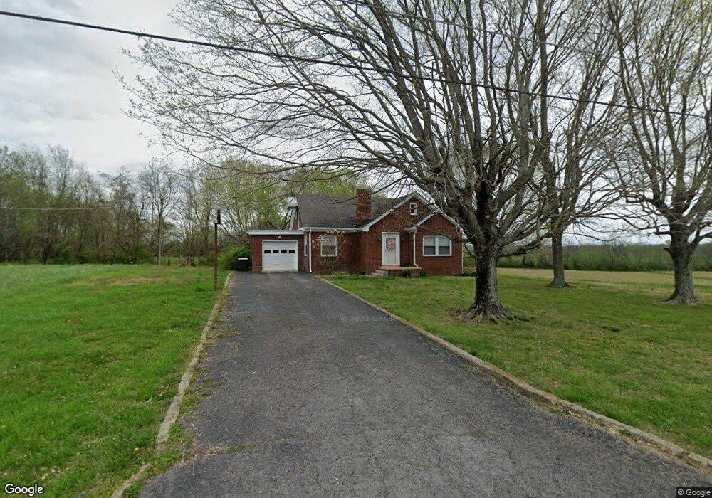
106 Radio Rd Springfield, TN 37172
Estimated Value: $225,944 - $358,000
--
Bed
1
Bath
1,068
Sq Ft
$285/Sq Ft
Est. Value
About This Home
This home is located at 106 Radio Rd, Springfield, TN 37172 and is currently estimated at $303,986, approximately $284 per square foot. 106 Radio Rd is a home located in Robertson County with nearby schools including Coopertown Elementary School, Coopertown Middle School, and Springfield High School.
Ownership History
Date
Name
Owned For
Owner Type
Purchase Details
Closed on
Jul 16, 2021
Sold by
Bell Patricia S and The Ron H Bell Revocable Trust
Bought by
Laborg James
Current Estimated Value
Purchase Details
Closed on
Dec 19, 1974
Bought by
Bell Roberta L
Create a Home Valuation Report for This Property
The Home Valuation Report is an in-depth analysis detailing your home's value as well as a comparison with similar homes in the area
Home Values in the Area
Average Home Value in this Area
Purchase History
| Date | Buyer | Sale Price | Title Company |
|---|---|---|---|
| Laborg James | $495,000 | None Available | |
| Bell Roberta L | -- | -- |
Source: Public Records
Tax History Compared to Growth
Tax History
| Year | Tax Paid | Tax Assessment Tax Assessment Total Assessment is a certain percentage of the fair market value that is determined by local assessors to be the total taxable value of land and additions on the property. | Land | Improvement |
|---|---|---|---|---|
| 2024 | $1,018 | $56,575 | $16,250 | $40,325 |
| 2023 | $1,018 | $56,575 | $16,250 | $40,325 |
| 2022 | $647 | $25,125 | $4,825 | $20,300 |
| 2021 | $647 | $25,125 | $4,825 | $20,300 |
| 2020 | $647 | $25,125 | $4,825 | $20,300 |
| 2019 | $647 | $25,125 | $4,825 | $20,300 |
| 2018 | $647 | $25,125 | $4,825 | $20,300 |
| 2017 | $663 | $21,500 | $4,025 | $17,475 |
| 2016 | $663 | $21,500 | $4,025 | $17,475 |
| 2015 | $636 | $21,500 | $4,025 | $17,475 |
| 2014 | $636 | $21,500 | $4,025 | $17,475 |
Source: Public Records
Map
Nearby Homes
- 108 Valley Dr
- 5106 High Oaks Place
- 5148 Highway 49 W
- 1203 Goose Dr
- 1161 Goose Dr
- 1503 5th Ave W
- 1137 Goose Dr
- 1100 Goose Dr
- 2060 Beverly Ct
- 3545 Jim Gower Rd
- 5058 New Chapel Rd
- 7373 New Chapel Rd
- 100 Pitt Ln
- 413 Dorris Ave
- 168 Dorris Ave
- 3166 John L Patterson St
- 1 W 20th Ave
- 1421 Lawrence Ln
- 2067 Bessie St
- 2222 Leota St
- 100 Radio Rd
- 100 Radio Rd
- 5123 High Oaks Place
- 311 Westwind Dr
- 313 Westwind Dr
- 309 Westwind Dr
- 5128 High Oaks Place
- 5121 High Oaks Place
- 315 Westwind Dr
- 307 Westwind Dr
- 305 Westwind Dr
- 317 Westwind Dr
- 306 Westwind Dr
- 105 Valley Dr
- 303 Westwind Dr
- 5119 High Oaks Place
- 304 Westwind Dr
- 103 Valley Dr
- 5122 High Oaks Place
- 5120 High Oaks Place Unit 15