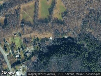
106 Roaring Brook Rd Williamstown, MA 01267
Estimated Value: $394,000 - $539,000
4
Beds
2
Baths
1,804
Sq Ft
$254/Sq Ft
Est. Value
About This Home
This home is located at 106 Roaring Brook Rd, Williamstown, MA 01267 and is currently estimated at $458,037, approximately $253 per square foot. 106 Roaring Brook Rd is a home located in Berkshire County with nearby schools including Lanesborough Elementary School and Mt. Greylock Regional High School.
Ownership History
Date
Name
Owned For
Owner Type
Purchase Details
Closed on
Jul 1, 2019
Sold by
Filiault John J and Filiault Carol A
Bought by
Filiault Jon-Joe
Current Estimated Value
Home Financials for this Owner
Home Financials are based on the most recent Mortgage that was taken out on this home.
Original Mortgage
$350,000
Outstanding Balance
$310,950
Interest Rate
4%
Mortgage Type
New Conventional
Estimated Equity
$151,948
Create a Home Valuation Report for This Property
The Home Valuation Report is an in-depth analysis detailing your home's value as well as a comparison with similar homes in the area
Home Values in the Area
Average Home Value in this Area
Purchase History
| Date | Buyer | Sale Price | Title Company |
|---|---|---|---|
| Filiault Jon-Joe | $180,000 | -- |
Source: Public Records
Mortgage History
| Date | Status | Borrower | Loan Amount |
|---|---|---|---|
| Open | Filiault Jon-Joe | $350,000 | |
| Previous Owner | Filiault Carol A | $185,000 | |
| Previous Owner | Filiault John J | $180,000 | |
| Previous Owner | Filiault Carol A | $42,000 | |
| Previous Owner | Filiault Carol A | $240,000 | |
| Previous Owner | Filiault John J | $30,000 | |
| Previous Owner | Filiault John J | $168,000 | |
| Previous Owner | Filiault John J | $160,000 |
Source: Public Records
Tax History Compared to Growth
Tax History
| Year | Tax Paid | Tax Assessment Tax Assessment Total Assessment is a certain percentage of the fair market value that is determined by local assessors to be the total taxable value of land and additions on the property. | Land | Improvement |
|---|---|---|---|---|
| 2025 | $5,218 | $378,100 | $93,000 | $285,100 |
| 2024 | $5,215 | $344,200 | $88,400 | $255,800 |
| 2023 | $5,071 | $313,600 | $80,400 | $233,200 |
| 2022 | $5,003 | $295,700 | $77,500 | $218,200 |
| 2021 | $4,808 | $277,900 | $77,500 | $200,400 |
| 2020 | $4,738 | $269,200 | $77,800 | $191,400 |
| 2019 | $6,599 | $244,000 | $74,200 | $169,800 |
| 2018 | $4,164 | $232,100 | $74,200 | $157,900 |
| 2017 | $3,955 | $232,100 | $74,200 | $157,900 |
| 2016 | $3,665 | $232,100 | $74,200 | $157,900 |
| 2015 | $3,623 | $232,100 | $74,200 | $157,900 |
| 2014 | $3,661 | $239,600 | $80,500 | $159,100 |
Source: Public Records
Map
Nearby Homes
- 41 Hancock Rd
- 0 Hancock Rd
- 1151 Hancock Rd
- 1541 Green River Rd Unit 1
- 78 Mallery Rd
- 860 Stratton Rd
- 1460 Cold Spring Rd
- 584 Water St
- 0 Holly Ln
- 0 Water St
- 0 Notch Rd
- 160 Water St Unit 301
- 160 Water St Unit 23
- 160 Water St Unit 103
- 160 Water St Unit 209
- 160 Water St Unit 309
- 2774 Hancock Rd
- 12 River Run
- 1 River Run Unit 1
- 775 Williamstown Rd
- 106 Roaring Brook Rd
- 136 Roaring Brook Rd
- 62 Roaring Brook Rd
- 125 Roaring Brook Rd
- 45 Roaring Brook Rd
- 34 Roaring Brook Rd
- 21 Roaring Brook Rd
- 14 Roaring Brook Rd
- 0 Roaring Brook Rd
- 720 New Ashford Rd
- 1071 New Ashford Rd
- 990 New Ashford Rd
- 722 New Ashford Rd
- 1166 New Ashford Rd
- 1099 New Ashford Rd
- 1131 New Ashford Rd
- 1135 New Ashford Rd
- 420 Potter Rd
- 409 Potter Rd