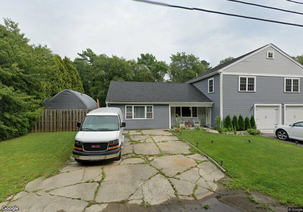
106 Robert St Unit 108 Westport, MA 02790
Sawdy Pond/Woods Corner NeighborhoodEstimated Value: $538,000 - $591,040
4
Beds
--
Bath
2,756
Sq Ft
$204/Sq Ft
Est. Value
About This Home
This home is located at 106 Robert St Unit 108, Westport, MA 02790 and is currently estimated at $562,260, approximately $204 per square foot. 106 Robert St Unit 108 is a home located in Bristol County with nearby schools including Alice A. Macomber Primary School, Westport Elementary School, and Westport Middle-High School.
Ownership History
Date
Name
Owned For
Owner Type
Purchase Details
Closed on
Sep 11, 2002
Sold by
Estee Dubtisky Stanley and Estee Dubtisky
Bought by
Bartle Robert A
Current Estimated Value
Home Financials for this Owner
Home Financials are based on the most recent Mortgage that was taken out on this home.
Original Mortgage
$179,580
Interest Rate
6.48%
Mortgage Type
Purchase Money Mortgage
Purchase Details
Closed on
Aug 31, 1989
Sold by
106-108 Robert Rt
Bought by
Dubitsky Stanley
Home Financials for this Owner
Home Financials are based on the most recent Mortgage that was taken out on this home.
Original Mortgage
$120,000
Interest Rate
9.7%
Mortgage Type
Purchase Money Mortgage
Create a Home Valuation Report for This Property
The Home Valuation Report is an in-depth analysis detailing your home's value as well as a comparison with similar homes in the area
Home Values in the Area
Average Home Value in this Area
Purchase History
| Date | Buyer | Sale Price | Title Company |
|---|---|---|---|
| Bartle Robert A | $181,000 | -- | |
| Dubitsky Stanley | $150,000 | -- |
Source: Public Records
Mortgage History
| Date | Status | Borrower | Loan Amount |
|---|---|---|---|
| Open | Dubitsky Stanley | $40,000 | |
| Open | Dubitsky Stanley | $220,000 | |
| Closed | Dubitsky Stanley | $179,580 | |
| Previous Owner | Dubitsky Stanley | $120,000 |
Source: Public Records
Tax History Compared to Growth
Tax History
| Year | Tax Paid | Tax Assessment Tax Assessment Total Assessment is a certain percentage of the fair market value that is determined by local assessors to be the total taxable value of land and additions on the property. | Land | Improvement |
|---|---|---|---|---|
| 2025 | $3,970 | $532,900 | $154,800 | $378,100 |
| 2024 | $4,007 | $518,400 | $143,400 | $375,000 |
| 2023 | $4,000 | $490,200 | $136,600 | $353,600 |
| 2022 | $3,780 | $445,700 | $136,600 | $309,100 |
| 2021 | $3,735 | $433,300 | $124,200 | $309,100 |
| 2020 | $2,350 | $278,800 | $119,200 | $159,600 |
| 2019 | $2,201 | $266,100 | $108,400 | $157,700 |
| 2018 | $2,066 | $252,900 | $116,600 | $136,300 |
| 2017 | $1,991 | $249,800 | $116,600 | $133,200 |
| 2016 | $1,921 | $242,800 | $116,600 | $126,200 |
| 2015 | $1,793 | $226,100 | $116,600 | $109,500 |
Source: Public Records
Map
Nearby Homes
- 40 Robert St
- 47 Robert St
- 33 Moniz Dr
- 218 American Legion Hwy
- 308 Robert St
- 8 Campion Ave
- 0 Crandall Rd
- 6 Angel Ct
- 374 Crandall Rd
- 51 Newton St
- 1125 Stafford Rd Unit 5
- 14 Glendale Ave
- 47 Devol Ave
- 219 Tickle Rd
- 0 Tickle Rd Unit 73453134
- 100 Cory's Ln
- 100 Corys Ln
- 75 Montgomery St
- 771 Sanford Rd
- 978 Sodom Rd
- 100 Robert St
- 100 Robert St Unit 1
- 100 Robert St Unit 2
- 112 Robert St
- 112 Robert St Unit B
- 102 Robert St
- 102 Robert St Unit 2
- 110 Robert St Unit A 110
- 110 Robert St
- 116 Robert St Unit 118
- 116-118 Robert St
- 94 Robert St Unit 96
- 118 Robert St Unit B
- 3 Keith Dr
- 122 Robert St Unit 124
- 93 Robert St
- 0 Keith Dr
- 7 Keith Dr
- 87 Robert St
- 6 Keith Dr