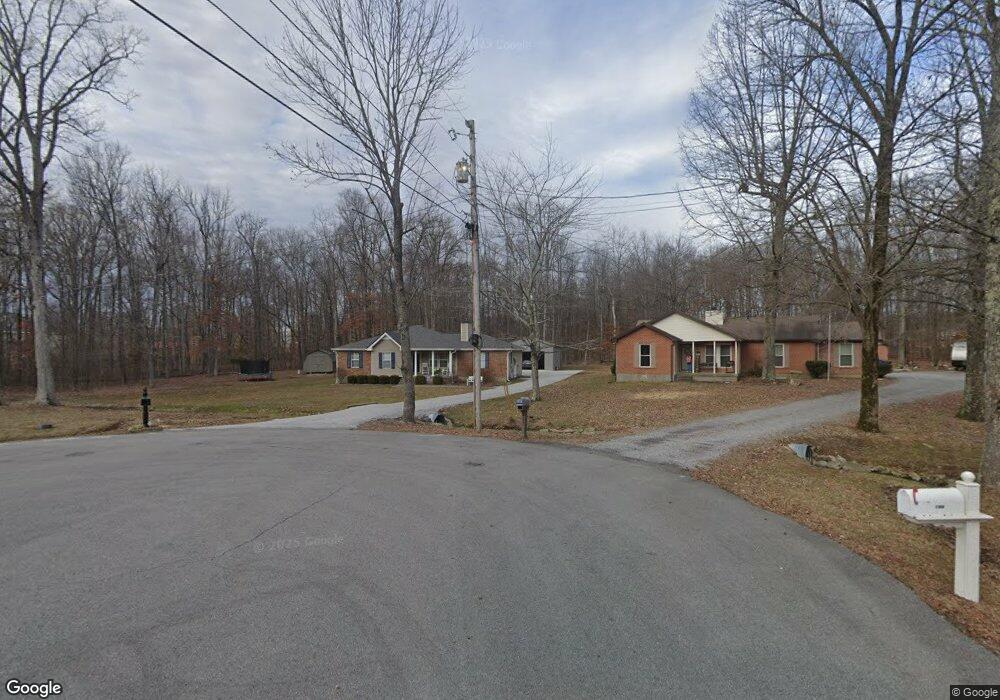
106 Rolling Forrest Ct White House, TN 37188
Estimated Value: $300,642 - $328,000
--
Bed
2
Baths
1,299
Sq Ft
$245/Sq Ft
Est. Value
About This Home
This home is located at 106 Rolling Forrest Ct, White House, TN 37188 and is currently estimated at $318,161, approximately $244 per square foot. 106 Rolling Forrest Ct is a home located in Sumner County with nearby schools including Harold B. Williams Elementary School, White House Middle School, and White House High School.
Ownership History
Date
Name
Owned For
Owner Type
Purchase Details
Closed on
May 26, 2016
Bought by
Allen Matthew Kyle
Current Estimated Value
Home Financials for this Owner
Home Financials are based on the most recent Mortgage that was taken out on this home.
Original Mortgage
$112,000
Outstanding Balance
$89,342
Interest Rate
3.64%
Estimated Equity
$228,819
Purchase Details
Closed on
Nov 6, 2009
Sold by
Boilard Yvon J
Bought by
Reese Richard
Home Financials for this Owner
Home Financials are based on the most recent Mortgage that was taken out on this home.
Original Mortgage
$129,731
Interest Rate
4.93%
Mortgage Type
FHA
Create a Home Valuation Report for This Property
The Home Valuation Report is an in-depth analysis detailing your home's value as well as a comparison with similar homes in the area
Home Values in the Area
Average Home Value in this Area
Purchase History
| Date | Buyer | Sale Price | Title Company |
|---|---|---|---|
| Allen Matthew Kyle | -- | -- | |
| Reese Richard | $137,500 | Windmill Title |
Source: Public Records
Mortgage History
| Date | Status | Borrower | Loan Amount |
|---|---|---|---|
| Open | Allen Matthew Kyle | $112,000 | |
| Closed | Allen Matthew Kyle | -- | |
| Previous Owner | Reese Richard | $129,731 |
Source: Public Records
Tax History Compared to Growth
Tax History
| Year | Tax Paid | Tax Assessment Tax Assessment Total Assessment is a certain percentage of the fair market value that is determined by local assessors to be the total taxable value of land and additions on the property. | Land | Improvement |
|---|---|---|---|---|
| 2024 | $1,148 | $80,800 | $23,750 | $57,050 |
| 2023 | $1,460 | $40,675 | $15,350 | $25,325 |
| 2022 | $1,443 | $40,675 | $15,350 | $25,325 |
| 2021 | $1,443 | $40,675 | $15,350 | $25,325 |
| 2020 | $1,341 | $40,675 | $15,350 | $25,325 |
| 2019 | $1,341 | $0 | $0 | $0 |
| 2018 | $1,091 | $0 | $0 | $0 |
| 2017 | $1,091 | $0 | $0 | $0 |
| 2016 | $731 | $0 | $0 | $0 |
| 2015 | -- | $0 | $0 | $0 |
| 2014 | -- | $0 | $0 | $0 |
Source: Public Records
Map
Nearby Homes
- 100 Rolling Acres Dr
- 110 Sycamore Dr
- 2724 Highway 31 W
- 109 Chalone Dr
- 103 Cypress Ct
- 101 Chalone Dr
- 202 Hunterwood Dr
- 125 Sycamore Dr
- 101 Laura Dr
- 405 Hunterwood Dr
- 427 Fieldstone Dr
- 1112 Southerlynn Dr
- 1128 Southerlynn Dr
- 1124 Southerlynn Dr
- 1136 Southerlynn Dr
- The Caldwell Plan at Marlin Pointe
- The Phoenix Plan at Marlin Pointe
- The Pearson Plan at Marlin Pointe
- The Braselton II Plan at Marlin Pointe
- 200 Sapphire Dr
- 105 Rolling Forrest Ct
- 104 Rolling Forrest Ct
- 102 Rolling Forrest Ct
- 103 Rolling Forrest Ct
- 104 Forrest Ln
- 106 Forrest Ln
- 102 Forrest Ln
- 400 Rolling Acres Dr
- 302 Rolling Acres Dr
- 402 Rolling Acres Dr
- 108 Forrest Ln
- 300 Rolling Acres Dr
- 103 Forrest Ln
- 220 Rolling Acres Dr
- 307 Rolling Acres Dr
- 109 Forrest Ln
- 305 Rolling Acres Dr
- 767 Mccurdy Rd
- 401 Rolling Acres Dr
- 303 Rolling Acres Dr