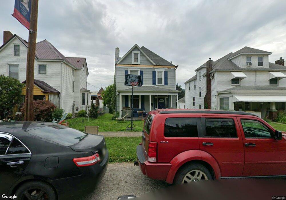
106 W Adams Ave Vandergrift, PA 15690
Estimated Value: $86,428 - $152,000
--
Bed
--
Bath
--
Sq Ft
3,964
Sq Ft Lot
About This Home
This home is located at 106 W Adams Ave, Vandergrift, PA 15690 and is currently estimated at $119,107. 106 W Adams Ave is a home located in Westmoreland County with nearby schools including Kiski Area High School.
Ownership History
Date
Name
Owned For
Owner Type
Purchase Details
Closed on
Aug 15, 2005
Sold by
Miller Barbara L and Cates Stephanie A
Bought by
Shaner William
Current Estimated Value
Purchase Details
Closed on
Jun 9, 2004
Sold by
Pelligrino Barbara
Bought by
Miller Barbara L and Cates Stephanie A
Create a Home Valuation Report for This Property
The Home Valuation Report is an in-depth analysis detailing your home's value as well as a comparison with similar homes in the area
Home Values in the Area
Average Home Value in this Area
Purchase History
| Date | Buyer | Sale Price | Title Company |
|---|---|---|---|
| Shaner William | $33,000 | None Available | |
| Miller Barbara L | $27,000 | -- |
Source: Public Records
Tax History Compared to Growth
Tax History
| Year | Tax Paid | Tax Assessment Tax Assessment Total Assessment is a certain percentage of the fair market value that is determined by local assessors to be the total taxable value of land and additions on the property. | Land | Improvement |
|---|---|---|---|---|
| 2025 | $1,813 | $11,110 | $2,720 | $8,390 |
| 2024 | $1,727 | $11,110 | $2,720 | $8,390 |
| 2023 | $1,590 | $11,110 | $2,720 | $8,390 |
| 2022 | $1,556 | $11,110 | $2,720 | $8,390 |
| 2021 | $1,557 | $11,110 | $2,720 | $8,390 |
| 2020 | $1,553 | $11,110 | $2,720 | $8,390 |
| 2019 | $1,547 | $11,110 | $2,720 | $8,390 |
| 2018 | $1,525 | $11,110 | $2,720 | $8,390 |
| 2017 | $1,492 | $11,110 | $2,720 | $8,390 |
| 2016 | $1,471 | $11,110 | $2,720 | $8,390 |
| 2015 | $1,471 | $11,110 | $2,720 | $8,390 |
| 2014 | $1,465 | $11,110 | $2,720 | $8,390 |
Source: Public Records
Map
Nearby Homes
- 311 Elm St
- 404 1/2 Franklin Ave
- 315 Spruce St
- 314 Linden St
- 112 Farragut Ave Unit 3
- 107 Sumner Ave
- 154 Jefferson Ave Unit 6
- 419 Vandergrift Ln
- 325 -1/2 Quay St
- 133 Sherman Ave
- 137 Sherman Ave
- 323 Sycamore St
- 121 Hamilton Ave
- 219 Quay St
- 517 Sycamore St
- 608 Kennedy Ave
- 716 Kennedy Ave
- 410 Longfellow St
- 1252 Jefferson St
- 533A Walnut St
- 108 W Adams Ave
- 102 W Adams Ave
- 104 W Adams Ave
- 208 Hancock Ave
- 129 Custer Ave
- 206 Hancock Ave
- 131 Custer Ave
- 127 Custer Ave
- 112 W Adams Ave
- 133 Custer Ave
- 125 Custer Ave
- 204 Hancock Ave
- 105 W Adams Ave
- 103 W Adams Ave
- 107 W Adams Ave
- 114 W Adams Ave
- 101 W Adams Ave
- 123 Custer Ave
- 109 W Adams Ave
- 137 Custer Ave