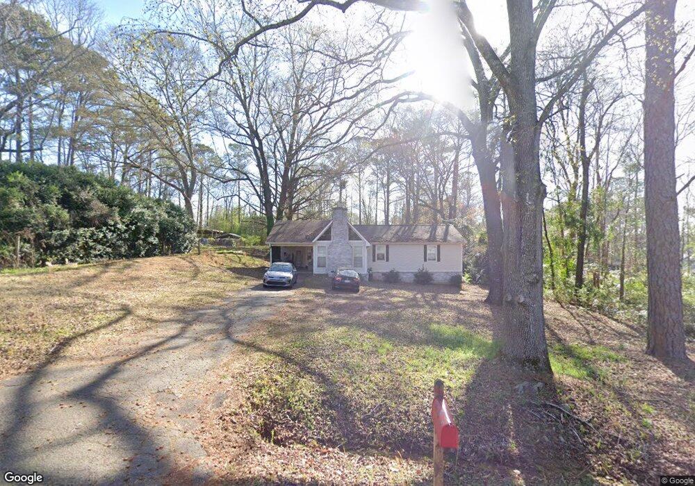
106 W Pyne Dr Unit 14 Lagrange, GA 30240
Estimated Value: $208,234 - $280,000
3
Beds
2
Baths
1,368
Sq Ft
$172/Sq Ft
Est. Value
About This Home
This home is located at 106 W Pyne Dr Unit 14, Lagrange, GA 30240 and is currently estimated at $235,809, approximately $172 per square foot. 106 W Pyne Dr Unit 14 is a home located in Troup County with nearby schools including Ethel W. Kight Elementary School, Hollis Hand Elementary School, and Franklin Forest Elementary School.
Ownership History
Date
Name
Owned For
Owner Type
Purchase Details
Closed on
Aug 26, 2021
Sold by
Marton Chelsea Payton
Bought by
Ray Bobby Alan and Ray Brandy N
Current Estimated Value
Home Financials for this Owner
Home Financials are based on the most recent Mortgage that was taken out on this home.
Original Mortgage
$159,065
Outstanding Balance
$144,737
Interest Rate
2.8%
Mortgage Type
FHA
Estimated Equity
$91,072
Purchase Details
Closed on
Jun 30, 2020
Sold by
Bailey Heather Leeann
Bought by
Martin Chelsa Payton and Martin Joseph Lee
Home Financials for this Owner
Home Financials are based on the most recent Mortgage that was taken out on this home.
Original Mortgage
$132,554
Interest Rate
3.1%
Mortgage Type
FHA
Purchase Details
Closed on
Aug 14, 2018
Sold by
Bolt Sylvia D
Bought by
Bailey Heather Leeann
Home Financials for this Owner
Home Financials are based on the most recent Mortgage that was taken out on this home.
Original Mortgage
$109,250
Interest Rate
4.5%
Mortgage Type
New Conventional
Purchase Details
Closed on
May 7, 2018
Sold by
Cook Adam Alan
Bought by
Bolt Sylvia D
Purchase Details
Closed on
May 6, 2014
Sold by
Bryant Joshua C
Bought by
Cook Adam Alan
Purchase Details
Closed on
Jan 28, 2013
Sold by
Sec Of Housing & U
Bought by
Bryant Joshua C
Home Financials for this Owner
Home Financials are based on the most recent Mortgage that was taken out on this home.
Original Mortgage
$58,525
Interest Rate
3.25%
Mortgage Type
FHA
Purchase Details
Closed on
Dec 6, 2011
Sold by
Branch Banking & Trust C
Bought by
Sec Of Housing & Urban
Purchase Details
Closed on
Jun 26, 1990
Sold by
Pate Donna B
Bought by
Samuel R Pate
Purchase Details
Closed on
Apr 12, 1977
Sold by
Durand Harry D
Bought by
Pate Donna B
Purchase Details
Closed on
Oct 14, 1975
Sold by
Overcash
Bought by
Durand Harry D
Create a Home Valuation Report for This Property
The Home Valuation Report is an in-depth analysis detailing your home's value as well as a comparison with similar homes in the area
Home Values in the Area
Average Home Value in this Area
Purchase History
| Date | Buyer | Sale Price | Title Company |
|---|---|---|---|
| Ray Bobby Alan | $162,000 | -- | |
| Martin Chelsa Payton | $135,000 | -- | |
| Bailey Heather Leeann | $115,000 | -- | |
| Bolt Sylvia D | $108,900 | -- | |
| Cook Adam Alan | $89,900 | -- | |
| Bryant Joshua C | $56,425 | -- | |
| Sec Of Housing & Urban | $89,921 | -- | |
| Samuel R Pate | -- | -- | |
| Pate Donna B | $36,000 | -- | |
| Durand Harry D | $22,500 | -- |
Source: Public Records
Mortgage History
| Date | Status | Borrower | Loan Amount |
|---|---|---|---|
| Open | Ray Bobby Alan | $159,065 | |
| Previous Owner | Martin Chelsa Payton | $132,554 | |
| Previous Owner | Bailey Heather Leeann | $109,250 | |
| Previous Owner | Bryant Joshua C | $58,525 |
Source: Public Records
Tax History Compared to Growth
Tax History
| Year | Tax Paid | Tax Assessment Tax Assessment Total Assessment is a certain percentage of the fair market value that is determined by local assessors to be the total taxable value of land and additions on the property. | Land | Improvement |
|---|---|---|---|---|
| 2024 | $1,761 | $64,560 | $10,000 | $54,560 |
| 2023 | $1,764 | $64,680 | $10,000 | $54,680 |
| 2022 | $1,739 | $62,320 | $10,000 | $52,320 |
| 2021 | $1,225 | $50,120 | $8,000 | $42,120 |
| 2020 | $1,056 | $35,000 | $3,920 | $31,080 |
| 2019 | $1,107 | $36,720 | $3,920 | $32,800 |
| 2018 | $1,018 | $33,760 | $3,920 | $29,840 |
| 2017 | $1,018 | $33,760 | $3,920 | $29,840 |
| 2016 | $1,022 | $33,891 | $3,936 | $29,955 |
| 2015 | $1,024 | $33,891 | $3,936 | $29,955 |
| 2014 | $683 | $22,570 | $3,334 | $19,236 |
| 2013 | -- | $31,951 | $3,936 | $28,015 |
Source: Public Records
Map
Nearby Homes
- 0 Deming St Unit 10550189
- LOT 4 Angela Dr
- E Angela Dr
- 709 Vernon Ferry Rd
- 135 Planters Ridge Dr
- 124 Foxdale Dr
- 243 Oak Dr
- 190 Hill Rd
- 103 Dogwood Ct
- 104 Dogwood Point
- 102 Foxdale Dr
- 200 Cheyenne Dr
- 226 Linda Ln
- 4004 White Oak Ln
- 146 Whitaker Rd
- 509 Connie Dr
- 610 Ginger Cir
- 110 Hawthorne Cir
- 104 Spring Valley Dr
- 117 Brookwood Dr