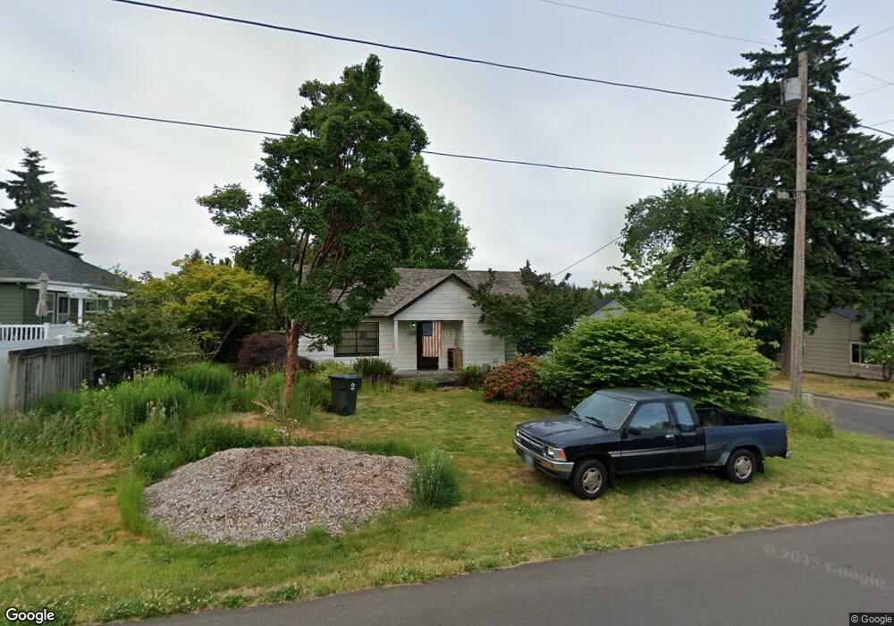
1060 Cedar Way SE Salem, OR 97302
South Central NeighborhoodEstimated Value: $411,000 - $475,000
1
Bed
2
Baths
1,948
Sq Ft
$226/Sq Ft
Est. Value
About This Home
This home is located at 1060 Cedar Way SE, Salem, OR 97302 and is currently estimated at $439,721, approximately $225 per square foot. 1060 Cedar Way SE is a home located in Marion County with nearby schools including McKinley Elementary School, Leslie Middle School, and South Salem High School.
Ownership History
Date
Name
Owned For
Owner Type
Purchase Details
Closed on
Jun 27, 2011
Sold by
Quigg Jerry F and Gaucher Lorraine Mae
Bought by
Quigg Jerry F
Current Estimated Value
Home Financials for this Owner
Home Financials are based on the most recent Mortgage that was taken out on this home.
Original Mortgage
$100,000
Interest Rate
4.56%
Mortgage Type
Seller Take Back
Purchase Details
Closed on
Sep 18, 2002
Sold by
Quigg Jerry F and Gaucher Lorraine Mae
Bought by
Quigg Jerry F and Gaucher Lorraine M
Create a Home Valuation Report for This Property
The Home Valuation Report is an in-depth analysis detailing your home's value as well as a comparison with similar homes in the area
Home Values in the Area
Average Home Value in this Area
Purchase History
| Date | Buyer | Sale Price | Title Company |
|---|---|---|---|
| Quigg Jerry F | $100,000 | F A T | |
| Quigg Jerry F | $100,000 | F A T | |
| Quigg Jerry F | -- | -- |
Source: Public Records
Mortgage History
| Date | Status | Borrower | Loan Amount |
|---|---|---|---|
| Closed | Quigg Jerry F | $100,000 |
Source: Public Records
Tax History Compared to Growth
Tax History
| Year | Tax Paid | Tax Assessment Tax Assessment Total Assessment is a certain percentage of the fair market value that is determined by local assessors to be the total taxable value of land and additions on the property. | Land | Improvement |
|---|---|---|---|---|
| 2025 | $3,347 | $175,580 | -- | -- |
| 2024 | $3,347 | $170,470 | -- | -- |
| 2023 | $3,248 | $165,510 | $0 | $0 |
| 2022 | $3,063 | $160,690 | $0 | $0 |
| 2021 | $2,975 | $156,010 | $0 | $0 |
| 2020 | $2,889 | $151,470 | $0 | $0 |
| 2019 | $2,787 | $147,060 | $0 | $0 |
| 2018 | $2,836 | $0 | $0 | $0 |
| 2017 | $2,560 | $0 | $0 | $0 |
| 2016 | $2,439 | $0 | $0 | $0 |
| 2015 | $2,457 | $0 | $0 | $0 |
| 2014 | $2,378 | $0 | $0 | $0 |
Source: Public Records
Map
Nearby Homes
- 2756 Pheasant Ave SE
- 999 Cedar Way SE
- 995 Fairview Ave SE
- 2872 Bluff Ave SE
- 1075 Vista Ave SE
- 3070 Troth Ct SE
- 2210 Winter St SE Unit 2220
- 2640 High St SE
- 3301 Bluff Ave SE
- 530 Fairview Ave SE
- 1245 Hillendale Dr SE
- 2005 Summer St SE Unit 2045
- 965 Morningside St SE
- 1030 Morningside Dr SE
- 2490 E Nob Hill St SE
- 2220 High St SE
- 3393 Pioneer Dr SE
- 1155 Howard St SE Unit 1173
- 3495 Hulsey Ave SE
- 1740 Berry St SE
- 2703 Bluff Ave SE
- 2735 Bluff Ave SE
- 2744 Pheasant Ave SE
- 1050 Cedar Way SE
- 2737 Pheasant Ave SE
- 2747 Pheasant Ave SE
- 1040 Cedar Way SE
- 2745 Bluff Ave SE
- 2692 Bluff Ave SE
- 1055 Cedar Way SE
- 2757 Pheasant Ave SE
- 2702 Bluff Ave SE
- 2762 Pheasant Ave SE
- 2600 Pheasant Ave SE
- 1045 Cedar Way SE
- 1030 Cedar Way SE
- 2675 Pheasant Ave SE
- 1010 Cedar Way SE
- 2769 Pheasant Ave SE
- 2761 Bluff Ave SE