Estimated Value: $71,705 - $277,000
Studio
2
Baths
812
Sq Ft
$237/Sq Ft
Est. Value
About This Home
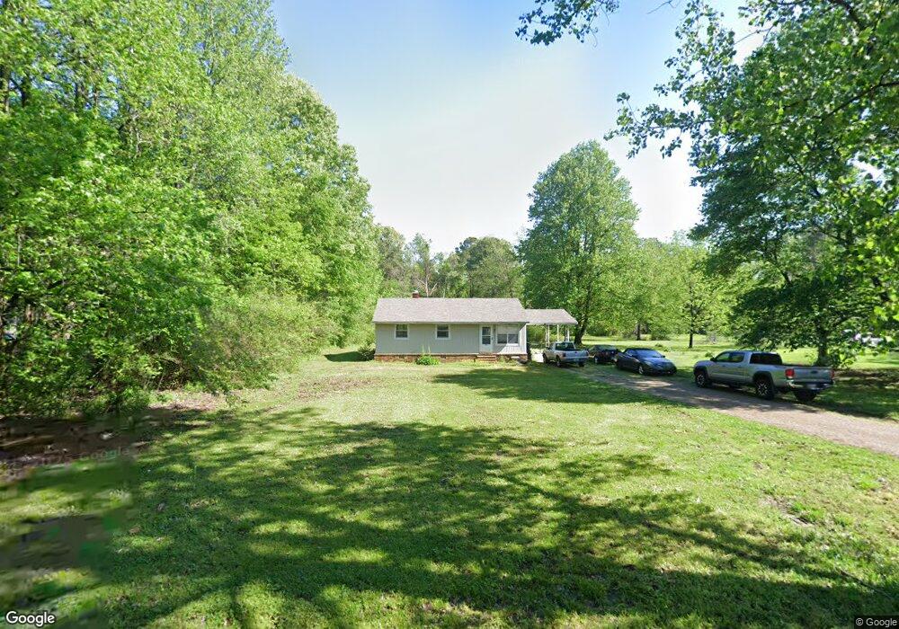
This home is located at 1060 Ecology Loop, Eads, TN 38028 and is currently estimated at $192,676, approximately $237 per square foot. 1060 Ecology Loop is a home located in Fayette County with nearby schools including Oakland Elementary School, West Junior High School, and Fayette Ware Comprehensive High School.
Ownership History
Date
Name
Owned For
Owner Type
Purchase Details
Closed on
Sep 5, 2019
Sold by
W C Adams Land Company
Bought by
Adams Warren C and Adams Donna
Current Estimated Value
Purchase Details
Closed on
Mar 2, 2012
Sold by
Adams W C Land Co
Bought by
Adams Warren C and Adams Donna Adams
Purchase Details
Closed on
Feb 25, 1994
Bought by
Adams Warren C and Adams Virginia B
Purchase Details
Closed on
May 28, 1993
Bought by
Arie Brian B
Purchase Details
Closed on
Apr 28, 1993
Bought by
Adams Warren C
Purchase Details
Closed on
Jan 24, 1990
Bought by
Adams Warren C
Purchase Details
Closed on
Sep 5, 1984
Bought by
Lane Harold L and Lane Muriel
Create a Home Valuation Report for This Property
The Home Valuation Report is an in-depth analysis detailing your home's value as well as a comparison with similar homes in the area
Purchase History
| Date | Buyer | Sale Price | Title Company |
|---|---|---|---|
| Adams Warren C | -- | None Available | |
| Adams Warren C | -- | -- | |
| Adams Warren C | -- | -- | |
| Adams Warren C | $33,500 | -- | |
| Arie Brian B | -- | -- | |
| Adams Warren C | -- | -- | |
| Adams Warren C | $10,000 | -- | |
| Lane Harold L | $1,700 | -- |
Source: Public Records
Tax History
| Year | Tax Paid | Tax Assessment Tax Assessment Total Assessment is a certain percentage of the fair market value that is determined by local assessors to be the total taxable value of land and additions on the property. | Land | Improvement |
|---|---|---|---|---|
| 2025 | $110 | $10,000 | $6,500 | $3,500 |
| 2024 | $110 | $8,550 | $6,250 | $2,300 |
| 2023 | $110 | $8,550 | $0 | $0 |
| 2022 | $110 | $8,550 | $6,250 | $2,300 |
| 2021 | $110 | $8,550 | $6,250 | $2,300 |
| 2020 | $122 | $8,550 | $6,250 | $2,300 |
| 2019 | $122 | $8,125 | $6,250 | $1,875 |
| 2018 | $122 | $8,125 | $6,250 | $1,875 |
| 2017 | $122 | $8,125 | $6,250 | $1,875 |
| 2016 | $132 | $8,225 | $6,250 | $1,975 |
| 2015 | $132 | $8,225 | $6,250 | $1,975 |
| 2014 | $132 | $8,225 | $6,250 | $1,975 |
Source: Public Records
Map
Nearby Homes
- 390 Rolling Acres Dr
- 245 Ecology Loop
- 0 Bell Grove Rd Unit 10211043
- 0 Bell Grove Rd Unit 23176368
- 0 Bell Grove Rd Unit 10211044
- 1575-1105 Bell Grove Rd
- 2000 U S Highway 64
- 225 Bibury Ln
- 110 Fair Meadows Ln
- 260 Bibury Ln
- 400 Cypress Village Ln
- 410 Cypress Village Ln
- 430 Cypress Village Ln
- 285 Bibury Ln
- 435 Cypress Village Ln
- 335 Bibury Ln
- 365 Bibury Ln
- 18160 Tennessee 196
- 0 Ivy Dr
- 18670 Tennessee 196
- 1060 Ecology Loop
- 1020 Ecology Loop
- 1120 Ecology Loop
- 980 Ecology Loop
- 1125 Ecology Loop
- 985 Ecology Loop
- 955 Ecology Loop
- 1215 Ecology Loop
- 810 West Dr
- 920 Ecology Loop
- 880 West Dr
- 50 Rolling Acres Dr
- 475 Rolling Acres Dr
- 425 Rolling Acres Dr
- 930 West Dr
- 1260 Ecology Loop
- 1260 Ecology Loop Unit 5.65 acr
- 365 Rolling Acres Dr
- 855 Ecology Loop
- 1275 Ecology Loop
Your Personal Tour Guide
Ask me questions while you tour the home.