Estimated Value: $71,000 - $124,000
3
Beds
1
Bath
893
Sq Ft
$122/Sq Ft
Est. Value
About This Home
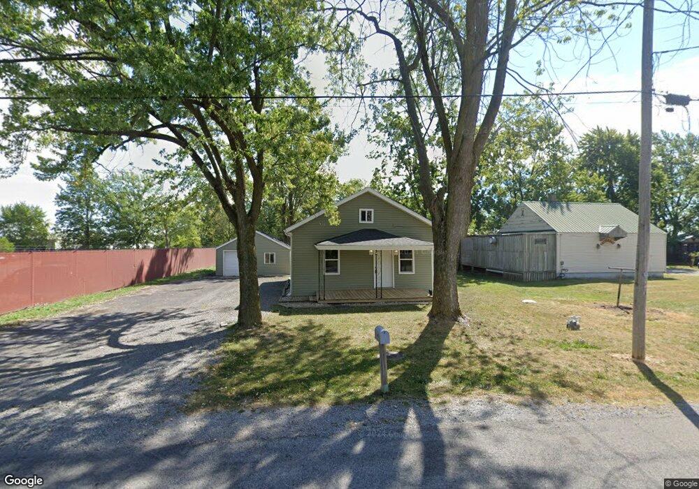
This home is located at 1060 Independence Rd, Lima, OH 45801 and is currently estimated at $109,316, approximately $122 per square foot. 1060 Independence Rd is a home located in Allen County with nearby schools including Bath Elementary School, Bath Middle School, and Bath High School.
Ownership History
Date
Name
Owned For
Owner Type
Purchase Details
Closed on
Oct 3, 2024
Sold by
Butlers Investment Properties Co
Bought by
Hoos Staten and Shively Caitlin
Current Estimated Value
Home Financials for this Owner
Home Financials are based on the most recent Mortgage that was taken out on this home.
Original Mortgage
$115,430
Outstanding Balance
$114,242
Interest Rate
6.46%
Mortgage Type
New Conventional
Estimated Equity
-$4,926
Purchase Details
Closed on
May 5, 2015
Sold by
Theis Betty Jean and Gilroy Rachael S
Bought by
Butlers Investment Properties Co
Purchase Details
Closed on
Jan 4, 1990
Bought by
Theis Charles A
Create a Home Valuation Report for This Property
The Home Valuation Report is an in-depth analysis detailing your home's value as well as a comparison with similar homes in the area
Purchase History
| Date | Buyer | Sale Price | Title Company |
|---|---|---|---|
| Hoos Staten | $119,000 | None Listed On Document | |
| Butlers Investment Properties Co | $5,000 | None Available | |
| Theis Charles A | $28,000 | -- |
Source: Public Records
Mortgage History
| Date | Status | Borrower | Loan Amount |
|---|---|---|---|
| Open | Hoos Staten | $115,430 |
Source: Public Records
Tax History
| Year | Tax Paid | Tax Assessment Tax Assessment Total Assessment is a certain percentage of the fair market value that is determined by local assessors to be the total taxable value of land and additions on the property. | Land | Improvement |
|---|---|---|---|---|
| 2024 | $790 | $17,500 | $3,500 | $14,000 |
| 2023 | $775 | $16,670 | $3,330 | $13,340 |
| 2022 | $747 | $16,110 | $3,330 | $12,780 |
| 2021 | $751 | $16,110 | $3,330 | $12,780 |
| 2020 | $576 | $11,100 | $3,150 | $7,950 |
| 2019 | $576 | $11,100 | $3,150 | $7,950 |
| 2018 | $538 | $11,100 | $3,150 | $7,950 |
| 2017 | $504 | $10,080 | $3,150 | $6,930 |
| 2016 | $508 | $10,080 | $3,150 | $6,930 |
| 2015 | $576 | $10,080 | $3,150 | $6,930 |
| 2014 | $576 | $11,450 | $3,150 | $8,300 |
| 2013 | $576 | $11,450 | $3,150 | $8,300 |
Source: Public Records
Map
Nearby Homes
- 1503 Findlay Rd Unit Lot 6
- 812 Christopher Dr
- 922 N Jefferson St
- 1435 N Central Ave
- 919 N Main St
- 1656 Stewart Rd
- 735 N Elizabeth St
- 124 N Perry St
- 207 W Lane Ave
- 316 Ewing Ave
- 1210 E Market St
- 514 & 516 N Elizabeth St
- 1021 N McDonel St
- 406 Ewing Ave
- 806 Bellefontaine Ave
- 557 W Ashton Ave
- 576 W Ashton Ave
- 416 Hazel Ave
- 129 S Pine St
- 435 Marian Ave
- 1070 Independence Rd
- 1061 Independence Rd
- 1052 Independence Rd
- 1057 Independence Rd
- 1055 Independence Rd
- 1065 Independence Rd
- 1069 Independence Rd
- 1048 Independence Rd
- 1049 Independence Rd
- 1072 Independence Rd
- 1075 Independence Rd
- 1041 Independence Rd
- 1045 Independence Rd
- 1053 Prosperity Rd
- 1077 Independence Rd
- 1038 Independence Rd
- 1055 Prosperity Rd
- 1075 Prosperity Rd
- 1061 Prosperity Rd
Your Personal Tour Guide
Ask me questions while you tour the home.