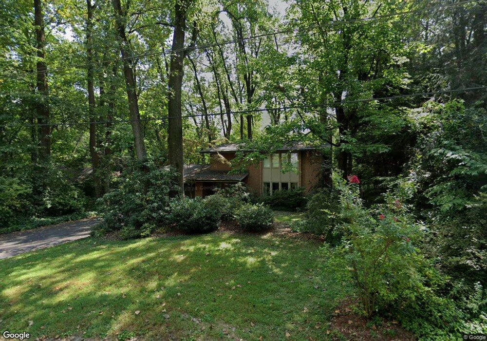
1060 Sherry Ln Lancaster, PA 17601
Oyster Point NeighborhoodEstimated Value: $457,000 - $545,000
3
Beds
3
Baths
2,327
Sq Ft
$212/Sq Ft
Est. Value
About This Home
This home is located at 1060 Sherry Ln, Lancaster, PA 17601 and is currently estimated at $493,074, approximately $211 per square foot. 1060 Sherry Ln is a home located in Lancaster County with nearby schools including Centerville Elementary School, Centerville Middle School, and Hempfield Senior High School.
Ownership History
Date
Name
Owned For
Owner Type
Purchase Details
Closed on
May 31, 2007
Sold by
Menei Joseph C and Menei Patricia E
Bought by
Haines James L and Olson Rebecca L
Current Estimated Value
Home Financials for this Owner
Home Financials are based on the most recent Mortgage that was taken out on this home.
Original Mortgage
$140,000
Outstanding Balance
$85,665
Interest Rate
6.19%
Mortgage Type
Purchase Money Mortgage
Estimated Equity
$407,409
Purchase Details
Closed on
Jun 20, 2002
Sold by
Miller Michael P and Miller Cheryl G
Bought by
Stalzer Joseph J and Tyler Stalzer Margie D
Home Financials for this Owner
Home Financials are based on the most recent Mortgage that was taken out on this home.
Original Mortgage
$60,000
Interest Rate
6.92%
Create a Home Valuation Report for This Property
The Home Valuation Report is an in-depth analysis detailing your home's value as well as a comparison with similar homes in the area
Home Values in the Area
Average Home Value in this Area
Purchase History
| Date | Buyer | Sale Price | Title Company |
|---|---|---|---|
| Haines James L | $317,000 | None Available | |
| Stalzer Joseph J | $178,000 | -- |
Source: Public Records
Mortgage History
| Date | Status | Borrower | Loan Amount |
|---|---|---|---|
| Open | Haines James L | $140,000 | |
| Previous Owner | Stalzer Joseph J | $60,000 |
Source: Public Records
Tax History Compared to Growth
Tax History
| Year | Tax Paid | Tax Assessment Tax Assessment Total Assessment is a certain percentage of the fair market value that is determined by local assessors to be the total taxable value of land and additions on the property. | Land | Improvement |
|---|---|---|---|---|
| 2025 | $5,478 | $253,500 | $69,300 | $184,200 |
| 2024 | $5,478 | $253,500 | $69,300 | $184,200 |
| 2023 | $5,369 | $253,500 | $69,300 | $184,200 |
| 2022 | $5,221 | $253,500 | $69,300 | $184,200 |
| 2021 | $5,138 | $253,500 | $69,300 | $184,200 |
| 2020 | $5,138 | $253,500 | $69,300 | $184,200 |
| 2019 | $5,051 | $253,500 | $69,300 | $184,200 |
| 2018 | $994 | $253,500 | $69,300 | $184,200 |
| 2017 | $5,497 | $218,300 | $42,800 | $175,500 |
| 2016 | $5,497 | $218,300 | $42,800 | $175,500 |
| 2015 | $1,104 | $218,300 | $42,800 | $175,500 |
| 2014 | $4,124 | $218,300 | $42,800 | $175,500 |
Source: Public Records
Map
Nearby Homes
- 880 Corvair Rd
- 916 Dorsea Rd
- 2778 Spring Valley Rd
- 3 Spring Walk Ct
- 9 Spring Walk Ct
- 695 Imperial Dr
- 2504 Brookside Dr
- 854 Centerville Rd
- 2940 Marietta Ave
- 403 Country Place Dr Unit 308
- 151 Pinnacle Point Dr
- 660 Lawrence Blvd Unit DEVONSHIRE
- 660 Lawrence Blvd Unit MAGNOLIA
- 660 Lawrence Blvd Unit ADDISON
- 660 Lawrence Blvd Unit LACHLAN
- 660 Lawrence Blvd Unit COVINGTON
- 660 Lawrence Blvd Unit ARCADIA
- 660 Lawrence Blvd Unit PARKER
- 2990 Nolt Rd
- Kipling Plan at Enclave at Independence Ridge
- 1040 Sherry Ln
- 1070 Sherry Ln
- 1031 Sherry Ln
- 1021 Sherry Ln
- 1030 Sherry Ln
- 1061 Sherry Ln
- 1041 Sherry Ln
- 1011 Sherry Ln
- 1051 Sherry Ln
- 1020 Sherry Ln
- 971 Corvair Rd
- 981 Corvair Rd
- 961 Corvair Rd
- 1010 Sherry Ln
- 2828 Spring Valley Rd
- 2832 Spring Valley Rd
- 2826 Spring Valley Rd
- 951 Corvair Rd
- 991 Corvair Rd
- 713 Hillaire Rd