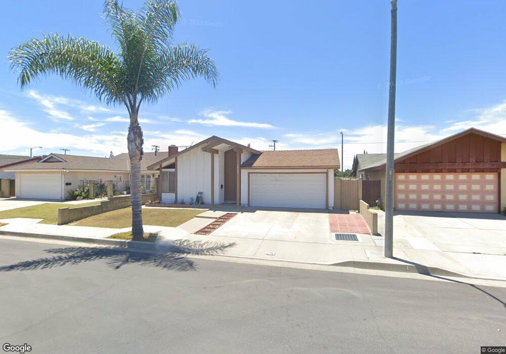
10603 Maple St Cypress, CA 90630
Estimated Value: $929,411 - $1,103,000
3
Beds
2
Baths
1,474
Sq Ft
$690/Sq Ft
Est. Value
About This Home
This home is located at 10603 Maple St, Cypress, CA 90630 and is currently estimated at $1,017,103, approximately $690 per square foot. 10603 Maple St is a home located in Orange County with nearby schools including Cerritos Elementary School, Orangeview Junior High, and Western High School.
Ownership History
Date
Name
Owned For
Owner Type
Purchase Details
Closed on
Aug 23, 2019
Sold by
Quain Helen and Quain Michael
Bought by
Quain Michael Patrick and Quain Helen Hyewon
Current Estimated Value
Purchase Details
Closed on
Feb 27, 2004
Sold by
Kang Woo Kil and Kang Jang Sook
Bought by
Kang Woo Kil and Quain Helen
Create a Home Valuation Report for This Property
The Home Valuation Report is an in-depth analysis detailing your home's value as well as a comparison with similar homes in the area
Home Values in the Area
Average Home Value in this Area
Purchase History
| Date | Buyer | Sale Price | Title Company |
|---|---|---|---|
| Quain Michael Patrick | -- | None Available | |
| Kang Woo Kil | -- | -- |
Source: Public Records
Tax History
| Year | Tax Paid | Tax Assessment Tax Assessment Total Assessment is a certain percentage of the fair market value that is determined by local assessors to be the total taxable value of land and additions on the property. | Land | Improvement |
|---|---|---|---|---|
| 2025 | $2,757 | $223,669 | $122,612 | $101,057 |
| 2024 | $2,757 | $219,284 | $120,208 | $99,076 |
| 2023 | $2,683 | $214,985 | $117,851 | $97,134 |
| 2022 | $2,627 | $210,770 | $115,540 | $95,230 |
| 2021 | $2,646 | $206,638 | $113,275 | $93,363 |
| 2020 | $2,610 | $204,520 | $112,114 | $92,406 |
| 2019 | $2,543 | $200,510 | $109,915 | $90,595 |
| 2018 | $2,506 | $196,579 | $107,760 | $88,819 |
| 2017 | $2,422 | $192,725 | $105,647 | $87,078 |
| 2016 | $2,410 | $188,947 | $103,576 | $85,371 |
| 2015 | $2,379 | $186,109 | $102,020 | $84,089 |
| 2014 | $2,262 | $182,464 | $100,022 | $82,442 |
Source: Public Records
Map
Nearby Homes
- 10685 Lynn Cir
- 6490 Carolina Cir
- 10593 Jill St
- 10305 Eudora Ave
- 10460 Lorinda Ave
- 3525 W Greentree Cir Unit G
- 10700 Knott Ave
- 3580 W Sweetbay Ct Unit B
- 10756 Knott Ave
- 7100 Cerritos Ave Unit 112
- 7100 Cerritos Ave Unit 21
- 7100 Cerritos Ave Unit 86
- 7100 Cerritos Ave Unit 85
- 10748 Knott Ave
- 7129 Cerritos Ave Unit 7
- 7101 Cerritos Ave Unit 21
- 10684 Bell St
- 7251 Middlesex Dr
- 7081 Fulton Way
- 7085 Fulton Way
- 10623 Maple St
- 10583 Maple St
- 10553 Maple St
- 10633 Maple St
- 6524 Teakwood St
- 10533 Maple St
- 6523 Teakwood St
- 10572 Beatrice St
- 6534 Teakwood St
- 10592 Beatrice St
- 10634 Maple St
- 10523 Maple St
- 6533 Teakwood St
- 10653 Maple St
- 10602 Beatrice St
- 10644 Maple St
- 10562 Beatrice St
- 6522 Manzanita Cir
- 6544 Teakwood St
- 6543 Teakwood St
Your Personal Tour Guide
Ask me questions while you tour the home.