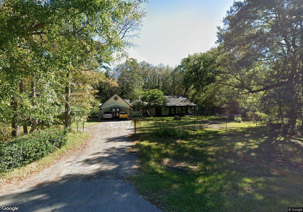
10604 Highway 613 Moss Point, MS 39562
Estimated Value: $132,000 - $235,000
4
Beds
3
Baths
1,970
Sq Ft
$90/Sq Ft
Est. Value
About This Home
This home is located at 10604 Highway 613, Moss Point, MS 39562 and is currently estimated at $177,713, approximately $90 per square foot. 10604 Highway 613 is a home located in Jackson County with nearby schools including Kreole Primary Elementary School, Escatawpa Upper Elementary School, and Magnolia Middle School.
Ownership History
Date
Name
Owned For
Owner Type
Purchase Details
Closed on
Feb 12, 2021
Sold by
Pierce Gary L and Pierce Teresa D
Bought by
Lockhart Glenda and Lockhart Gene
Current Estimated Value
Home Financials for this Owner
Home Financials are based on the most recent Mortgage that was taken out on this home.
Original Mortgage
$72,858
Outstanding Balance
$52,139
Interest Rate
2.7%
Mortgage Type
Stand Alone Refi Refinance Of Original Loan
Estimated Equity
$125,574
Create a Home Valuation Report for This Property
The Home Valuation Report is an in-depth analysis detailing your home's value as well as a comparison with similar homes in the area
Home Values in the Area
Average Home Value in this Area
Purchase History
| Date | Buyer | Sale Price | Title Company |
|---|---|---|---|
| Lockhart Glenda | -- | None Available |
Source: Public Records
Mortgage History
| Date | Status | Borrower | Loan Amount |
|---|---|---|---|
| Open | Lockhart Glenda | $72,858 |
Source: Public Records
Tax History
| Year | Tax Paid | Tax Assessment Tax Assessment Total Assessment is a certain percentage of the fair market value that is determined by local assessors to be the total taxable value of land and additions on the property. | Land | Improvement |
|---|---|---|---|---|
| 2025 | $304 | $10,306 | $578 | $9,728 |
| 2024 | $304 | $10,018 | $564 | $9,454 |
| 2023 | $304 | $10,018 | $564 | $9,454 |
| 2022 | $1,814 | $15,026 | $0 | $0 |
| 2021 | $1,825 | $15,107 | $0 | $0 |
| 2020 | $1,636 | $13,390 | $686 | $12,704 |
| 2019 | $1,603 | $13,390 | $686 | $12,704 |
| 2018 | $694 | $8,299 | $457 | $7,842 |
| 2017 | $689 | $8,299 | $457 | $7,842 |
| 2016 | $356 | $8,299 | $457 | $7,842 |
| 2015 | $301 | $73,450 | $4,570 | $68,880 |
| 2014 | $334 | $7,682 | $457 | $7,225 |
| 2013 | $334 | $7,682 | $457 | $7,225 |
Source: Public Records
Map
Nearby Homes
- 3225 Riverbend Rd
- 10 Ac Donniebrook Ln
- 10428 Riverbend Cir
- 0 Mississippi 613
- 9277 Riverlodge Dr
- 3601 Sandy Bayou Rd
- 3700 Cochran Ave
- 8629 Mississippi 613
- 10401 Dawnridge Dr
- 4316 Knowlcrest Dr
- 4221 Knowles Ave
- 8304 Austeria St
- 4432 Lily Patch Ln
- 4113 Mimosa Dr
- 0 Saracennia Rd
- 000 Saracennia Rd
- 0 Hwy 613 Hwy Unit 4127039
- 0 Hwy 613 Hwy Unit 4137821
- 0 Hwy 613 Hwy Unit 4129036
- 10132 Graystone Dr
- 10604 Mississippi 613
- 10516 Highway 613
- 10529 Highway 613
- 10519 Highway 613
- 3232 Riverbend Rd
- 3228 Riverbend Rd
- 10701 Highway 613 Unit DRO
- 3224 Riverbend Rd
- 10509 Mississippi 613
- 3233 Riverbend Rd
- 10509 Highway 613
- 3229 Riverbend Rd
- 3220 Riverbend Rd
- 10514 Highway 613
- 3221 Riverbend Rd
- 3216 Riverbend Rd
- 10505 Highway 613
- 3212 Donniebrook Ln
- 3217 Riverbend Rd
- 10736 Highway 613
Your Personal Tour Guide
Ask me questions while you tour the home.