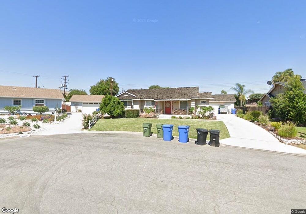
10606 Cullman Ave Whittier, CA 90603
South Whittier NeighborhoodEstimated Value: $845,000 - $945,000
3
Beds
2
Baths
1,586
Sq Ft
$555/Sq Ft
Est. Value
About This Home
This home is located at 10606 Cullman Ave, Whittier, CA 90603 and is currently estimated at $880,724, approximately $555 per square foot. 10606 Cullman Ave is a home located in Los Angeles County with nearby schools including Jordan Elementary School, Rancho-Starbuck Intermediate School, and La Habra High School.
Ownership History
Date
Name
Owned For
Owner Type
Purchase Details
Closed on
Nov 21, 1994
Sold by
Vandaele John and The Henrietta S Grubar Trust
Bought by
Stark Billy W and Stark Judith A
Current Estimated Value
Home Financials for this Owner
Home Financials are based on the most recent Mortgage that was taken out on this home.
Original Mortgage
$166,500
Interest Rate
9.28%
Purchase Details
Closed on
May 18, 1994
Sold by
Grubar Henrietta S
Bought by
Vandaele John
Create a Home Valuation Report for This Property
The Home Valuation Report is an in-depth analysis detailing your home's value as well as a comparison with similar homes in the area
Home Values in the Area
Average Home Value in this Area
Purchase History
| Date | Buyer | Sale Price | Title Company |
|---|---|---|---|
| Stark Billy W | $185,000 | First American Title Company | |
| Vandaele John | -- | -- |
Source: Public Records
Mortgage History
| Date | Status | Borrower | Loan Amount |
|---|---|---|---|
| Previous Owner | Stark Billy W | $166,500 |
Source: Public Records
Tax History Compared to Growth
Tax History
| Year | Tax Paid | Tax Assessment Tax Assessment Total Assessment is a certain percentage of the fair market value that is determined by local assessors to be the total taxable value of land and additions on the property. | Land | Improvement |
|---|---|---|---|---|
| 2025 | $4,031 | $310,712 | $155,356 | $155,356 |
| 2024 | $4,031 | $304,620 | $152,310 | $152,310 |
| 2023 | $4,010 | $298,648 | $149,324 | $149,324 |
| 2022 | $3,954 | $292,794 | $146,397 | $146,397 |
| 2021 | $3,859 | $287,054 | $143,527 | $143,527 |
| 2020 | $3,836 | $284,112 | $142,056 | $142,056 |
| 2019 | $3,739 | $278,542 | $139,271 | $139,271 |
| 2018 | $3,504 | $273,082 | $136,541 | $136,541 |
| 2016 | $3,352 | $262,480 | $131,240 | $131,240 |
| 2015 | $3,215 | $258,538 | $129,269 | $129,269 |
| 2014 | $3,156 | $253,474 | $126,737 | $126,737 |
Source: Public Records
Map
Nearby Homes
- 16164 Leffco Rd
- 10418 Bogardus Ave
- 16121 Lisco St
- 16046 Gables Loop
- 16540 Whittier Blvd
- 10303 Pounds Ave
- 10931 Groveside Ave
- 10930 Groveland Ave
- 2611 Gregory Ln
- 15914 Lashburn St
- 16040 Leffingwell Rd Unit 103
- 16040 Leffingwell Rd Unit 76
- 16621 Crape Myrtle Ln
- 16428 Whittier Blvd Unit 2
- 2401 Canfield Dr
- 15952 Norcrest Dr
- 2641 Stanton Ave
- 2311 Canfield Dr
- 240 Oakland Dr
- 1436 La Riata Dr
- 10614 Cullman Ave
- 10600 Cullman Ave
- 10641 Newcomb Ave
- 10635 Newcomb Ave
- 10647 Newcomb Ave
- 16305 Citrustree Rd
- 10607 Cullman Ave
- 10603 Cullman Ave
- 10615 Cullman Ave
- 10655 Newcomb Ave
- 16249 Citrustree Rd
- 16316 Whittier Blvd
- 10616 Bogardus Ave
- 10608 Bogardus Ave
- 10602 Bogardus Ave
- 10640 Newcomb Ave
- 10614 Bogardus Ave
- 10634 Newcomb Ave
- 10644 Newcomb Ave
- 10552 Bogardus Ave