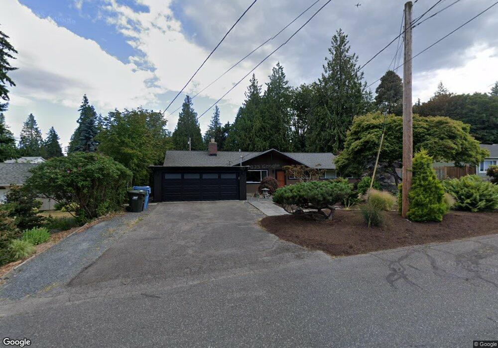
10608 231st St SW Edmonds, WA 98020
Sherwood Forest NeighborhoodEstimated Value: $958,670 - $1,229,000
4
Beds
2
Baths
1,584
Sq Ft
$661/Sq Ft
Est. Value
About This Home
This home is located at 10608 231st St SW, Edmonds, WA 98020 and is currently estimated at $1,047,668, approximately $661 per square foot. 10608 231st St SW is a home located in Snohomish County with nearby schools including Sherwood Elementary School, College Place Middle School, and Edmonds-Woodway High School.
Ownership History
Date
Name
Owned For
Owner Type
Purchase Details
Closed on
Apr 12, 2004
Sold by
Reynolds James Milton and Reynolds Frances L
Bought by
Buchan Leigh F
Current Estimated Value
Home Financials for this Owner
Home Financials are based on the most recent Mortgage that was taken out on this home.
Original Mortgage
$230,050
Outstanding Balance
$97,527
Interest Rate
4.25%
Mortgage Type
Purchase Money Mortgage
Estimated Equity
$950,141
Create a Home Valuation Report for This Property
The Home Valuation Report is an in-depth analysis detailing your home's value as well as a comparison with similar homes in the area
Home Values in the Area
Average Home Value in this Area
Purchase History
| Date | Buyer | Sale Price | Title Company |
|---|---|---|---|
| Buchan Leigh F | $287,600 | Lawyers Title Agency Of Wash |
Source: Public Records
Mortgage History
| Date | Status | Borrower | Loan Amount |
|---|---|---|---|
| Open | Buchan Leigh F | $230,050 |
Source: Public Records
Tax History Compared to Growth
Tax History
| Year | Tax Paid | Tax Assessment Tax Assessment Total Assessment is a certain percentage of the fair market value that is determined by local assessors to be the total taxable value of land and additions on the property. | Land | Improvement |
|---|---|---|---|---|
| 2025 | $5,582 | $793,500 | $571,000 | $222,500 |
| 2024 | $5,582 | $783,200 | $559,000 | $224,200 |
| 2023 | $5,824 | $846,800 | $584,000 | $262,800 |
| 2022 | $5,450 | $651,600 | $452,000 | $199,600 |
| 2020 | $5,080 | $543,200 | $355,000 | $188,200 |
| 2019 | $4,743 | $510,800 | $326,000 | $184,800 |
| 2018 | $4,724 | $507,200 | $326,000 | $181,200 |
| 2017 | $4,001 | $389,600 | $241,000 | $148,600 |
| 2016 | $3,688 | $355,800 | $213,000 | $142,800 |
| 2015 | $3,596 | $326,600 | $204,000 | $122,600 |
| 2013 | $3,075 | $263,400 | $163,000 | $100,400 |
Source: Public Records
Map
Nearby Homes
- 11211 Wachusett Rd
- 11130 S Deer Dr
- 22628 106th Ave W
- 11110 Algonquin Rd
- 23024 99th Ave W
- 9801 234th St SW Unit 1
- 11108 239th Place SW
- 24104 105th Place W
- 24012 102nd Place W
- 11432 238th St SW
- 9526 234th St SW
- 23511 96th Ave W
- 22430 Dogwood Ln
- 637 Elm Place
- 9511 Edmonds Way
- 550 Elm Way Unit 408
- 1221 Coronado Place
- 22212 98th Ave W
- 1140 3rd Ave S
- 22039 98th Place W
- 10702 231st St SW
- 10606 231st St SW
- 10705 Robin Hood Dr
- 10627 Robin Hood Dr
- 10713 Robin Hood Dr
- 10604 231st St SW
- 10605 231st St SW
- 10704 231st St SW
- 23010 107th Place W
- 10617 Robin Hood Dr
- 10721 Robin Hood Dr
- 10703 231st St SW
- 23007 107th Place W
- 23104 106th Ave W
- 10602 231st St SW
- 10706 231st St SW
- 10603 Robin Hood Dr
- 23008 107th Place W
- 10702 Robin Hood Dr
- 10626 Robin Hood Dr