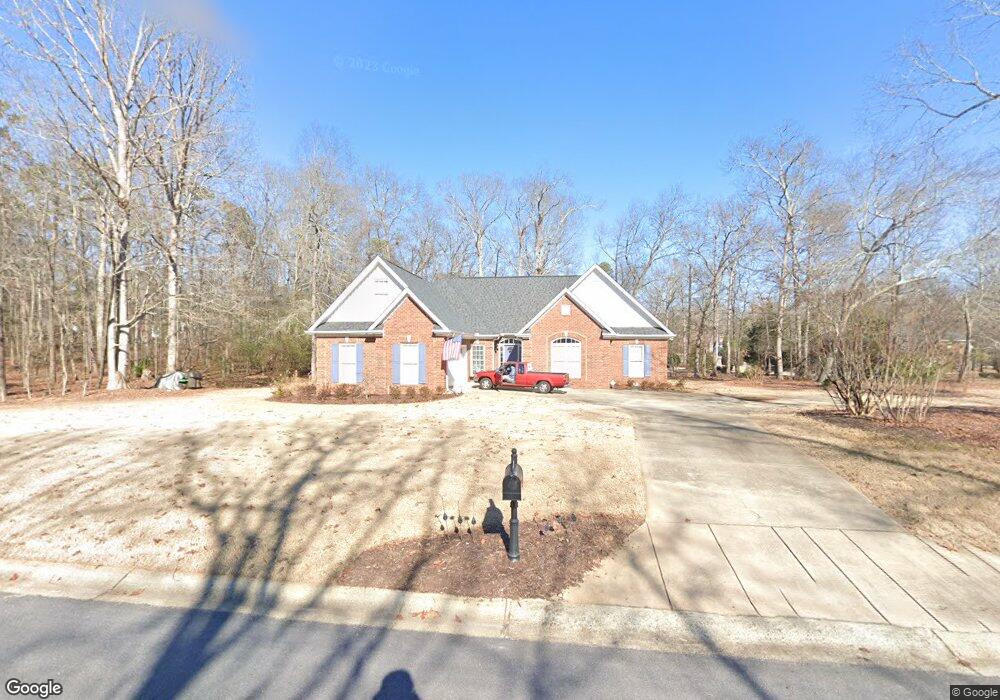
1061 Power Ridge Place Bogart, GA 30622
Estimated Value: $591,108 - $709,000
4
Beds
4
Baths
2,748
Sq Ft
$229/Sq Ft
Est. Value
About This Home
This home is located at 1061 Power Ridge Place, Bogart, GA 30622 and is currently estimated at $629,027, approximately $228 per square foot. 1061 Power Ridge Place is a home located in Oconee County with nearby schools including Rocky Branch Elementary School, Malcom Bridge Middle School, and North Oconee High School.
Ownership History
Date
Name
Owned For
Owner Type
Purchase Details
Closed on
Jul 12, 2019
Sold by
Skinner Dawn R
Bought by
Hagan Albert Q and Hagan Linda B
Current Estimated Value
Home Financials for this Owner
Home Financials are based on the most recent Mortgage that was taken out on this home.
Original Mortgage
$284,800
Outstanding Balance
$181,775
Interest Rate
3.82%
Mortgage Type
New Conventional
Estimated Equity
$447,252
Purchase Details
Closed on
May 24, 2001
Sold by
Nelms Carey L
Bought by
Skinner Paul A
Purchase Details
Closed on
Oct 4, 1999
Sold by
H & H General
Bought by
Nelms Carey L
Create a Home Valuation Report for This Property
The Home Valuation Report is an in-depth analysis detailing your home's value as well as a comparison with similar homes in the area
Home Values in the Area
Average Home Value in this Area
Purchase History
| Date | Buyer | Sale Price | Title Company |
|---|---|---|---|
| Hagan Albert Q | $356,000 | -- | |
| Skinner Paul A | $249,400 | -- | |
| Nelms Carey L | $245,000 | -- |
Source: Public Records
Mortgage History
| Date | Status | Borrower | Loan Amount |
|---|---|---|---|
| Open | Hagan Albert Q | $284,800 |
Source: Public Records
Tax History Compared to Growth
Tax History
| Year | Tax Paid | Tax Assessment Tax Assessment Total Assessment is a certain percentage of the fair market value that is determined by local assessors to be the total taxable value of land and additions on the property. | Land | Improvement |
|---|---|---|---|---|
| 2024 | $2,648 | $198,306 | $30,000 | $168,306 |
| 2023 | $2,648 | $179,684 | $20,000 | $159,684 |
| 2022 | $3,027 | $159,437 | $20,000 | $139,437 |
| 2021 | $3,264 | $146,416 | $20,000 | $126,416 |
| 2020 | $3,225 | $139,133 | $20,000 | $119,133 |
| 2019 | $2,950 | $127,263 | $20,000 | $107,263 |
| 2018 | $2,663 | $112,520 | $20,000 | $92,520 |
| 2017 | $2,640 | $111,522 | $20,000 | $91,522 |
| 2016 | $2,524 | $106,634 | $20,000 | $86,634 |
| 2015 | $2,484 | $104,718 | $22,000 | $82,718 |
| 2014 | $2,455 | $101,214 | $22,000 | $79,214 |
| 2013 | -- | $94,695 | $22,000 | $72,695 |
Source: Public Records
Map
Nearby Homes
- 1120 Liberty Ln
- 1145 Summerfield Ln
- 1180 Summerfield Ln
- 4100 Monroe Hwy
- 4400 Monroe Hwy Unit PARCEL 1-7
- 00 Ruth Jackson Rd
- 0 Ruth Jackson Rd Unit 10582108
- 3240 Monroe Hwy
- 1181 Pete Dickens Rd
- 1327 Eisenhower Ave
- 1250 Pete Dickens Rd
- 1665 Eisenhower Ave
- 2479 Eisenhower Ave
- 1640 Madison Ct
- 2736 Eisenhower Ave
- 3041 Monroe Hwy
- 1101 Derby Ln
- 1050 Cobblestone Ln
- 1080 Glenwood Ln
- 1060 Power Ridge Place
- 1091 Holcomb Ct
- 1111 Glenwood Ln
- 1071 Holcomb Ct
- 0 Glenwood Ln Unit 7366733
- 0 Glenwood Ln Unit 7244715
- 0 Glenwood Ln Unit 8826529
- 0 Glenwood Ln Unit 8156388
- 0 Glenwood Ln
- 1091 Glenwood Ln
- 1040 Power Ridge Place
- 1060 Glenwood Ln
- 1131 Glenwood Ln
- 115 Holcomb Ct
- 0 Holcomb Ct
- 1071 Glenwood Ln
- 1061 Holcomb Ct
- 1131 Holcomb Ct
- 1140 Glenwood Ln