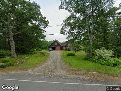
1061 State Route 32 Round Pond, ME 04564
Estimated Value: $371,000 - $848,000
--
Bed
--
Bath
--
Sq Ft
2.2
Acres
About This Home
This home is located at 1061 State Route 32, Round Pond, ME 04564 and is currently estimated at $557,633. 1061 State Route 32 is a home located in Lincoln County with nearby schools including Bristol Consolidated School.
Ownership History
Date
Name
Owned For
Owner Type
Purchase Details
Closed on
Apr 27, 2012
Sold by
Vincent 2Nd Leland G
Bought by
Laday George S and Laday Hannah
Current Estimated Value
Home Financials for this Owner
Home Financials are based on the most recent Mortgage that was taken out on this home.
Original Mortgage
$185,000
Outstanding Balance
$132,715
Interest Rate
3.91%
Mortgage Type
Purchase Money Mortgage
Estimated Equity
$352,565
Create a Home Valuation Report for This Property
The Home Valuation Report is an in-depth analysis detailing your home's value as well as a comparison with similar homes in the area
Home Values in the Area
Average Home Value in this Area
Purchase History
| Date | Buyer | Sale Price | Title Company |
|---|---|---|---|
| Laday George S | -- | -- |
Source: Public Records
Mortgage History
| Date | Status | Borrower | Loan Amount |
|---|---|---|---|
| Open | Laday George S | $185,000 |
Source: Public Records
Tax History Compared to Growth
Tax History
| Year | Tax Paid | Tax Assessment Tax Assessment Total Assessment is a certain percentage of the fair market value that is determined by local assessors to be the total taxable value of land and additions on the property. | Land | Improvement |
|---|---|---|---|---|
| 2024 | $2,542 | $285,600 | $50,600 | $235,000 |
| 2023 | $2,271 | $285,600 | $50,600 | $235,000 |
| 2022 | $2,056 | $285,600 | $50,600 | $235,000 |
| 2021 | $2,056 | $285,600 | $50,600 | $235,000 |
| 2020 | $2,071 | $285,600 | $50,600 | $235,000 |
| 2019 | $1,928 | $285,600 | $50,600 | $235,000 |
| 2018 | $1,785 | $285,600 | $50,600 | $235,000 |
| 2017 | $1,785 | $285,600 | $50,600 | $235,000 |
| 2016 | $1,487 | $188,200 | $23,700 | $164,500 |
| 2015 | $1,590 | $188,200 | $23,700 | $164,500 |
| 2014 | $1,487 | $188,200 | $23,700 | $164,500 |
| 2013 | $1,449 | $188,200 | $23,700 | $164,500 |
Source: Public Records
Map
Nearby Homes
- 404 Lower Round Pond Rd
- 1233 State Route 32
- 1 Mccracken Ln
- M6l54
- 1276 State Route 32
- Lot 009 Reny Rd
- 175 Quail Run Rd
- 31 Viking Way
- 41 Harding Rd
- 5 Southern Point Rd
- 507 Maine 32
- 22 Bodkin Hill Rd
- 153 Back Shore Rd
- 20 Lemeuls Rd
- 17 Eastwood Ct
- M6L53 Bristol Rd
- M6L54 Bristol Rd
- M8 L63 Bristol Rd
- Lot 10.6 Louds Island
- 36 Eastwood Ct
- 1061 State Route 32
- 1047 State Route 32
- 1050 State Route 32
- 1092 State Route 32
- 16 Carolane Acres
- 1018 State Route 32
- 38 Carolane Acres
- 1006 Maine 32
- 1089 State Route 32
- 1006 State Route 32
- 1001 State Route 32
- 1106 State Route 32
- 975 State Route 32
- 973 State Route 32
- 15 Elliott Hill Rd
- 1118 Maine 32
- 1120 State Route 32
- 1118 State Route 32
- 5-52 Maine 32
- 00 Maine 32