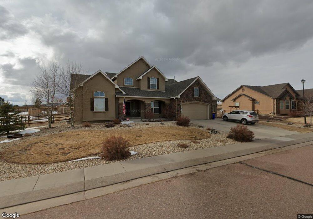
10610 Pictured Rocks Dr Peyton, CO 80831
Falcon NeighborhoodEstimated Value: $692,000 - $757,000
5
Beds
4
Baths
2,525
Sq Ft
$286/Sq Ft
Est. Value
About This Home
This home is located at 10610 Pictured Rocks Dr, Peyton, CO 80831 and is currently estimated at $720,976, approximately $285 per square foot. 10610 Pictured Rocks Dr is a home with nearby schools including Meridian Ranch Elementary School, Falcon Middle School, and Falcon High School.
Ownership History
Date
Name
Owned For
Owner Type
Purchase Details
Closed on
Jul 29, 2016
Sold by
Samethurst Virginia R and Samethurst David W
Bought by
Roth Lonny G and Roth Mandy J
Current Estimated Value
Home Financials for this Owner
Home Financials are based on the most recent Mortgage that was taken out on this home.
Original Mortgage
$373,500
Outstanding Balance
$298,009
Interest Rate
3.48%
Mortgage Type
New Conventional
Estimated Equity
$422,967
Purchase Details
Closed on
Nov 14, 2013
Sold by
Elite Properties Of America Inc
Bought by
Smethurst Virginia R and Smethurst David W
Home Financials for this Owner
Home Financials are based on the most recent Mortgage that was taken out on this home.
Original Mortgage
$425,900
Interest Rate
4.28%
Mortgage Type
VA
Purchase Details
Closed on
Jul 2, 2013
Sold by
Gtl Inc
Bought by
Elite Properties Of America Inc
Create a Home Valuation Report for This Property
The Home Valuation Report is an in-depth analysis detailing your home's value as well as a comparison with similar homes in the area
Home Values in the Area
Average Home Value in this Area
Purchase History
| Date | Buyer | Sale Price | Title Company |
|---|---|---|---|
| Roth Lonny G | $415,000 | Stewart Title | |
| Smethurst Virginia R | $416,954 | None Available | |
| Elite Properties Of America Inc | $70,500 | Heritage Title |
Source: Public Records
Mortgage History
| Date | Status | Borrower | Loan Amount |
|---|---|---|---|
| Open | Roth Lonny G | $373,500 | |
| Previous Owner | Smethurst Virginia R | $425,900 |
Source: Public Records
Tax History Compared to Growth
Tax History
| Year | Tax Paid | Tax Assessment Tax Assessment Total Assessment is a certain percentage of the fair market value that is determined by local assessors to be the total taxable value of land and additions on the property. | Land | Improvement |
|---|---|---|---|---|
| 2025 | $4,767 | $49,150 | -- | -- |
| 2024 | $4,629 | $50,150 | $9,000 | $41,150 |
| 2022 | $3,699 | $36,650 | $7,390 | $29,260 |
| 2021 | $3,834 | $37,700 | $7,600 | $30,100 |
| 2020 | $3,846 | $35,070 | $5,510 | $29,560 |
| 2019 | $3,824 | $35,070 | $5,510 | $29,560 |
| 2018 | $3,295 | $29,910 | $5,040 | $24,870 |
| 2017 | $3,117 | $29,910 | $5,040 | $24,870 |
| 2016 | $3,362 | $33,040 | $5,570 | $27,470 |
| 2015 | $3,364 | $33,040 | $5,570 | $27,470 |
| 2014 | $3,307 | $32,080 | $5,970 | $26,110 |
Source: Public Records
Map
Nearby Homes
- 10641 Greenbelt Dr
- 10530 Pictured Rocks Dr
- 10467 Pictured Rocks Dr
- 10488 Cedar Breaks Dr
- 12784 Angelina Dr
- 10489 Cedar Breaks Dr
- 10429 Cedar Breaks Dr
- 10603 Ross Lake Dr
- 10476 Ross Lake Dr
- 12144 Point Reyes Dr
- 10932 Huron Peak Place
- 12272 Isle Royale Dr
- 10433 Capital Peak Way
- 11577 Cranston Dr
- 10965 Long Summer Ct
- 12517 Culebra Peak Dr
- 10388 Mount Wilson Place
- 12216 Chimney Smoke Dr
- 9880 Everglades Dr
- 10398 Mount Evans Dr
- 10594 Pictured Rocks Dr
- 10626 Pictured Rocks Dr
- 10611 Pictured Rocks Dr
- 10578 Pictured Rocks Dr
- 10595 Pictured Rocks Dr
- 10627 Pictured Rocks Dr
- 10642 Pictured Rocks Dr
- 10579 Pictured Rocks Dr
- 10647 Pictured Rocks Dr
- 10643 Pictured Rocks Dr
- 10658 Greenbelt Dr
- 10640 Greenbelt Dr
- 10562 Pictured Rocks Dr
- 10658 Pictured Rocks Dr
- 10563 Pictured Rocks Dr
- 10622 Greenbelt Dr
- 10530 Indian Paint Trail
- 10659 Pictured Rocks Dr
- 10565 Indian Paint Trail
- 10694 Greenbelt Dr