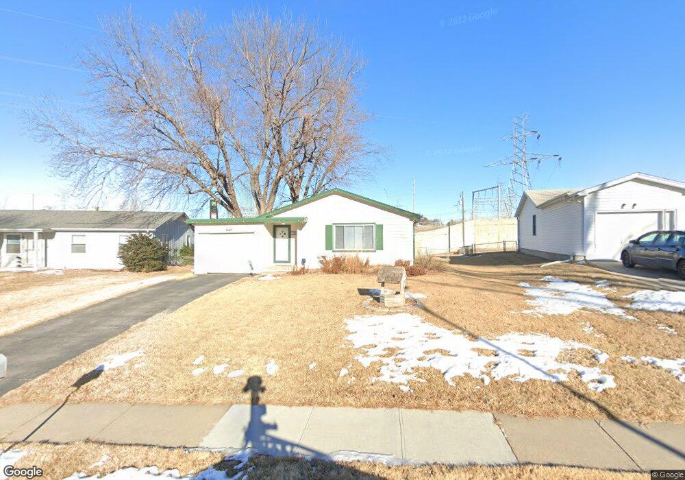
10616 Parker St Omaha, NE 68114
Northwest Omaha NeighborhoodEstimated Value: $238,000 - $258,000
3
Beds
2
Baths
1,570
Sq Ft
$156/Sq Ft
Est. Value
About This Home
This home is located at 10616 Parker St, Omaha, NE 68114 and is currently estimated at $244,353, approximately $155 per square foot. 10616 Parker St is a home located in Douglas County with nearby schools including Edison Elementary School, Beveridge Magnet Middle School, and Burke High School.
Ownership History
Date
Name
Owned For
Owner Type
Purchase Details
Closed on
Apr 22, 2021
Sold by
Matrix Properties Llc
Bought by
Transportation Management Group Llc
Current Estimated Value
Purchase Details
Closed on
Apr 8, 2020
Sold by
Bush Carol A
Bought by
Matrix Properties Llc
Home Financials for this Owner
Home Financials are based on the most recent Mortgage that was taken out on this home.
Original Mortgage
$148,000
Interest Rate
3.5%
Mortgage Type
Construction
Purchase Details
Closed on
Oct 16, 2001
Sold by
Jones Todd Allen and Jones Aimee
Bought by
Bush Carol A
Home Financials for this Owner
Home Financials are based on the most recent Mortgage that was taken out on this home.
Original Mortgage
$97,097
Interest Rate
6.84%
Mortgage Type
FHA
Create a Home Valuation Report for This Property
The Home Valuation Report is an in-depth analysis detailing your home's value as well as a comparison with similar homes in the area
Home Values in the Area
Average Home Value in this Area
Purchase History
| Date | Buyer | Sale Price | Title Company |
|---|---|---|---|
| Transportation Management Group Llc | $158,000 | Spyglass Title & Escrow | |
| Matrix Properties Llc | $130,000 | Midwest Title Inc | |
| Bush Carol A | $98,000 | -- |
Source: Public Records
Mortgage History
| Date | Status | Borrower | Loan Amount |
|---|---|---|---|
| Previous Owner | Matrix Properties Llc | $148,000 | |
| Previous Owner | Bush Carol A | $97,097 |
Source: Public Records
Tax History Compared to Growth
Tax History
| Year | Tax Paid | Tax Assessment Tax Assessment Total Assessment is a certain percentage of the fair market value that is determined by local assessors to be the total taxable value of land and additions on the property. | Land | Improvement |
|---|---|---|---|---|
| 2025 | $2,838 | $263,200 | $23,500 | $239,700 |
| 2024 | $3,703 | $175,500 | $23,500 | $152,000 |
| 2023 | $3,703 | $175,500 | $23,500 | $152,000 |
| 2022 | $3,687 | $172,700 | $23,500 | $149,200 |
| 2021 | $3,655 | $172,700 | $23,500 | $149,200 |
| 2020 | $3,500 | $163,500 | $23,500 | $140,000 |
| 2019 | $3,511 | $163,500 | $23,500 | $140,000 |
| 2018 | $3,285 | $152,800 | $23,500 | $129,300 |
| 2017 | $3,090 | $152,800 | $23,500 | $129,300 |
| 2016 | $3,090 | $144,000 | $13,600 | $130,400 |
| 2015 | $2,850 | $134,600 | $12,700 | $121,900 |
| 2014 | $2,850 | $134,600 | $12,700 | $121,900 |
Source: Public Records
Map
Nearby Homes
- 10634 Parker St
- 10828 Oakbrook Cir
- 1723 N 110th St
- 1623 N 109th Plaza
- 10535 Izard St
- 2613 N 112th St
- 11218 Ohio St
- 9830 Charles St
- 2511 N 98th Ave
- 2505 N 98th Ave
- 1301 N 97th Cir
- 1480 N 96th Ave
- 3316 N 101st St
- 10015 Bedford Ave
- 9612 Cady Ave
- 9612 Maple St
- 9612 Binney St
- 9406 Parker St
- 9345 Blondo St
- 9361 Hillside Plaza
- 10612 Parker St
- 10620 Parker St
- 10606 Parker St
- 10624 Parker St
- 10617 Parker St
- 10611 Parker St
- 10628 Parker St
- 10623 Parker St
- 10605 Parker St
- 10707 Blondo St
- 10629 Parker St
- 10541 Parker St
- 10635 Parker St
- 10622 Decatur St
- 10535 Parker St
- 10616 Decatur St
- 10640 Parker St
- 10628 Decatur St
- 10610 Decatur St
- 10528 Parker St