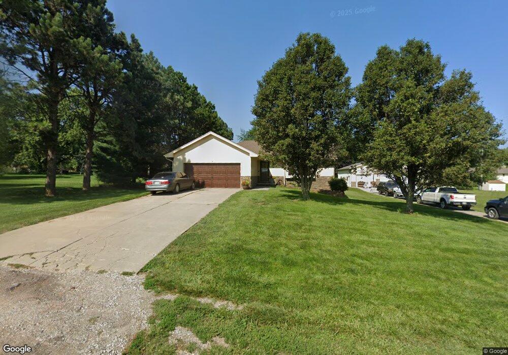
10620 N 189th Ave Bennington, NE 68007
Estimated Value: $356,000 - $505,000
2
Beds
2
Baths
2,185
Sq Ft
$202/Sq Ft
Est. Value
About This Home
This home is located at 10620 N 189th Ave, Bennington, NE 68007 and is currently estimated at $442,075, approximately $202 per square foot. 10620 N 189th Ave is a home located in Douglas County with nearby schools including Bennington High School and Legacy School.
Ownership History
Date
Name
Owned For
Owner Type
Purchase Details
Closed on
Dec 13, 2019
Sold by
Guinn Nicholas R
Bought by
Taft Clint and Taft Morgan
Current Estimated Value
Home Financials for this Owner
Home Financials are based on the most recent Mortgage that was taken out on this home.
Original Mortgage
$276,250
Outstanding Balance
$243,029
Interest Rate
3.6%
Mortgage Type
New Conventional
Estimated Equity
$199,046
Purchase Details
Closed on
Jan 2, 2018
Sold by
Petersen Andrew G and Petersen Taylor A
Bought by
Guinn Nicholas R
Home Financials for this Owner
Home Financials are based on the most recent Mortgage that was taken out on this home.
Original Mortgage
$236,000
Interest Rate
3.99%
Mortgage Type
New Conventional
Purchase Details
Closed on
Apr 29, 2010
Sold by
Federal Home Loan Mortgage Corp
Bought by
Peterson Andrew G
Purchase Details
Closed on
Jan 7, 2010
Sold by
Lindquist Eric H Tr
Bought by
Federal Home Loan Mortgage Corp
Create a Home Valuation Report for This Property
The Home Valuation Report is an in-depth analysis detailing your home's value as well as a comparison with similar homes in the area
Home Values in the Area
Average Home Value in this Area
Purchase History
| Date | Buyer | Sale Price | Title Company |
|---|---|---|---|
| Taft Clint | $325,000 | None Available | |
| Guinn Nicholas R | $308,000 | Missouri River Title | |
| Peterson Andrew G | $150,000 | -- | |
| Federal Home Loan Mortgage Corp | $153,000 | -- |
Source: Public Records
Mortgage History
| Date | Status | Borrower | Loan Amount |
|---|---|---|---|
| Open | Taft Clint | $276,250 | |
| Closed | Guinn Nicholas R | $236,000 |
Source: Public Records
Tax History Compared to Growth
Tax History
| Year | Tax Paid | Tax Assessment Tax Assessment Total Assessment is a certain percentage of the fair market value that is determined by local assessors to be the total taxable value of land and additions on the property. | Land | Improvement |
|---|---|---|---|---|
| 2025 | $5,192 | $389,300 | $50,900 | $338,400 |
| 2024 | $6,527 | $356,700 | $50,900 | $305,800 |
| 2023 | $6,527 | $356,700 | $50,900 | $305,800 |
| 2022 | $6,893 | $356,700 | $50,900 | $305,800 |
| 2021 | $6,524 | $337,800 | $50,900 | $286,900 |
| 2020 | $6,582 | $337,800 | $50,900 | $286,900 |
| 2019 | $3,688 | $195,700 | $28,300 | $167,400 |
| 2018 | $3,700 | $195,700 | $28,300 | $167,400 |
| 2017 | $3,647 | $195,700 | $28,300 | $167,400 |
| 2016 | $3,647 | $187,400 | $20,000 | $167,400 |
| 2015 | $3,465 | $187,400 | $20,000 | $167,400 |
| 2014 | $3,465 | $187,400 | $20,000 | $167,400 |
Source: Public Records
Map
Nearby Homes
- 10630 N 190th Ave
- 19202 State St
- 17808 S Reflection Ave
- 11819 N 178th Cir
- 16605 Olivia St
- 10898 N 172nd St
- 9402 N 173rd Ave
- 9607 N 173rd Ave
- 9603 N 173rd Ave
- 9606 N 173rd Ave
- 9602 N 173rd Ave
- 10967 N 173rd Ave
- 11060 N 173rd St
- 12101 N 177th Cir
- 11825 N 176th Cir
- 17664 Sunflower St
- 11052 N 173rd St
- 11103 N 173rd St
- 11116 N 173rd St
- 11016 N 172nd St
- 10530 N 189th Ave
- 10611 N 189th Ave
- 10611 N 190th Ave
- 10541 N 189th Ave
- 10531 N 190th Ave
- 10520 N 189th Ave
- 10631 N 190th Ave
- 10521 N 189th Ave
- 10515 N 190th Ave
- 10530 N 188th Ave
- 18862 Military Rd
- 10620 N 190th Ave
- 10530 N 190th Ave
- 18950 Military Rd
- 18990 Military Rd
- 10440 N 189th Ave
- 10520 N 188th Ave
- 10520 N 190th Ave
- 10435 N 190th Ave
- 10441 N 189th Ave