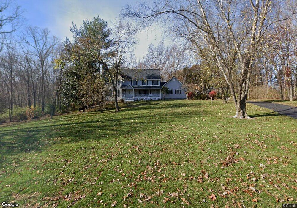
10621 Saint Andrews Ct Festus, MO 63028
Estimated Value: $340,000 - $576,000
--
Bed
--
Bath
1,530
Sq Ft
$313/Sq Ft
Est. Value
About This Home
This home is located at 10621 Saint Andrews Ct, Festus, MO 63028 and is currently estimated at $478,652, approximately $312 per square foot. 10621 Saint Andrews Ct is a home located in Jefferson County with nearby schools including Festus Intermediate School, Festus Elementary School, and Festus Middle School.
Ownership History
Date
Name
Owned For
Owner Type
Purchase Details
Closed on
Jun 9, 2000
Sold by
Held Scott A and Held Paula
Bought by
Stoll Mark T and Stoll Tanya L
Current Estimated Value
Home Financials for this Owner
Home Financials are based on the most recent Mortgage that was taken out on this home.
Original Mortgage
$200,000
Interest Rate
8.13%
Create a Home Valuation Report for This Property
The Home Valuation Report is an in-depth analysis detailing your home's value as well as a comparison with similar homes in the area
Home Values in the Area
Average Home Value in this Area
Purchase History
| Date | Buyer | Sale Price | Title Company |
|---|---|---|---|
| Stoll Mark T | -- | First American Title |
Source: Public Records
Mortgage History
| Date | Status | Borrower | Loan Amount |
|---|---|---|---|
| Closed | Stoll Mark T | $200,000 |
Source: Public Records
Tax History Compared to Growth
Tax History
| Year | Tax Paid | Tax Assessment Tax Assessment Total Assessment is a certain percentage of the fair market value that is determined by local assessors to be the total taxable value of land and additions on the property. | Land | Improvement |
|---|---|---|---|---|
| 2025 | $3,678 | $69,500 | $11,700 | $57,800 |
| 2024 | $3,678 | $60,600 | $11,700 | $48,900 |
| 2023 | $3,678 | $60,600 | $11,700 | $48,900 |
| 2022 | $3,296 | $54,600 | $5,700 | $48,900 |
| 2021 | $3,299 | $54,600 | $5,700 | $48,900 |
| 2020 | $3,130 | $48,600 | $4,900 | $43,700 |
| 2019 | $3,129 | $48,600 | $4,900 | $43,700 |
| 2018 | $2,814 | $48,600 | $4,900 | $43,700 |
| 2017 | $2,619 | $48,600 | $4,900 | $43,700 |
| 2016 | $2,321 | $43,400 | $4,800 | $38,600 |
| 2015 | -- | $43,400 | $4,800 | $38,600 |
Source: Public Records
Map
Nearby Homes
- 2724 Niagara Falls Ct
- 0 Hwy A 62 Acres Unit 20012897
- 0 Bailey School Rd
- 1926 Belmont Dr
- 0
- 0 Tbb Birchwood Overlook - Maple
- 1876 W Main St
- 1808 Hawk Pointe Dr
- 1852 W Main St
- 0 Tbb Birchwood Overlook-Dogwood Unit MAR24022693
- 2324 Garden Ln
- 1807 Orchard Ln
- 0 Tbb Birchwood Overlook Birchwo Unit MAR24022701
- 0 Tbb Birchwood Overlook-Red Bud Unit MAR24022708
- 0 Tbb Birchwood Overlook-Redbudi Unit MAR24022702
- 0 Tbb Birchwood Overlook-Hickory
- 2303 Garden Ln
- 1 Appomattox Ridge
- 0 Tbb Bichwood Overlook-Sycamore Unit MAR24022712
- 132 Blue Ridge Trace
- 10607 Saint Andrews Ct
- 10632 Saint Andrews Ct
- 10616 Saint Andrews Ct
- 3208 Burning Tree Ln
- 10608 Saint Andrews Ct
- 10629 Saint Andrews Ct
- 10600 Saint Andrews Ct
- 3201 Burning Tree Ln
- 10637 Saint Andrews Ct
- 10648 Saint Andrews Ct
- 3224 Burning Tree Ln
- 10645 Saint Andrews Ct
- 3246 Burning Tree Ln
- 10653 Saint Andrews Ct
- 0TBB Falls@ Ltl Crk-Breckenridge II
- 0TBB Falls at Little Creek-Aspen II
- 0TBB the Falls @ Ltl Crk- Littleton
- 3215 Burning Tree Ln
- 0TBB the Falls @ Ltl Crk- Frisco II
- 0TBB Falls @ Ltl Creek-Montrose II