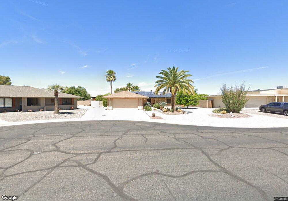
10622 W Carob Dr Sun City, AZ 85373
Estimated Value: $332,737 - $393,000
--
Bed
3
Baths
1,709
Sq Ft
$211/Sq Ft
Est. Value
About This Home
This home is located at 10622 W Carob Dr, Sun City, AZ 85373 and is currently estimated at $361,184, approximately $211 per square foot. 10622 W Carob Dr is a home located in Maricopa County with nearby schools including Parkridge Elementary School, Sunrise Mountain High School, and Sonoran Science Academy-Peoria.
Ownership History
Date
Name
Owned For
Owner Type
Purchase Details
Closed on
Feb 15, 2022
Sold by
Thistle Glenn C and Thistle Nancy L
Bought by
Thistle Glenn C and Thistle Nancy L
Current Estimated Value
Purchase Details
Closed on
Feb 13, 2012
Sold by
Thistle Glen C and Thistle Nancy L
Bought by
Thistle Glen C and Thistle Nancy L
Home Financials for this Owner
Home Financials are based on the most recent Mortgage that was taken out on this home.
Original Mortgage
$76,100
Interest Rate
3.83%
Mortgage Type
New Conventional
Purchase Details
Closed on
Jan 5, 2001
Sold by
Cate James E and Cate Roberta M
Bought by
Thistle Glen C and Thistle Nancy L
Purchase Details
Closed on
Mar 24, 1997
Sold by
Gudel Harriet
Bought by
Cate James E and Cate Roberta M
Create a Home Valuation Report for This Property
The Home Valuation Report is an in-depth analysis detailing your home's value as well as a comparison with similar homes in the area
Home Values in the Area
Average Home Value in this Area
Purchase History
| Date | Buyer | Sale Price | Title Company |
|---|---|---|---|
| Thistle Glenn C | -- | None Listed On Document | |
| Thistle Glen C | -- | Lsi | |
| Thistle Glen C | $117,500 | North American Title Agency | |
| Cate James E | $86,900 | Security Title Agency |
Source: Public Records
Mortgage History
| Date | Status | Borrower | Loan Amount |
|---|---|---|---|
| Previous Owner | Thistle Glen C | $76,100 |
Source: Public Records
Tax History Compared to Growth
Tax History
| Year | Tax Paid | Tax Assessment Tax Assessment Total Assessment is a certain percentage of the fair market value that is determined by local assessors to be the total taxable value of land and additions on the property. | Land | Improvement |
|---|---|---|---|---|
| 2025 | $1,630 | $20,096 | -- | -- |
| 2024 | $1,475 | $19,140 | -- | -- |
| 2023 | $1,475 | $29,610 | $5,920 | $23,690 |
| 2022 | $1,377 | $23,520 | $4,700 | $18,820 |
| 2021 | $1,421 | $22,470 | $4,490 | $17,980 |
| 2020 | $1,386 | $20,260 | $4,050 | $16,210 |
| 2019 | $1,371 | $19,220 | $3,840 | $15,380 |
| 2018 | $1,318 | $17,770 | $3,550 | $14,220 |
| 2017 | $1,272 | $16,260 | $3,250 | $13,010 |
| 2016 | $668 | $15,610 | $3,120 | $12,490 |
| 2015 | $1,136 | $14,300 | $2,860 | $11,440 |
Source: Public Records
Map
Nearby Homes
- 18617 N Kiva Dr Unit 47
- 18601 N Welk Dr
- 10737 W Sack Dr
- 10514 Willowcreek Cir
- 19039 N Dinero Rd
- 18442 N 104th Ave
- 10830 W Willowbrook Dr Unit 45
- 18410 N 104th Ave
- 10609 W Concho Cir
- 19041 N Pierson Rd
- 10918 W Manzanita Dr
- 10318 W Manzanita Dr
- 19222 N Welk Dr
- 10879 W Sack Dr
- 10950 W Union Hills Dr Unit 1349
- 19222 N Pierson Rd
- 10414 W Ponderosa Cir
- 10625 W Chisholm Ct
- 17844 N 102nd Dr
- 19535 N 107th Dr Unit 2
- 10618 W Carob Dr
- 10626 W Carob Dr
- 10625 W Aztec Dr
- 10621 W Aztec Dr
- 10614 W Carob Dr
- 10630 W Carob Dr
- 10629 W Aztec Dr
- 10621 W Carob Dr
- 10617 W Aztec Dr
- 10625 W Carob Dr
- 10617 W Carob Dr
- 10613 W Carob Dr
- 18613 N Kiva Dr
- 10630 W Aztec Dr
- 10622 W Aztec Dr
- 18621 N Kiva Dr
- 10609 W Carob Dr
- 10626 W Aztec Dr
- 10618 W Aztec Dr Unit 47
- 18625 N Kiva Dr