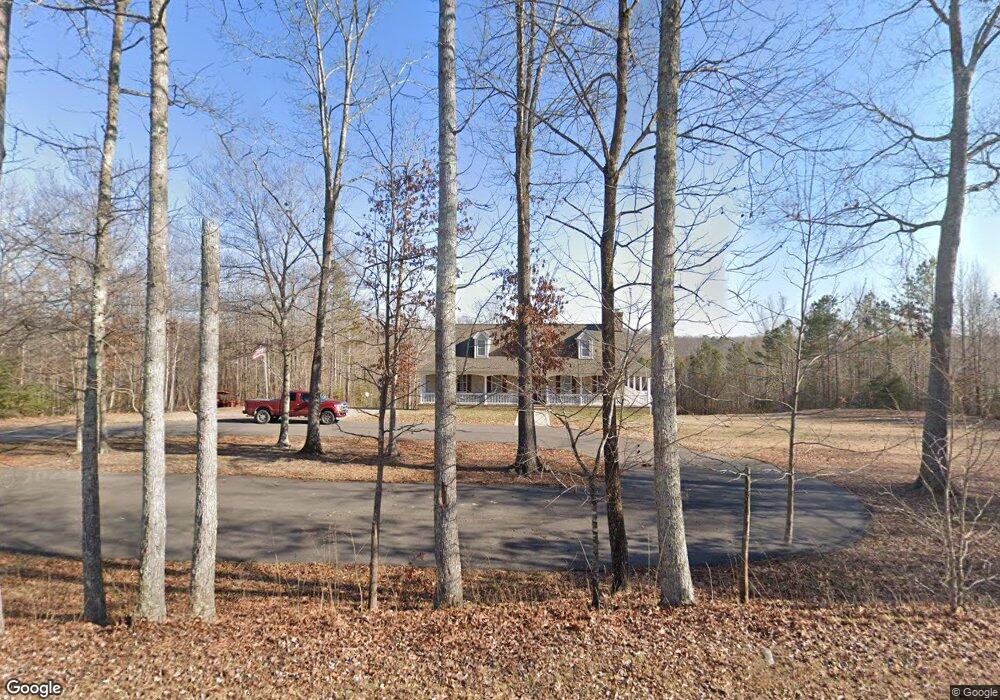
10625 Tunstall Rd New Kent, VA 23124
Estimated Value: $465,000 - $665,700
3
Beds
3
Baths
2,105
Sq Ft
$267/Sq Ft
Est. Value
About This Home
This home is located at 10625 Tunstall Rd, New Kent, VA 23124 and is currently estimated at $561,925, approximately $266 per square foot. 10625 Tunstall Rd is a home with nearby schools including New Kent High School.
Ownership History
Date
Name
Owned For
Owner Type
Purchase Details
Closed on
Apr 13, 2016
Sold by
The Reyes Living Trust Dated November 30
Bought by
Broyhill Paul R
Current Estimated Value
Purchase Details
Closed on
Oct 10, 2012
Sold by
Dillon Terry Ellen
Bought by
Reyes Raymond
Home Financials for this Owner
Home Financials are based on the most recent Mortgage that was taken out on this home.
Original Mortgage
$75,000
Interest Rate
3.59%
Mortgage Type
Land Contract Argmt. Of Sale
Create a Home Valuation Report for This Property
The Home Valuation Report is an in-depth analysis detailing your home's value as well as a comparison with similar homes in the area
Home Values in the Area
Average Home Value in this Area
Purchase History
| Date | Buyer | Sale Price | Title Company |
|---|---|---|---|
| Broyhill Paul R | $110,000 | The Closing Shop Llc | |
| Reyes Raymond | $100,000 | -- |
Source: Public Records
Mortgage History
| Date | Status | Borrower | Loan Amount |
|---|---|---|---|
| Previous Owner | Reyes Raymond | $75,000 |
Source: Public Records
Tax History Compared to Growth
Tax History
| Year | Tax Paid | Tax Assessment Tax Assessment Total Assessment is a certain percentage of the fair market value that is determined by local assessors to be the total taxable value of land and additions on the property. | Land | Improvement |
|---|---|---|---|---|
| 2025 | $3,779 | $629,800 | $170,300 | $459,500 |
| 2024 | $3,716 | $629,800 | $170,300 | $459,500 |
| 2023 | $3,627 | $541,300 | $149,600 | $391,700 |
| 2022 | $3,627 | $541,300 | $149,600 | $391,700 |
| 2021 | $3,306 | $418,500 | $141,900 | $276,600 |
| 2020 | $3,306 | $418,500 | $141,900 | $276,600 |
| 2019 | $3,262 | $397,800 | $128,000 | $269,800 |
| 2018 | $105 | $128,000 | $128,000 | $0 |
| 2017 | $911 | $109,700 | $109,700 | $0 |
| 2016 | $911 | $109,700 | $109,700 | $0 |
| 2015 | $875 | $104,200 | $104,200 | $0 |
| 2014 | -- | $104,200 | $104,200 | $0 |
Source: Public Records
Map
Nearby Homes
- 6329 Orchard Rd
- 6085 Antler Hill Ct
- 5921 Bushnell Dr
- 7178 Canopy Cir
- The Madison Plan at Viniterra
- The Elliott Plan at Viniterra
- The King James Plan at Viniterra
- The Claremont Plan at Viniterra
- The Pennington Plan at Viniterra
- The Wilton Plan at Viniterra
- 9600 Sweet Tannin Ct
- 9579 Sweet Tannin Ct
- Drexel Plan at Greenwood Estates
- Drexel Plan at Falling Creek - The Estates at Falling Creek
- Brevard Plan at Falling Creek - The Estates at Falling Creek
- Asheboro Plan at Greenwood Estates
- Moseley Plan at Falling Creek - The Townes at Falling Creek
- Cypress Plan at Falling Creek - The Estates at Falling Creek
- Oxford Plan at Falling Creek - The Estates at Falling Creek
- Raleigh Plan at Falling Creek - The Estates at Falling Creek
- 10701 Tunstall Rd
- 10475 Tunstall Rd
- 10415 Tunstall Rd
- 10600 Old Church Rd
- 10605 Old Church Rd Unit A
- 10345 Tunstall Rd
- 10377 Tunstall Rd
- 11030 Old Church Rd
- 11040 Tunstall Station
- 10335 Tunstall Rd Unit A
- 11050 Tunstall Station
- 6558 N Tunstall Station Rd
- 10301 Tunstall Rd
- 10557 Old Church Rd
- 6555 N Tunstall Station Rd Unit A
- 120+AC Old Church Rd
- 10310 Tunstall Rd
- 10231 Tunstall Rd
- 6556 N Tunstall Station Rd
- 6556 N Tunstall Station Rd