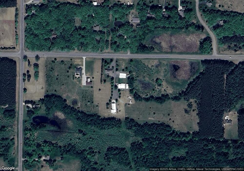
10629 305th Ave Princeton, MN 55371
Estimated Value: $109,000 - $565,000
2
Beds
2
Baths
1,568
Sq Ft
$268/Sq Ft
Est. Value
About This Home
This home is located at 10629 305th Ave, Princeton, MN 55371 and is currently estimated at $419,724, approximately $267 per square foot. 10629 305th Ave is a home located in Sherburne County with nearby schools including Princeton Intermediate School, Princeton Middle School, and Princeton High School.
Ownership History
Date
Name
Owned For
Owner Type
Purchase Details
Closed on
Jul 17, 2014
Sold by
Vahlsing Kim L and Vahlsing Mary K
Bought by
George Brad L and George Angela J
Current Estimated Value
Purchase Details
Closed on
Jan 12, 2001
Sold by
Union Bank & Trust Co
Bought by
Not Provided
Purchase Details
Closed on
Feb 1, 1996
Sold by
Wenwood Inc
Bought by
Union Bank & Trust Co
Purchase Details
Closed on
Apr 1, 1983
Sold by
Begsaget Irvin E
Bought by
Wenwood Inc
Create a Home Valuation Report for This Property
The Home Valuation Report is an in-depth analysis detailing your home's value as well as a comparison with similar homes in the area
Home Values in the Area
Average Home Value in this Area
Purchase History
| Date | Buyer | Sale Price | Title Company |
|---|---|---|---|
| George Brad L | $7,000 | Home Security Abstract & Tit | |
| Not Provided | $19,540 | -- | |
| Union Bank & Trust Co | $15,585 | -- | |
| Wenwood Inc | $30,951 | -- |
Source: Public Records
Mortgage History
| Date | Status | Borrower | Loan Amount |
|---|---|---|---|
| Closed | Wenwood Inc | -- |
Source: Public Records
Tax History Compared to Growth
Tax History
| Year | Tax Paid | Tax Assessment Tax Assessment Total Assessment is a certain percentage of the fair market value that is determined by local assessors to be the total taxable value of land and additions on the property. | Land | Improvement |
|---|---|---|---|---|
| 2025 | $4,762 | $570,800 | $165,900 | $404,900 |
| 2024 | $4,404 | $66,800 | $66,800 | $0 |
| 2023 | $4,124 | $66,800 | $66,800 | $0 |
| 2022 | $4,010 | $460,100 | $114,300 | $345,800 |
| 2020 | $3,946 | $387,700 | $107,000 | $280,700 |
| 2019 | $3,680 | $371,300 | $100,600 | $270,700 |
| 2018 | $3,730 | $340,300 | $99,100 | $241,200 |
| 2017 | $3,548 | $327,400 | $99,100 | $228,300 |
| 2016 | $3,574 | $314,600 | $91,800 | $222,800 |
| 2015 | $3,354 | $297,600 | $87,100 | $210,500 |
| 2014 | -- | $278,200 | $78,100 | $200,100 |
| 2013 | -- | $74,700 | $52,400 | $22,300 |
Source: Public Records
Map
Nearby Homes
- 30863 105th St
- XXX 313th Ave NW
- 30934 115th St
- xxxx 313th Ave NW
- 10203 316th Ave
- XXXX 305th Ave NW
- 29995 Baugh St NW
- TBD Baugh St NW
- 13282 295th Ave NW
- 28945 120th St
- 31737 120th St
- 9055 295th Ave NW
- 9803 287th Ave NW
- 13495 295th Ave NW
- 12247 317th Ave
- 30712 128th St NW
- 28840 Highway 169
- 000 Tiger St NW
- Lot 4 Tiger St NW
- 12235 323rd Ave
- 10629 305th Ave
- 10701 305th Ave
- 30405 108th St
- 30311 108th St
- 10636 305th Ave
- 10636 305th Ave
- 10544 302nd Ave
- 10618 302nd Ave NW
- 10618 305th Ave
- 30249 108th St
- 10728 305th Ave
- 10535 306th Ave
- 10544 302nd Ave NW
- 10632 302nd Ave NW
- 10632 302nd Ave NW
- 10525 306th Ave
- 10530 302nd Ave NW
- 10465 305th Ave
- 10515 306th Ave
- 10648 302nd Ave NW
