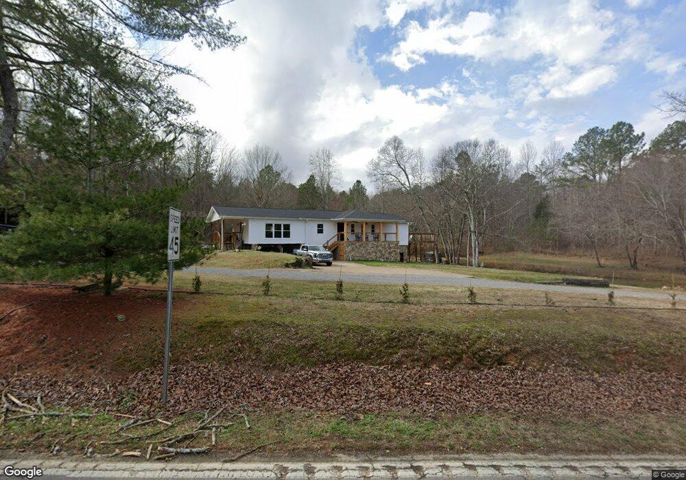
10629 Hixson Pike Soddy Daisy, TN 37379
Estimated Value: $328,000 - $419,000
--
Bed
--
Bath
1,824
Sq Ft
$195/Sq Ft
Est. Value
About This Home
This home is located at 10629 Hixson Pike, Soddy Daisy, TN 37379 and is currently estimated at $354,927, approximately $194 per square foot. 10629 Hixson Pike is a home located in Hamilton County with nearby schools including Loftis Middle School.
Ownership History
Date
Name
Owned For
Owner Type
Purchase Details
Closed on
Jun 25, 2020
Sold by
Ronk Susan Lynn and Wilson Howard W
Bought by
Wilson Derrick R
Current Estimated Value
Home Financials for this Owner
Home Financials are based on the most recent Mortgage that was taken out on this home.
Original Mortgage
$90,000
Outstanding Balance
$79,806
Interest Rate
3.1%
Mortgage Type
Commercial
Estimated Equity
$275,121
Purchase Details
Closed on
Dec 19, 1996
Sold by
Wilson Wesley
Bought by
Ronk Susan Lynn
Create a Home Valuation Report for This Property
The Home Valuation Report is an in-depth analysis detailing your home's value as well as a comparison with similar homes in the area
Home Values in the Area
Average Home Value in this Area
Purchase History
| Date | Buyer | Sale Price | Title Company |
|---|---|---|---|
| Wilson Derrick R | $100,000 | None Available | |
| Ronk Susan Lynn | -- | -- |
Source: Public Records
Mortgage History
| Date | Status | Borrower | Loan Amount |
|---|---|---|---|
| Open | Wilson Derrick R | $90,000 |
Source: Public Records
Tax History Compared to Growth
Tax History
| Year | Tax Paid | Tax Assessment Tax Assessment Total Assessment is a certain percentage of the fair market value that is determined by local assessors to be the total taxable value of land and additions on the property. | Land | Improvement |
|---|---|---|---|---|
| 2024 | $1,195 | $53,400 | $0 | $0 |
| 2023 | $1,213 | $53,400 | $0 | $0 |
| 2022 | $1,204 | $53,400 | $0 | $0 |
| 2021 | $1,204 | $53,400 | $0 | $0 |
| 2020 | $1,705 | $61,350 | $0 | $0 |
| 2019 | $1,705 | $61,350 | $0 | $0 |
| 2018 | $1,705 | $61,350 | $0 | $0 |
| 2017 | $1,705 | $61,350 | $0 | $0 |
| 2016 | $1,551 | $0 | $0 | $0 |
| 2015 | $1,551 | $55,775 | $0 | $0 |
| 2014 | $1,551 | $0 | $0 | $0 |
Source: Public Records
Map
Nearby Homes
- 2338 Stonesage Rd
- 2727 Thicket Rd
- 2110 Autumn River Dr
- 10947 High River Dr
- 11015 High River Dr
- 10166 Hunters Hollow Dr
- 10160 Hunters Hollow Dr
- 10105 Hixson Pike
- 11036 High River Dr
- 10041 Rolling Wind Dr
- 2033 Angler Dr
- 1724 Magnum Ln
- 9955 Rolling Wind Dr
- 9901 Breeze Hill Ln
- 2522 W Wind Dr
- 10224 Tommys Ln
- 5671 Willow Point Ln
- 1524 Green Pond Rd
- 9802 Shoreline Heights Dr
- 9824 Waterside Way
- 10642 Hixson Pike
- 10628 Hixson Pike
- 2230 Green Pond Rd
- 2226 Green Pond Rd
- 10650 Hixson Pike
- 2222 Green Pond Rd
- 2227 Green Pond Rd
- 10611 Hixson Pike
- 2214 Green Pond Rd
- 10610 Hixson Pike
- 10711 Hixson Pike
- 10592 Hixson Pike
- 2213 Green Pond Rd
- 2215 Green Pond Rd
- 10717 Hixson Pike
- 10713 Hixson Pike
- 2208 Green Pond Rd
- 2211 Green Pond Rd
- 10590 Hixson Pike
- 2204 Green Pond Rd